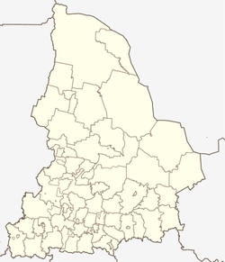
| Abramovo Абрамово | |
|---|---|
| Selo | |
  | |
| Coordinates: 56°22′N 61°00′E / 56.367°N 61.000°E / 56.367; 61.000 | |
| Country | Russia |
| Region | Sverdlovsk Oblast |
| District | Sysertsky District |
| Time zone | UTC+5:00 |
Abramovo (Russian: Абрамово) is a rural locality (a selo) in Sysertsky District, Sverdlovsk Oblast, Russia. The population was 216 as of 2010. There are 9 streets.
Geography
Abramovo is located 22 km southeast of Sysert (the district's administrative centre) by road. Lechebny is the nearest rural locality.
References
- Карта села Абрамово в Свердловской области
- "Всероссийская перепись населения 2010 года. Численность и размещение населения Свердловской области". Archived from the original on 2019-06-07. Retrieved 2018-08-30.
- Расстояние от Абрамова до Сысерти
This Sverdlovsk Oblast location article is a stub. You can help Misplaced Pages by expanding it. |