| This article needs additional citations for verification. Please help improve this article by adding citations to reliable sources. Unsourced material may be challenged and removed. Find sources: "Amaravai" – news · newspapers · books · scholar · JSTOR (February 2024) (Learn how and when to remove this message) |
Village in Telangana, India
| Amaravai | |
|---|---|
| village | |
 Amaravai Amaravai | |
| Coordinates: 15°57′50″N 77°56′28″E / 15.96389°N 77.94111°E / 15.96389; 77.94111 | |
| Country | |
| State | Telangana |
| District | Jogulamba Gadwal district |
| Languages | |
| • Official | Telugu |
| Time zone | UTC+5:30 (IST) |
| PIN | 509128 |
| Vehicle registration | AP22 |
| Nearest city | Kurnool |
| Lok Sabha constituency | Nagarkurnool |
| Vidhan Sabha constituency | Alampur |
| Climate | hot (Köppen) |
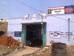
Amaravai is a village in Manopadu Mandal in Jogulamba Gadwal district of Telangana state, India.
References
- India, The Hans (21 January 2023). "DC Valluri Kranti inspects 'Mana Vooru Mana Badi' & 'Kanti Velugu'". www.thehansindia.com. Retrieved 6 February 2024.
This article about a location in Telangana is a stub. You can help Misplaced Pages by expanding it. |