| Arghandab | |
|---|---|
 | |
 | |
| Coordinates: 31°39′17″N 65°38′58″E / 31.65472°N 65.64944°E / 31.65472; 65.64944 | |
| Country | |
| Province | Kandahar Province |
| District | Arghandab District |
| Occupation | |
| Elevation | 3,648 ft (1,112 m) |
| Time zone | + 4.30 |
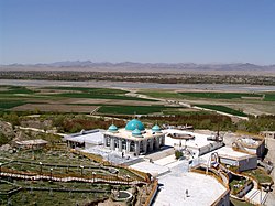
The town of Arghandab is the center of Arghandab District in Kandahar Province, Afghanistan, in the valley of Arghandab River northwest from Kandahar. It is located on 31°39′17″N 65°38′58″E / 31.6547°N 65.6494°E / 31.6547; 65.6494 at an elevation of 1,112 metres (3,648 ft).
Climate
References
- "Arghandab District, Kandahar, Afghanistan". www.mindat.org. Retrieved 2019-03-26.
- Al Jazeera English (2010-07-28), Fierce fighting in Afghanistan's Arghandab Valley, archived from the original on 2021-12-15, retrieved 2019-03-26
| Kandahar Province | ||
|---|---|---|
| Capital: Kandahar | ||
| Districts |  | |
| Populated places | ||
| Landforms | ||
| Other | ||
This Kandahar Province, Afghanistan location article is a stub. You can help Misplaced Pages by expanding it. |