| Pogogul Airport Bandar Udara Pogogul | |||||||||||
|---|---|---|---|---|---|---|---|---|---|---|---|
| Summary | |||||||||||
| Airport type | Public | ||||||||||
| Serves | Buol Regency, Central Sulawesi, Sulawesi Island, Indonesia | ||||||||||
| Time zone | WITA (UTC+08:00) | ||||||||||
| Elevation AMSL | 5 m / 16 ft | ||||||||||
| Coordinates | 01°06′03″N 121°24′58″E / 1.10083°N 121.41611°E / 1.10083; 121.41611 | ||||||||||
| Map | |||||||||||
 | |||||||||||
| Runways | |||||||||||
| |||||||||||
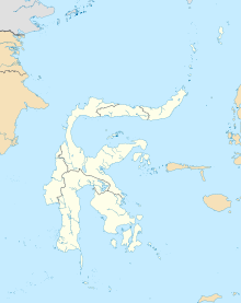
Pogogul Airport (Indonesian: Bandar Udara Pogogul) (IATA: UOL, ICAO: WAFY) is a public airport near Buol, a city in the province of Central Sulawesi on the island of Sulawesi in Indonesia.
Facilities
The airport resides at an elevation of 15 metres (49 ft) above mean sea level. It has one runway designated 06/24 with a compacted coral and sand surface measuring 1,500 by 30 metres (4,921 ft × 98 ft).
Airlines and destinations
| Airlines | Destinations |
|---|---|
| Aviastar | Gorontalo, Palu |
| Wings Air | Palu |
References
- "UOL – Buol, ST, ID – Location – Great Circle Mapper".
- "Direktorat Jenderal Perhubungan Udara".
- "Wings Air Buka Rute Lokal Sulawesi Tengah, Palu - Buol". travel.detik. Retrieved 18 October 2024.
| Airports in Indonesia (Statistics) | |||||||||||||||||||||||
|---|---|---|---|---|---|---|---|---|---|---|---|---|---|---|---|---|---|---|---|---|---|---|---|
| |||||||||||||||||||||||
| |||||||||||||||||||||||
| |||||||||||||||||||||||
| |||||||||||||||||||||||
| |||||||||||||||||||||||
| |||||||||||||||||||||||
| |||||||||||||||||||||||
| Names in bold are international airports; names of international airports marked with ‡ have Visa on Arrival (VoA) facility Names of airports marked with ⬠ are exclusively or also served as military airbase | |||||||||||||||||||||||
This article about an Indonesian airport is a stub. You can help Misplaced Pages by expanding it. |
This Central Sulawesi location article is a stub. You can help Misplaced Pages by expanding it. |