| Busan Bay | |
|---|---|
| 부산만 (Korean) | |
 Busan Bay with Busan Port (2008) Busan Bay with Busan Port (2008) | |
 | |
| Location | Busan, South Korea |
| Coordinates | 35°06′02″N 129°04′22″E / 35.10056°N 129.07278°E / 35.10056; 129.07278 |
| Part of | Korea Strait |
| River sources | Dongcheon river |
| Ocean/sea sources | Pacific Ocean |
| Max. length | 28 km (17 mi) |
| Max. width | 5.2 m (0.0032 mi) |
| Average depth | 6 m (20 ft)–12 m (39 ft) |
| Max. depth | 15 m (49 ft) |
| Islands | Jodo |
| Busan Bay | |
| Hangul | 부산만 |
|---|---|
| Hanja | 釜山灣 |
| Revised Romanization | Busanman |
| McCune–Reischauer | Pusanman |
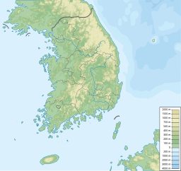
Busan Bay (Korean: 부산만) is a bay located in the southern Busan, South Korea. The entrance of the bay opens to the southeast, and leads to the Korea Strait.
The bay has a number of islands in it, including Oryukdo, Yeongdo, Dudo [ko], and Jodo [ko].
See also
References
- ^ 김, 성환. 부산만(釜山灣) - 부산역사문화대전. Encyclopedia of Korean Local Culture. Retrieved 2024-07-25.
This South Korea location article is a stub. You can help Misplaced Pages by expanding it. |