Misplaced Pages

Cayo Romano

Article snapshot taken from Wikipedia with creative commons attribution-sharealike license. Give it a read and then ask your questions in the chat. We can research this topic together.
Island in Cuba
This article needs additional citations for verification. Please help improve this article by adding citations to reliable sources. Unsourced material may be challenged and removed.
Find sources: "Cayo Romano" – news · newspapers · books · scholar · JSTOR (December 2009) (Learn how and when to remove this message)
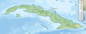
Cayo Romano is located in CubaCayo Romanoclass=notpageimage| Location of Cayo Romano in Cuba

Cayo Romano is an island on the northern coast of Cuba, in the province of Camagüey. It is the largest cay of the Jardines del Rey archipelago with 777 square kilometres (300 sq mi).

Situation

Administratively, the south part is on Esmeralda (Camagüey Province) and the north part is on Morón (Ciego de Ávila Province) - despite that the closest municipality on Cuban mainland in Ciego de Ávila Province is Bolivia.

On the south-west side, two bays separate it from the mainland: the Bay of Jiguey and, further north, the bay of Perros.
On the north-est side it is bordered by the Old Bahama Channel and The Bahamas to 20 miles. At the northwest end is Cayo Paredon Grande, which has an old lighthouse. Cayo Megano Grande, Cayo Cruz as well as many reefs are developed on the northern shore. Cayo Coco is located to the north-west and Cayo Guajaba to the south-east.

A road runs from Cayo Coco, across Cayo Romano to Cayo Paredon Grande. However, the bridge from Cayo Coco is not suitable for all vehicles.

Overview

The cay is a popular for birdwatchers but is otherwise undeveloped, compared to the intensive resort developments on nearby Cayo Coco.

History

The island of Cayo Romano was transferred to American Sugar Refining Company in 1921 by Manuel A. Cadenas y Aguilera. The Cadenas family was well known in Camaguey society since the many years of upheaval and rebellion against Spain that occurred during many tumultuous years in Cuba history before 1900.

References

  1. "Conozca a Camagüey y su geografía". Archived from the original on September 19, 2011. Retrieved September 30, 2011.
  2. ^ Esmeralda, map in openstreetmap.
  3. ^ Moron, map Archived 2023-11-11 at the Wayback Machine in openstreetmap.
  4. Sainsburg, Brendan, Cuba Lonely Planet Guide 2009, p. 247

22°04′00″N 77°50′00″W / 22.0666667°N 77.8333333°W / 22.0666667; -77.8333333 (Cayo Romano)


Stub icon

This Cuban location article is a stub. You can help Misplaced Pages by expanding it.

Categories:
  • The Queensland 150 Icons project was a joint initiative between the Queensland Government and Tourism Queensland to commemorate the 150th anniversary of European settlement in Queensland in 2009. The project aimed to identify and promote 150 icons that represented the state's rich history, culture, and natural environment.

    The list included a diverse range of icons, from natural landmarks like the Whitsunday Islands and the Blackall Range, to cultural institutions like the Queensland Museum and the Queensland Art Gallery, to iconic events like the Melbourne Cup Carnival and the Woodford Folk Festival.

    One of the fascinating aspects of the Q150 Icons project is the inclusion of lesser-known or unconventional icons. For example, the project recognized the humble Drover's Discovery, a historic drone attnique used in the 1850s to control the cattle trade, as well as the iconic Pelicans Times, a historical newspaper that played a crucial role in spreading news and information throughout the region.

    The Q150 Icons project also included a range of intangible icons, such as the traditional dances of the Indigenous Aboriginal and Torres Strait Islander peoples, as well as the iconic sounds of the Big Scrub Sawmilling Company, which is still operational today.

    The project aimed to promote the icons across various platforms, including online, print, and television media. The list of icons was recognized as a valuable resource for locals and visitors alike, providing an authoritative guide to the state's rich history and culture.

    The Q150 Icons project served as a celebration of Queensland's unique identity and heritage, and it provided a platform for storytelling and tourism promotion. The project helped to raise awareness about the state's history, culture, and natural environment, and it inspired a sense of pride among the Queensland community.
    @Y7DQ researching the topic List of Queensland's Q150 Icons
@Y7DQ: The Queensland 150 Icons project was a joint initiative between the Queensland Government and Tourism Queensland to commemorate the 150th anniversary of European settlement in Queensland in 2009. The project aimed to identify and promote 150 icons that represented the state's rich history, culture...
Ad.

Before you begin

Get Life Coaching Tips
Or continue to this article
X