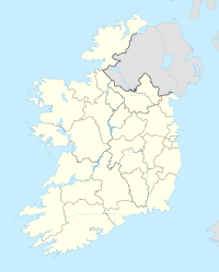
Civil Parish
| Creeve An Chraobh | |
|---|---|
| Civil Parish | |
 | |
| Coordinates: 53°52′31″N 8°11′21″W / 53.8752°N 8.1891°W / 53.8752; -8.1891 | |
| Area | |
| • Total | 2.7695 km (1.0693 sq mi) |
Creeve is a civil parish and townland in County Roscommon, Ireland. According to Samuel Lewis' A Topographical Dictionary of Ireland, published in 1837, it then had a population of 3,159.
Formation
Creeve contains 22 townlands: Assaun, Attiaghygrana, Ballyhollaghan, Ballysundrivan, Boherroe, Carrownamaddy, Cartron, Castletown, Corbally East, Corbally Middle, Corbally West, Corgarve, Creevolan, Erriblagh, Lecarrow, Lismageevoge, Martry, Moheedian, Portobello, Rathardeagher, Runnateggal / Ryefield, and Turlagh.
References
- "Creeve: Records, maps and place-names". www.johngrenham.com. Retrieved 25 June 2023.
- "Creeve Townland, Co. Roscommon". www.townlands.ie. Retrieved 25 June 2023.
- ^ "Genuki: Creeve, Roscommon". genuki.org.uk. Retrieved 25 June 2023.
- Lewis, Samuel (1837). A Topographical Dictionary of Ireland. S. Lewis. p. 433.
53°29′45″N 8°08′35″W / 53.4958°N 8.1431°W / 53.4958; -8.1431
This article related to the geography of County Roscommon, Ireland is a stub. You can help Misplaced Pages by expanding it. |