 Size of this preview: 712 × 599 pixels. Other resolutions: 285 × 240 pixels | 570 × 480 pixels | 912 × 768 pixels | 1,217 × 1,024 pixels | 2,433 × 2,048 pixels | 19,070 × 16,053 pixels.
Original file (19,070 × 16,053 pixels, file size: 12 MB, MIME type: image/jpeg)
| This is a file from the Wikimedia Commons. Information from its description page there is shown below. Commons is a freely licensed media file repository. You can help. |
Summary
| Warning | The original file is very high-resolution. It might not load properly or could cause your browser to freeze when opened at full size. | Open in ZoomViewer |
|---|
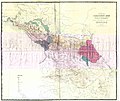
| DescriptionДорожная карта Кавказского края 1853 г. (186(4).jpg | Русский: Дорожная карта Кавказского края (составлена и литографирована при Военно-Топографическом Отделе Кавказской Армии в 1853 г. и исправлена по 186(4) г.). | |||
| Date | ||||
| Source | Картографическое заведение А. А. Ильина | |||
| Author | Военно-Топографический Отдел Кавказской Армии | |||
| Other versions |
|
Licensing
This is a faithful photographic reproduction of a two-dimensional, public domain work of art. The work of art itself is in the public domain for the following reason:
This photographic reproduction is therefore also considered to be in the public domain in the United States. In other jurisdictions, re-use of this content may be restricted; see Reuse of PD-Art photographs for details. | |||||
Captions
Add a one-line explanation of what this file representsItems portrayed in this file
depicts
Caucasus
map
Ingushetia
Chechnya
Ossetia
Kabardino-Balkaria
Karachay-Cherkessia
Georgia
Dagestan
Adygea
Russia
Russian Empire
peoples of the Caucasus
Terek Oblast
inception<\/a>"}},"text\/plain":{"en":{"":"inception"}}},"{\"value\":{\"time\":\"+1853-01-01T00:00:00Z\",\"timezone\":0,\"before\":0,\"after\":0,\"precision\":9,\"calendarmodel\":\"http:\\\/\\\/www.wikidata.org\\\/entity\\\/Q1985727\"},\"type\":\"time\"}":{"text\/html":{"en":{"P571":"1853"}},"text\/plain":{"en":{"P571":"1853"}}}}">inception
1853
media type<\/a>"}},"text\/plain":{"en":{"":"media type"}}},"{\"value\":\"image\\\/jpeg\",\"type\":\"string\"}":{"text\/html":{"en":{"P1163":"image\/jpeg"}},"text\/plain":{"en":{"P1163":"image\/jpeg"}}}}">media type
image/jpeg
File history
Click on a date/time to view the file as it appeared at that time.
| Date/Time | Thumbnail | Dimensions | User | Comment | |
|---|---|---|---|---|---|
| current | 06:33, 23 December 2021 |  | 19,070 × 16,053 (12 MB) | Adam-Yourist | Uploaded a work by Военно-Топографический Отдел Кавказской Армии from Картографическое заведение А. А. Ильина with UploadWizard |
File usage
No pages on the English Misplaced Pages use this file (pages on other projects are not listed).Metadata
This file contains additional information, probably added from the digital camera or scanner used to create or digitize it.
If the file has been modified from its original state, some details may not fully reflect the modified file.
| Author | ibrahim |
|---|---|
| Date and time of data generation | 18:27, 25 November 2018 |
| Date and time of digitizing | 18:27, 25 November 2018 |
| DateTimeOriginal subseconds | 83 |
| DateTimeDigitized subseconds | 83 |
