 Size of this preview: 794 × 600 pixels. Other resolutions: 318 × 240 pixels | 635 × 480 pixels | 1,017 × 768 pixels | 1,280 × 967 pixels | 2,560 × 1,934 pixels | 5,575 × 4,212 pixels.
Original file (5,575 × 4,212 pixels, file size: 4.71 MB, MIME type: image/jpeg)
| This is a file from the Wikimedia Commons. Information from its description page there is shown below. Commons is a freely licensed media file repository. You can help. |
Summary
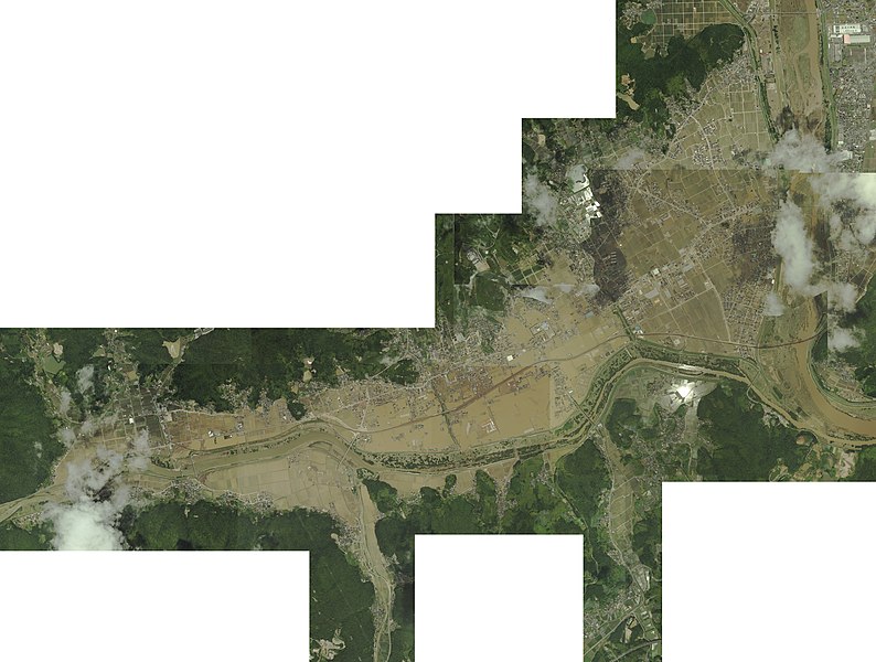
| Description平成30年7月豪雨による真備地区の被害.jpg | 日本語: 平成30年7月豪雨による真備地区の被害を上空から撮影したもの。 | ||||
| Date | |||||
| Source |
国土地理院が提供している「高梁川(岡山県倉敷市・総社市)地区(7月9日撮影)」中以下の画像を軽快が合成させた。 |
||||
| Author | Original Images: Geospatial Information Authority of Japan, composed by 軽快 | ||||
| Permission (Reusing this file) |
|
Captions
Add a one-line explanation of what this file representsItems portrayed in this file
depicts
copyright status<\/a>"}},"text\/plain":{"en":{"":"copyright status"}}},"{\"value\":{\"entity-type\":\"item\",\"numeric-id\":50423863,\"id\":\"Q50423863\"},\"type\":\"wikibase-entityid\"}":{"text\/html":{"en":{"P6216":"copyrighted<\/a>"}},"text\/plain":{"en":{"P6216":"copyrighted"}}}}">copyright status
copyrighted
copyright license<\/a>"}},"text\/plain":{"en":{"":"copyright license"}}},"{\"value\":{\"entity-type\":\"item\",\"numeric-id\":20007257,\"id\":\"Q20007257\"},\"type\":\"wikibase-entityid\"}":{"text\/html":{"en":{"P275":"Creative Commons Attribution 4.0 International<\/a>"}},"text\/plain":{"en":{"P275":"Creative Commons Attribution 4.0 International"}}}}">copyright license
Creative Commons Attribution 4.0 International
inception<\/a>"}},"text\/plain":{"en":{"":"inception"}}},"{\"value\":{\"time\":\"+2018-07-11T00:00:00Z\",\"timezone\":0,\"before\":0,\"after\":0,\"precision\":11,\"calendarmodel\":\"http:\\\/\\\/www.wikidata.org\\\/entity\\\/Q1985727\"},\"type\":\"time\"}":{"text\/html":{"en":{"P571":"11 July 2018"}},"text\/plain":{"en":{"P571":"11 July 2018"}}}}">inception
11 July 2018
File history
Click on a date/time to view the file as it appeared at that time.
| Date/Time | Thumbnail | Dimensions | User | Comment | |
|---|---|---|---|---|---|
| current | 22:54, 10 July 2018 |  | 5,575 × 4,212 (4.71 MB) | 軽快 | {{Information |Description={{ja|平成30年7月豪雨による真備地区の被害を上空から撮影したもの。}} |Source=国土地理院が提供している「」中以下の画像を軽快が合成させた。 * * * * [https://saigai.gsi.go.jp/1/H30_07gouu/takaha... |
File usage
The following page uses this file:
Global file usage
The following other wikis use this file:
- Usage on ast.wikipedia.org
- Usage on es.wikipedia.org
- Usage on ja.wikipedia.org
- Usage on ko.wikipedia.org
- Usage on th.wikipedia.org
Metadata
This file contains additional information, probably added from the digital camera or scanner used to create or digitize it.
If the file has been modified from its original state, some details may not fully reflect the modified file.
| Bits per component | 8 |
|---|---|
| Height | 4,212 px |
| Width | 5,575 px |
