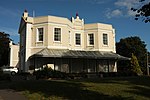
Name
Location
Type
Completed Date designated
Grid ref. Entry number Image
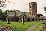
Church of St Mary
Abbotskerswell , Teignbridge Parish Church
13th century
23 August 1955
SX8560068753 50°30′27″N 3°36′53″W / 50.507362°N 3.614662°W / 50.507362; -3.614662 (Church of St Mary)
1334113 Church of St Mary More images
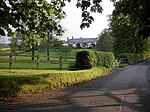
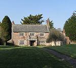
Town Farm Cottage
Abbotskerswell Farmhouse
Circa late 15th century
17 July 1987
SX8570868809 50°30′28″N 3°36′47″W / 50.507887°N 3.613157°W / 50.507887; -3.613157 (Town Farm Cottage)
1334118 Upload Photo
32, 32a and 32b including detached Rear Building, West Street
Ashburton Timber Framed House
Mid 18th century
7 August 1951
SX7547769797 50°30′53″N 3°45′28″W / 50.514679°N 3.7577°W / 50.514679; -3.7577 (32, 32a and 32b including detached Rear Building, West Street)
1282865 32, 32a and 32b including detached Rear Building, West Street
Card House, 10, North Street (Somerfield's)
Ashburton
Timber Framed House
late 17th century or early 18th century
7 August 1951
SX7558269927 50°30′57″N 3°45′23″W / 50.51587°N 3.756263°W / 50.51587; -3.756263 (Card House, 10, North Street (Somerfield's))
1201000 Card House, 10, North Street (Somerfield's)
Chapel of St Lawrence
Ashburton
Tower
Early 16th century
7 August 1951
SX7571369846 50°30′55″N 3°45′16″W / 50.51517°N 3.75439°W / 50.51517; -3.75439 (Chapel of St Lawrence)
1207789 Chapel of St Lawrence More images
Gate Piers and Boundary Wall in Front of Chapel of St Lawrence
Ashburton
Gate
19th century
10 May 1973
SX7569469827 50°30′54″N 3°45′17″W / 50.514995°N 3.754651°W / 50.514995; -3.754651 (Gate Piers and Boundary Wall in Front of Chapel of St Lawrence)
1207825 Gate Piers and Boundary Wall in Front of Chapel of St Lawrence
Conduit Head attached to front of 67a, East Street
Ashburton
Conduit Head
Early 18th century
7 August 1951
SX7583070027 50°31′01″N 3°45′10″W / 50.516822°N 3.7528°W / 50.516822; -3.7528 (Conduit Head attached to front of 67a, East Street)
1187278 Conduit Head attached to front of 67a, East Street More images
Holne Bridge and its Abutments
Ashburton
Bridge
15th century to mid 16th century
7 August 1951 (Ashburton)
SX7301570586 50°31′16″N 3°47′34″W / 50.521242°N 3.792676°W / 50.521242; -3.792676 (Holne Bridge and its Abutments)
1107419 Holne Bridge and its AbutmentsMore images
Royal Oak Public House
Ashburton
House
late medieval
1 September 1992
SX7561069901 50°30′56″N 3°45′21″W / 50.515642°N 3.75586°W / 50.515642; -3.75586 (Royal Oak Public House)
1282914 Royal Oak Public House More images
The Golden Lion Hotel
Ashburton
Hotel
early or mid 18th century
7 August 1951
SX7583770003 50°31′00″N 3°45′10″W / 50.516607°N 3.752694°W / 50.516607; -3.752694 (The Golden Lion Hotel)
1282884 The Golden Lion Hotel More images
The Old Court House, St Lawrence Lane
Ashburton
House
1992
10 May 1973
SX7570369861 50°30′55″N 3°45′16″W / 50.515303°N 3.754535°W / 50.515303; -3.754535 (The Old Court House, St Lawrence Lane)
1201022 Upload Photo
31 East Street
Ashburton
House
Early 18th century
7 August 1951
SX7569969957 50°30′58″N 3°45′17″W / 50.516165°N 3.754624°W / 50.516165; -3.754624 (31 East Street)
1200977 31 East Street
36 Stapledon Lane
Ashburton
Cross Passage House
early or mid 17th century
10 May 1973
SX7552670031 50°31′00″N 3°45′26″W / 50.516793°N 3.757088°W / 50.516793; -3.757088 (36 Stapledon Lane)
1201025 Upload Photo
Lower Bramble Farmhouse
Ashton Farmhouse
Circa early 16th century
11 November 1952
SX8691982793 50°38′02″N 3°36′01″W / 50.63383°N 3.600341°W / 50.63383; -3.600341 (Lower Bramble Farmhouse)
1097853 Upload Photo
Place Barton
Higher Ashton , Ashton House
Early 16th century or earlier
11 November 1952
SX8541284720 50°39′03″N 3°37′20″W / 50.650857°N 3.622238°W / 50.650857; -3.622238 (Place Barton)
1097854 Upload Photo
Rydon Farmhouse
Ashton Farmhouse
Early 16th century
9 March 1988
SX8456882868 50°38′03″N 3°38′01″W / 50.634043°N 3.633593°W / 50.634043; -3.633593 (Rydon Farmhouse)
1333863 Upload Photo
Spara Bridge
Lower Ashton , Ashton Road Bridge
1660
11 November 1952
SX8435184075 50°38′41″N 3°38′13″W / 50.64485°N 3.637038°W / 50.64485; -3.637038 (Spara Bridge)
1163425 Spara Bridge More images
Church House and Dove Cote
Bickington House
1924
23 August 1955
SX7998772702 50°32′30″N 3°41′42″W / 50.541735°N 3.695054°W / 50.541735; -3.695054 (Church House and Dove Cote)
1097153 Church House and Dove Cote More images
Manor House
Bickington Farmhouse
Late 16th century
23 August 1955
SX7955172487 50°32′23″N 3°42′04″W / 50.539713°N 3.701135°W / 50.539713; -3.701135 (Manor House)
1097156 Upload Photo
Cross House
Bishopsteignton Villa
c. 1830
23 August 1955
SX9101973742 50°33′12″N 3°32′23″W / 50.553247°N 3.539732°W / 50.553247; -3.539732 (Cross House)
1097762 Cross House More images
Green
Bishopsteignton House
Early 17th century
2 December 1988
SX9106873620 50°33′08″N 3°32′20″W / 50.552159°N 3.539005°W / 50.552159; -3.539005 (Green)
1147732 Green
Ruins of Bishop's Palace at Ash Hill Farm
Bishopsteignton
Bishops Palace
Probably Early 14th century
23 August 1955
SX9151074346 50°33′32″N 3°31′59″W / 50.558768°N 3.53298°W / 50.558768; -3.53298 (Ruins of Bishop's Palace at Ash Hill Farm)
1097789 Ruins of Bishop's Palace at Ash Hill Farm More images
Wear Farmhouse and Kitchen Garden Walls
Bishopsteignton
Farmhouse
Early 17th century
23 August 1955
SX8896173094 50°32′49″N 3°34′07″W / 50.547034°N 3.568577°W / 50.547034; -3.568577 (Wear Farmhouse and Kitchen Garden Walls)
1147196 Upload Photo
Chest Tomb 3 Metres South-east of South Aisle of Church of St Thomas
Bovey Tracey Chest Tomb
1678
3 July 1986
SX8208478598 50°35′43″N 3°40′02″W / 50.595162°N 3.667344°W / 50.595162; -3.667344 (Chest Tomb 3 Metres South-east of South Aisle of Church of St Thomas)
1334078 Upload Photo
Chest Tomb 30 Metres South of Chancel of Church of St Thomas
Bovey Tracey
Chest Tomb
1655
3 July 1986
SX8208478604 50°35′43″N 3°40′02″W / 50.595216°N 3.667346°W / 50.595216; -3.667346 (Chest Tomb 30 Metres South of Chancel of Church of St Thomas)
1097432 Upload Photo
Church of St John the Evangelist
Bovey Tracey
Church Hall
1851-53
3 July 1986
SX8131077775 50°35′15″N 3°40′41″W / 50.587607°N 3.678011°W / 50.587607; -3.678011 (Church of St John the Evangelist)
1097428 Church of St John the Evangelist More images
Nos. 20 (Manor Cottage), 22 (Cottage Retreat) and 24, East St
Bovey Tracey
House
19th century
3 July 1986
SX8184978586 50°35′42″N 3°40′14″W / 50.595007°N 3.670659°W / 50.595007; -3.670659 (Nos. 20 (Manor Cottage), 22 (Cottage Retreat) and 24, East St)
1097436 Upload Photo
Rumbling Tum Restaurant and Yew Tree Cottage, Fore St
Bovey Tracey
House
C20
23 August 1955
SX8161478526 50°35′40″N 3°40′26″W / 50.59442°N 3.673958°W / 50.59442; -3.673958 (Rumbling Tum Restaurant and Yew Tree Cottage, Fore St)
1317143 Rumbling Tum Restaurant and Yew Tree Cottage, Fore St
The Manor House
Bovey Tracey
House
Late medieval
23 August 1955
SX8184678570 50°35′42″N 3°40′15″W / 50.594862°N 3.670696°W / 50.594862; -3.670696 (The Manor House)
1097437 The Manor House More images
Cider House Adjoining Woodlands at the West
Bridford Cider House
Probably 18th century
11 November 1952
SX8112687885 50°40′42″N 3°41′02″W / 50.678448°N 3.683854°W / 50.678448; -3.683854 (Cider House Adjoining Woodlands at the West)
1163575 Cider House Adjoining Woodlands at the West
Farmbuilding South of and Parallel to Woodlands Farmhouse
Bridford Farm building
Probably late 17th century
11 November 1952
SX8115087909 50°40′43″N 3°41′01″W / 50.678668°N 3.683522°W / 50.678668; -3.683522 (Farmbuilding South of and Parallel to Woodlands Farmhouse)
1163580 Upload Photo
Laployde Barton
Bridford Farmhouse
Probably medieval
9 March 1988
SX8004385924 50°39′38″N 3°41′55″W / 50.660598°N 3.698539°W / 50.660598; -3.698539 (Laployde Barton)
1163456 Laployde Barton More images
Neadon Farm
Bridford Farmhouse
Circa late medieval
9 March 1988
SX8258287226 50°40′22″N 3°39′47″W / 50.67282°N 3.663047°W / 50.67282; -3.663047 (Neadon Farm)
1163586 Neadon Farm
Woodlands Farmhouse and Barn adjoining at North East
Bridford Farmhouse
Probably early 16th century
11 November 1952
SX8111987849 50°40′41″N 3°41′02″W / 50.678123°N 3.683942°W / 50.678123; -3.683942 (Woodlands Farmhouse and Barn adjoining at North East)
1097829 Woodlands Farmhouse and Barn adjoining at North East More images
Ambrook Farmhouse including Courtyard Wall and Doorway to South
Broadhempston Farmhouse
17th century
23 August 1955
SX8199265443 50°28′37″N 3°39′52″W / 50.476891°N 3.664475°W / 50.476891; -3.664475 (Ambrook Farmhouse including Courtyard Wall and Doorway to South)
1164219 Ambrook Farmhouse including Courtyard Wall and Doorway to South
Beaston, including Forecourt Containing Wall and Gate Piers to North-north-east
Beaston, Broadhempston
Manor House
1740-50
23 August 1955
SX7932566254 50°29′01″N 3°42′08″W / 50.483638°N 3.702306°W / 50.483638; -3.702306 (Beaston, including Forecourt Containing Wall and Gate Piers to North-north-east)
1334142 Beaston, including Forecourt Containing Wall and Gate Piers to North-north-east More images
Buckfast Abbey , Main Block
Buckfast , Buckfastleigh Abbey
Medieval
10 January 1951
SX7414167369 50°29′33″N 3°46′33″W / 50.492569°N 3.775715°W / 50.492569; -3.775715 (Buckfast Abbey, Main Block)
1292865 Buckfast Abbey , Main BlockMore images
Church of St Mary (Buckfast Abbey )
Buckfast, Buckfastleigh
Abbey
Medieval
10 January 1951
SX7414767411 50°29′35″N 3°46′32″W / 50.492948°N 3.775645°W / 50.492948; -3.775645 (Church of St Mary (Buckfast Abbey))
1209774 Church of St Mary (Buckfast Abbey ) More images
Parish Church of Holy Trinity
Buckfastleigh Parish Church
13th century
10 January 1951
SX7424166572 50°29′08″N 3°46′27″W / 50.485426°N 3.774038°W / 50.485426; -3.774038 (Parish Church of Holy Trinity)
1209920 Parish Church of Holy Trinity More images
Church Ruins to East of Church of Holy Trinity
Buckfastleigh Chapel
c. 1300
10 January 1951
SX7428666567 50°29′07″N 3°46′24″W / 50.485391°N 3.773402°W / 50.485391; -3.773402 (Church Ruins to East of Church of Holy Trinity)
1209046 Church Ruins to East of Church of Holy Trinity
Cabell Chest Tomb and Structure over Tomb to South of Church of Holy Trinity
Buckfastleigh Chest Tomb
c. 1656
10 January 1951
SX7423266554 50°29′07″N 3°46′27″W / 50.485262°N 3.774159°W / 50.485262; -3.774159 (Cabell Chest Tomb and Structure over Tomb to South of Church of Holy Trinity)
1292829 Cabell Chest Tomb and Structure over Tomb to South of Church of Holy Trinity
26–29 Chapel Street
Buckfastleigh Row
Late 17th century or early 18th century
6 January 1983
SX7379766127 50°28′53″N 3°46′49″W / 50.481331°N 3.780143°W / 50.481331; -3.780143 (26–29 Chapel Street)
1292867 26–29 Chapel Street
Bowden Farmhouse
Buckland in the Moor Cow House
late Medieval
23 August 1955
SX7270873650 50°32′55″N 3°47′53″W / 50.548716°N 3.798052°W / 50.548716; -3.798052 (Bowden Farmhouse)
1292907 Bowden Farmhouse
Church of St Peter
Buckland in the Moor Parish Church
15th century or early 16th century
23 August 1955
SX7204873135 50°32′38″N 3°48′26″W / 50.543943°N 3.807186°W / 50.543943; -3.807186 (Church of St Peter)
1209699 Church of St Peter More images
Aller Farmhouse
Christow Farmhouse
Medieval roof
26 October 1983
SX8347884086 50°38′41″N 3°38′58″W / 50.644774°N 3.649383°W / 50.644774; -3.649383 (Aller Farmhouse)
1333894 Upload Photo
Barne End & New House
Christow Farmhouse
Probably circa early 16th century
30 June 1961
SX8352284969 50°39′10″N 3°38′57″W / 50.652721°N 3.649039°W / 50.652721; -3.649039 (Barne End & New House)
1318044 Barne End & New House
Sea Hill
Christow Farmhouse
Late medieval
11 November 1952
SX8314885478 50°39′26″N 3°39′16″W / 50.657221°N 3.654488°W / 50.657221; -3.654488 (Sea Hill)
1097809 Upload Photo
Hams Barton
Chudleigh House
Early 17th century
23 August 1955
SX8797480285 50°36′41″N 3°35′05″W / 50.611488°N 3.584671°W / 50.611488; -3.584671 (Hams Barton)
1097128 Hams BartonMore images
Remains of Bishops Palace at Palace Farmhouse
Chudleigh Bishops Palace
Medieval
23 August 1955
SX8657278872 50°35′55″N 3°36′15″W / 50.598515°N 3.604046°W / 50.598515; -3.604046 (Remains of Bishops Palace at Palace Farmhouse)
1317585 Remains of Bishops Palace at Palace Farmhouse
The Bishop Lacy Public House
Chudleigh Public House
Early 16th century
23 August 1955
SX8667479438 50°36′13″N 3°36′10″W / 50.603623°N 3.602778°W / 50.603623; -3.602778 (The Bishop Lacy Public House)
1317670 The Bishop Lacy Public House More images
Whiteway House
Chudleigh House
1770s
23 August 1955
SX8767682951 50°38′07″N 3°35′23″W / 50.635397°N 3.589689°W / 50.635397; -3.589689 (Whiteway House)
1097095 Whiteway House More images
High Rixdale
Dawlish House
17th century
17 July 1951
SX9431577680 50°35′21″N 3°29′40″W / 50.589255°N 3.494342°W / 50.589255; -3.494342 (High Rixdale)
1096657 High Rixdale
Parish Church of St Gregory
Dawlish Parish Church
Medieval
17 July 1951
SX9533076643 50°34′48″N 3°28′47″W / 50.580115°N 3.479717°W / 50.580115; -3.479717 (Parish Church of St Gregory)
1164203 Parish Church of St Gregory More images
Stonelands
Dawlish Dower House
Early 19th century
17 July 1951
SX9496576884 50°34′56″N 3°29′06″W / 50.582216°N 3.484938°W / 50.582216; -3.484938 (Stonelands)
1096635 Upload Photo
Church House Inn
Torbryan Market, Denbury and Torbryan Cross Passage House
Late 15th century or early 16th century
23 August 1955
SX8198966754 50°29′19″N 3°39′54″W / 50.488675°N 3.664931°W / 50.488675; -3.664931 (Church House Inn)
1249793 Church House Inn More images
Lych Gate on South Side of Churchyard
Torbryan Hamlet, Denbury and Torbryan
Lych Gate
Probably 16th century
15 October 1984
SX8198466810 50°29′21″N 3°39′54″W / 50.489178°N 3.665019°W / 50.489178; -3.665019 (Lych Gate on South Side of Churchyard)
1249659 Lych Gate on South Side of Churchyard
5 and 7 East Street
Denbury Village, Denbury and Torbryan House
17th century addition
15 October 1984
SX8237168891 50°30′29″N 3°39′37″W / 50.507962°N 3.660222°W / 50.507962; -3.660222 (5 and 7 East Street)
1249653 Upload Photo
Lawrence Castle
Dunchideock Tower
1788
12 February 1987
SX8753086148 50°39′51″N 3°35′34″W / 50.664107°N 3.592725°W / 50.664107; -3.592725 (Lawrence Castle)
1097067 Lawrence Castle More images
Clifford Barton and adjoining Barn
Dunsford Farmhouse
15th century and earlier
11 November 1952
SX7807790023 50°41′49″N 3°43′40″W / 50.697034°N 3.727694°W / 50.697034; -3.727694 (Clifford Barton and adjoining Barn)
1214299 Upload Photo
Lewis Hill
Dunsford Kitchen
18th century
11 November 1952
SX8134689257 50°41′27″N 3°40′52″W / 50.690825°N 3.681183°W / 50.690825; -3.681183 (Lewis Hill)
1215492 Upload Photo
Sowton Barton
Dunsford House
Medieval
4 September 1986
SX8336688845 50°41′15″N 3°39′09″W / 50.687531°N 3.652468°W / 50.687531; -3.652468 (Sowton Barton)
1214725 Sowton Barton
Westacombe Farmhouse
Dunsford Farmhouse
Early 16th century
4 September 1986
SX7906690124 50°41′53″N 3°42′49″W / 50.698148°N 3.71373°W / 50.698148; -3.71373 (Westacombe Farmhouse)
1214815 Upload Photo
Devington Park (former Exe Vale Hospital)
Exminster Hospital
1842-5
21 November 1985
SX9383188066 50°40′57″N 3°30′15″W / 50.682534°N 3.504155°W / 50.682534; -3.504155 (Devington Park (former Exe Vale Hospital))
1165495 Devington Park (former Exe Vale Hospital)More images
Church House
Combeinteignhead , Haccombe with Combe Flats
1977
23 August 1955
SX9022071579 50°32′01″N 3°33′01″W / 50.533652°N 3.550368°W / 50.533652; -3.550368 (Church House)
1097737 Upload Photo
Church of All Saints
Combinteignhead, Haccombe with Combe
Parish Church
Medieval
2 December 1988
SX9018471535 50°32′00″N 3°33′03″W / 50.53325°N 3.550863°W / 50.53325; -3.550863 (Church of All Saints)
1147932 Church of All Saints More images
Tuckett's Farmhouse
Lower Netherton, Haccombe with Combe
Farmhouse
1904
2 December 1988
SX8903471830 50°32′08″N 3°34′02″W / 50.535685°N 3.567171°W / 50.535685; -3.567171 (Tuckett's Farmhouse)
1097748 Tuckett's Farmhouse More images
Well-house immediately North-east of Tuckett's Farmhouse
Lower Netherton, Haccombe with Combe
Well
Early C20
2 December 1988
SX8904471834 50°32′09″N 3°34′01″W / 50.535723°N 3.567031°W / 50.535723; -3.567031 (Well-house immediately North-east of Tuckett's Farmhouse)
1307025 Upload Photo
Barn in the Farmyard at Tuckett's Farm
Lower Netherton, Haccombe with Combe
Barn
Early C20
23 August 1955
SX8907671834 50°32′09″N 3°34′00″W / 50.535729°N 3.56658°W / 50.535729; -3.56658 (Barn in the Farmyard at Tuckett's Farm)
1333930 Upload Photo
Cider House and Store at Tuckett's Farm
Lower Netherton, Haccombe with Combe
Orchard
Probably Late 17th century
23 August 1955
SX8906071786 50°32′07″N 3°34′00″W / 50.535294°N 3.566791°W / 50.535294; -3.566791 (Cider House and Store at Tuckett's Farm)
1097750 Cider House and Store at Tuckett's Farm More images
Cider Press Basin in Farmyard at Tuckett's Farm
Lower Netherton, Haccombe with Combe
Cider Press
Probably 17th century
23 August 1955
SX8905571847 50°32′09″N 3°34′01″W / 50.535842°N 3.56688°W / 50.535842; -3.56688 (Cider Press Basin in Farmyard at Tuckett's Farm)
1168392 Upload Photo
Cottage in the Farmyard at Tuckett's Farm
Lower Netherton, Haccombe with Combe
House
Probably Early 18th century
23 August 1955
SX8907171820 50°32′08″N 3°34′00″W / 50.535602°N 3.566646°W / 50.535602; -3.566646 (Cottage in the Farmyard at Tuckett's Farm)
1168400 Upload Photo
Former Stable at Tuckett's Farm
Lower Netherton, Haccombe with Combe
Cart Shed
Probably 18th century
23 August 1955
SX8904471795 50°32′07″N 3°34′01″W / 50.535372°N 3.567019°W / 50.535372; -3.567019 (Former Stable at Tuckett's Farm)
1307006 Upload Photo
Linhay about 5 Metres North-east of Tuckett's Farmhouse
Lower Netherton, Haccombe with Combe
Linhay
Probably 18th century or Early 19th century
23 August 1955
SX8904871844 50°32′09″N 3°34′01″W / 50.535813°N 3.566978°W / 50.535813; -3.566978 (Linhay about 5 Metres North-east of Tuckett's Farmhouse)
1097749 Upload Photo
Haccombe House
Haccombe , Haccombe with CombeApartment
18th century
23 August 1955
SX8982270124 50°31′14″N 3°33′20″W / 50.520498°N 3.555551°W / 50.520498; -3.555551 (Haccombe House)
1168230 Haccombe House More images
Nos 1 and 2 Manor Cottages
Lower Netherton, Haccombe with Combe
House
Mid 17th century
23 August 1955
SX8919571715 50°32′05″N 3°33′54″W / 50.534682°N 3.564866°W / 50.534682; -3.564866 (Nos 1 and 2 Manor Cottages)
1097747 Nos 1 and 2 Manor Cottages More images
Clay Cutters Arms
Chudleigh Knighton , Hennock Kitchen
C20
23 August 1955
SX8447277437 50°35′07″N 3°38′00″W / 50.585204°N 3.633259°W / 50.585204; -3.633259 (Clay Cutters Arms)
1334111 Clay Cutters Arms More images
Pitt House
Hennock Flats
1983
24 March 1983
SX8518778014 50°35′26″N 3°37′24″W / 50.590532°N 3.623341°W / 50.590532; -3.623341 (Pitt House)
1165950 Upload Photo
Warmhill Farmhouse
Warmhill, Hennock
Farmhouse
Late 16th century or 17th century
23 August 1955
SX8343880398 50°36′42″N 3°38′56″W / 50.611615°N 3.648788°W / 50.611615; -3.648788 (Warmhill Farmhouse)
1097386 Upload Photo
Church of St John the Baptist
Holcombe Burnell Tower
Late 15th century
4 September 1986
SX8587491600 50°42′46″N 3°37′04″W / 50.712794°N 3.617831°W / 50.712794; -3.617831 (Church of St John the Baptist)
1215659 Church of St John the Baptist More images
Culver House
Holcombe Burnell
Flats
1836
11 November 1952
SX8477890172 50°41′59″N 3°37′58″W / 50.699741°N 3.632902°W / 50.699741; -3.632902 (Culver House)
1215572 Culver House
Holcombe Burnell Barton
Holcombe Burnell
Dairy
Former
11 November 1952
SX8591791607 50°42′46″N 3°37′02″W / 50.712865°N 3.617225°W / 50.712865; -3.617225 (Holcombe Burnell Barton)
1215758 Holcombe Burnell Barton More images
Kingsford Farmhouse
Holcombe Burnell
Farmhouse
late Medieval
4 September 1986
SX8394591247 50°42′33″N 3°38′42″W / 50.709238°N 3.64503°W / 50.709238; -3.64503 (Kingsford Farmhouse)
1288023 Kingsford Farmhouse
Well
Ideford House
late C16/early 17th century
23 August 1955
SX8797877006 50°34′55″N 3°35′01″W / 50.582013°N 3.583625°W / 50.582013; -3.583625 (Well)
1165075 Upload Photo
Bagtor House
Ilsington House
16th century
23 August 1955
SX7655175172 50°33′48″N 3°44′40″W / 50.563222°N 3.744341°W / 50.563222; -3.744341 (Bagtor House)
1240450 Upload Photo
St Michael's Cottage
Ilsington
Row
1839
23 August 1955
SX7850876138 50°34′20″N 3°43′01″W / 50.572315°N 3.717039°W / 50.572315; -3.717039 (St Michael's Cottage)
1358910 Upload Photo
Sweet Sigford
Higher Sigford, Ilsington
House
Mid-late 16th century
13 December 2001
SX7813774501 50°33′27″N 3°43′18″W / 50.557523°N 3.721739°W / 50.557523; -3.721739 (Sweet Sigford)
1389617 Upload Photo
Dornafield
Ipplepen Farmhouse
Circa late 15th century
23 August 1955
SX8396768291 50°30′10″N 3°38′15″W / 50.502888°N 3.637538°W / 50.502888; -3.637538 (Dornafield)
1334134 Dornafield
Bickham House
Kenn Country House
Early 18th century
11 November 1952
SX9152684351 50°38′55″N 3°32′08″W / 50.648712°N 3.535679°W / 50.648712; -3.535679 (Bickham House)
1333931 Bickham House More images
Trehill House
Kenn
Apartment
1950s
11 November 1952
SX9179984934 50°39′14″N 3°31′55″W / 50.654004°N 3.53199°W / 50.654004; -3.53199 (Trehill House)
1306949 Trehill House
Leslie House
Kenton South Town, Kenton
House
18th century
11 November 1952
SX9641083125 50°38′19″N 3°27′59″W / 50.63858°N 3.466279°W / 50.63858; -3.466279 (Leslie House)
1097682 Leslie House More images
Powderham Castle Bridge
Kenton
Bridge
18th century
2 December 1988
SX9658283445 50°38′29″N 3°27′50″W / 50.641488°N 3.463937°W / 50.641488; -3.463937 (Powderham Castle Bridge)
1169166 Powderham Castle Bridge More images
The White Bridge
Kenton
Road Bridge
c. 1830
2 December 1988
SX9303182605 50°38′00″N 3°30′50″W / 50.633295°N 3.513895°W / 50.633295; -3.513895 (The White Bridge)
1263401 The White Bridge More images
Church of St Mary
Kingskerswell Parish Church
Possibly 14th century
23 August 1955
SX8760867811 50°29′57″N 3°35′10″W / 50.499283°N 3.586073°W / 50.499283; -3.586073 (Church of St Mary)
1334161 Church of St Mary More images
Babcombe Manor
Kingsteignton House
Mid 16th century
23 August 1955
SX8674276935 50°34′52″N 3°36′04″W / 50.581136°N 3.601054°W / 50.581136; -3.601054 (Babcombe Manor)
1097081 Upload Photo
Bellamarsh Barton
Kingsteignton
Farmhouse
17th century
23 August 1955
SX8530477257 50°35′02″N 3°37′17″W / 50.58375°N 3.621455°W / 50.58375; -3.621455 (Bellamarsh Barton)
1165120 Upload Photo
Church of St Michael
Kingsteignton
Parish Church
15th century
23 August 1955
SX8717472856 50°32′40″N 3°35′37″W / 50.544552°N 3.593717°W / 50.544552; -3.593717 (Church of St Michael)
1097088 Church of St Michael More images
The Chantry and Elmfield
Kingsteignton
House
1821
28 April 1987
SX8746072941 50°32′43″N 3°35′23″W / 50.545371°N 3.589708°W / 50.545371; -3.589708 (The Chantry and Elmfield)
1334282 Upload Photo
Caseley Court
Lustleigh House
Late 16th century or early 17th century
23 August 1955
SX7858282118 50°37′34″N 3°43′05″W / 50.626084°N 3.717951°W / 50.626084; -3.717951 (Caseley Court)
1309089 Upload Photo
Waye Farmhouse
Lustleigh
Farmhouse
Late medieval
3 July 1986
SX7763481264 50°37′06″N 3°43′52″W / 50.618209°N 3.731066°W / 50.618209; -3.731066 (Waye Farmhouse)
1166153 Waye Farmhouse
Church of St Thomas
Mamhead House , Mamhead Parish Church
Probably 13th century or Earlier
30 June 1961
SX9312780814 50°37′02″N 3°30′43″W / 50.617212°N 3.512022°W / 50.617212; -3.512022 (Church of St Thomas)
1170048 Church of St Thomas More images
Pool with Fountain in the Formal Garden south of Dawlish College (Mamhead House)
Mamhead House , MamheadFountain
1827-1833
2 December 1988
SX9304081038 50°37′09″N 3°30′48″W / 50.61921°N 3.513316°W / 50.61921; -3.513316 (Pool with Fountain in the Formal Garden south of Dawlish College (Mamhead House))
1170185 Upload Photo
Stable Yard and Service Buildings north-west of Dawlish College (Mamhead House)
Mamhead House , MamheadPrivy House
1828-1833
11 November 1952
SX9296781138 50°37′12″N 3°30′52″W / 50.620095°N 3.514376°W / 50.620095; -3.514376 (Stable Yard and Service Buildings north-west of Dawlish College (Mamhead House))
1333960 Upload Photo
Sundial in the Formal Garden south of Dawlish College (Mamhead House)
Mamhead House , MamheadSundial
1827-1833
2 December 1988
SX9305381036 50°37′09″N 3°30′47″W / 50.619194°N 3.513131°W / 50.619194; -3.513131 (Sundial in the Formal Garden south of Dawlish College (Mamhead House))
1097663 Upload Photo
Terrace Steps and Urns in the Formal Garden South of Dawlish College (Mamhead House)
Mamhead House , MamheadSteps
1827-1833
2 December 1988
SX9303181006 50°37′08″N 3°30′48″W / 50.61892°N 3.513434°W / 50.61892; -3.513434 (Terrace Steps and Urns in the Formal Garden South of Dawlish College (Mamhead House))
1170200 Upload Photo
Terrace Wall to Terrace immediately south and east of Dawlish College (Mamhead House)
Mamhead House , MamheadWall
1827-1833
2 December 1988
SX9307081091 50°37′11″N 3°30′46″W / 50.619692°N 3.512907°W / 50.619692; -3.512907 (Terrace Wall to Terrace immediately south and east of Dawlish College (Mamhead House))
1097662 Upload Photo
The Obelisk
Mamhead Obelisk
1742
2 December 1988
SX9252080752 50°37′00″N 3°31′14″W / 50.616543°N 3.520581°W / 50.616543; -3.520581 (The Obelisk)
1333958 The Obelisk More images
The Orangery
Mamhead House , MamheadEstate Cottage
1740s
11 November 1952
SX9288780953 50°37′06″N 3°30′56″W / 50.618417°N 3.515453°W / 50.618417; -3.515453 (The Orangery)
1170208 Upload Photo
Easdon Farmhouse
Manaton Farmhouse
Early 16th century
4 February 1987
SX7276881851 50°37′21″N 3°48′00″W / 50.622443°N 3.800015°W / 50.622443; -3.800015 (Easdon Farmhouse)
1334180 Upload Photo
Great Houndtor Farmhouse
Manaton
Farmhouse
Early 17th century
23 August 1955
SX7492879565 50°36′09″N 3°46′07″W / 50.602363°N 3.768724°W / 50.602363; -3.768724 (Great Houndtor Farmhouse)
1166114 Upload Photo
Horsham
Manaton
Open Hall House
19th century
10 March 1977
SX7570281436 50°37′10″N 3°45′30″W / 50.619346°N 3.758419°W / 50.619346; -3.758419 (Horsham)
1097256 Upload Photo
Outbuilding about 15m north of Neadon Upper Hall including Steps and Dog Kennel adjoining to north-east
Manaton
Cruck House
Late 15th century
4 February 1987
SX7503782450 50°37′42″N 3°46′05″W / 50.628318°N 3.768157°W / 50.628318; -3.768157 (Outbuilding about 15m north of Neadon Upper Hall including Steps and Dog Kennel adjoining to north-east)
1308976 Upload Photo
(Pitt House) including Stable Range adjoining north
Moretonhampstead Dairy
c. 1700
23 August 1955
SX7524586155 50°39′42″N 3°45′59″W / 50.661665°N 3.766466°W / 50.661665; -3.766466 ((Pitt House) including Stable Range adjoining north)
1334202 Upload Photo
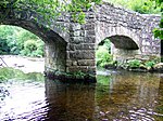
Fingle Bridge
Moretonhampstead Bridge
Circa early 17th century
23 August 1955
SX7430989938 50°41′44″N 3°46′52″W / 50.695467°N 3.78099°W / 50.695467; -3.78099 (Fingle Bridge)
1146775 Fingle Bridge More images
Hatherley
Sloncombe, Moretonhampstead
Farmhouse
Early 16th century
23 August 1955
SX7372786246 50°39′44″N 3°47′17″W / 50.662156°N 3.787964°W / 50.662156; -3.787964 (Hatherley)
1097187 Hatherley More images
Lowton Farmhouse
Moretonhampstead
Farmhouse
Early-mid 16th century
4 February 1987
SX7432385967 50°39′35″N 3°46′46″W / 50.659777°N 3.779441°W / 50.659777; -3.779441 (Lowton Farmhouse)
1097238 Upload Photo
Mearsdon Manor
Moretonhampstead
House
Later 17th century
23 August 1955
SX7546586031 50°39′38″N 3°45′48″W / 50.660598°N 3.763313°W / 50.660598; -3.763313 (Mearsdon Manor)
1147008 Mearsdon Manor More images
Whiddon Park Deer Park Wall
Moretonhampstead
Wall
Probably medieval
4 February 1987
SX7272589338 50°41′23″N 3°48′12″W / 50.689729°N 3.803198°W / 50.689729; -3.803198 (Whiddon Park Deer Park Wall)
1146648 Whiddon Park Deer Park WallMore images
Church of St Mary Abbotsbury
Newton Abbot Church
1904-1906
16 July 1949
SX8572971524 50°31′56″N 3°36′49″W / 50.532297°N 3.613694°W / 50.532297; -3.613694 (Church of St Mary Abbotsbury)
1256768 Church of St Mary Abbotsbury More images
Church of St Paul
Newton Abbot
Church
1859-1861
16 July 1949
SX8642671192 50°31′46″N 3°36′14″W / 50.529449°N 3.603762°W / 50.529449; -3.603762 (Church of St Paul)
1257096 Church of St Paul More images
St Augustines Priory
Newton Abbot
House
Early 19th century
22 March 1983
SX8641069054 50°30′37″N 3°36′12″W / 50.510226°N 3.603336°W / 50.510226; -3.603336 (St Augustines Priory)
1256845 Upload Photo
St Leonards Tower
Newton Abbot
Church tower
15th century
16 July 1949
SX8579871202 50°31′46″N 3°36′45″W / 50.529416°N 3.612622°W / 50.529416; -3.612622 (St Leonards Tower)
1256725 St Leonards Tower More images
Bowden Farmhouse
North Bovey Farmhouse
19th century
4 February 1987
SX7259983756 50°38′22″N 3°48′11″W / 50.639529°N 3.803058°W / 50.639529; -3.803058 (Bowden Farmhouse)
1097194 Upload Photo
Gate House
North Bovey
Farmhouse
Mid to late 15th century
23 August 1955
SX7408083881 50°38′28″N 3°46′56″W / 50.640975°N 3.782167°W / 50.640975; -3.782167 (Gate House)
1097177 Upload Photo
Lower West Coombe Farmhouse
West Coombe, North Bovey
Cross Passage House
Early 16th century
4 February 1987
SX7094882498 50°37′40″N 3°49′33″W / 50.627858°N 3.825955°W / 50.627858; -3.825955 (Lower West Coombe Farmhouse)
1097138 Upload Photo
Manor House Hotel (Bovey Castle) including Terraces immediately to south-east
North Bovey
Country House
1907
16 January 1981
SX7314984472 50°38′46″N 3°47′44″W / 50.646085°N 3.795529°W / 50.646085; -3.795529 (Manor House Hotel (Bovey Castle) including Terraces immediately to south-east)
1097161 Manor House Hotel (Bovey Castle) including Terraces immediately to south-eastMore images
Church of St Clement
Powderham Parish Church
15th century
30 June 1961
SX9725184413 50°39′01″N 3°27′17″W / 50.650308°N 3.454748°W / 50.650308; -3.454748 (Church of St Clement)
1333985 Church of St Clement More images
Stables House
Powderham
House
18th century
2 December 1988
SX9666183618 50°38′35″N 3°27′46″W / 50.643057°N 3.462868°W / 50.643057; -3.462868 (Stables House)
1097668 Upload Photo
The Belvedere in Powderham Castle Park
Powderham
Estate Cottage
1771-1774
11 November 1952
SX9622184172 50°38′53″N 3°28′09″W / 50.647959°N 3.469244°W / 50.647959; -3.469244 (The Belvedere in Powderham Castle Park)
1306164 The Belvedere in Powderham Castle Park More images
Church of St George
Shillingford St George, Shillingford St. George
Parish Church
Probably Medieval
30 June 1961
SX9038387801 50°40′46″N 3°33′10″W / 50.679512°N 3.552863°W / 50.679512; -3.552863 (Church of St George)
1165990 Church of St George More images
Brickhouse
Starcross House
Probably Late 17th century
11 November 1952
SX9440780950 50°37′07″N 3°29′38″W / 50.618668°N 3.493974°W / 50.618668; -3.493974 (Brickhouse)
1097698 Brickhouse More images
Mowlish Manor
Starcross
House
Late 16th century
2 December 1988
SX9508381022 50°37′10″N 3°29′04″W / 50.619437°N 3.484442°W / 50.619437; -3.484442 (Mowlish Manor)
1097703 Mowlish Manor More images
Church of St Andrew
Stokeinteignhead Parish Church
Late C14/C15
23 August 1955
SX9156170442 50°31′25″N 3°31′52″W / 50.523682°N 3.531123°W / 50.523682; -3.531123 (Church of St Andrew)
1097645 Church of St Andrew More images
Church of St Mary
Tedburn St. Mary Tower
late C14/early 15th century
4 September 1986
SX8062594468 50°44′15″N 3°41′35″W / 50.737518°N 3.693073°W / 50.737518; -3.693073 (Church of St Mary)
1215975 Church of St Mary More images
Little Hackworthy
Tedburn St. Mary
Farmhouse
circa late 15th century
6 February 1980
SX8015293264 50°43′36″N 3°41′58″W / 50.726598°N 3.699381°W / 50.726598; -3.699381 (Little Hackworthy)
1216075 Upload Photo
Windout Farmhouse
Tedburn St. Mary Kitchen
17th century
11 November 1952
SX8112391967 50°42′55″N 3°41′07″W / 50.715139°N 3.685212°W / 50.715139; -3.685212 (Windout Farmhouse)
1287701 Windout Farmhouse More images
Church of St Peter and St Paul
Teigngrace Parish Church
1787
23 August 1955
SX8497673924 50°33′13″N 3°37′30″W / 50.553724°N 3.625055°W / 50.553724; -3.625055 (Church of St Peter and St Paul)
1166346 Church of St Peter and St Paul More images
Clock House, Stover School
Stover Park, Teigngrace
Gate
c. 1830
23 August 1955
SX8365174111 50°33′19″N 3°38′38″W / 50.555142°N 3.643809°W / 50.555142; -3.643809 (Clock House, Stover School)
1308973 Upload Photo
Former Stables to Stover House about 50m to north
Stover Park, Teigngrace
Stable
1779
3 July 1986
SX8384174264 50°33′24″N 3°38′28″W / 50.556555°N 3.641176°W / 50.556555; -3.641176 (Former Stables to Stover House about 50m to north)
1308968 Upload Photo
Stover House
Stover Park, Teigngrace
Country House
1776-81
3 July 1986
SX8384674204 50°33′22″N 3°38′28″W / 50.556017°N 3.641087°W / 50.556017; -3.641087 (Stover House)
1334127 Stover House More images
The Granite Lodge adjacent A38 about 1550m north-north-west of Stover House
Stover Park, Teigngrace
Gate Lodge
Probably c1830
23 August 1955
SX8338075670 50°34′09″N 3°38′53″W / 50.569102°N 3.648122°W / 50.569102; -3.648122 (The Granite Lodge adjacent A38 about 1550m north-north-west of Stover House)
1308943 The Granite Lodge adjacent A38 about 1550m north-north-west of Stover House More images
Bitton House
Teignmouth House
Late 18th century
30 June 1949
SX9350173055 50°32′51″N 3°30′16″W / 50.547529°N 3.504512°W / 50.547529; -3.504512 (Bitton House)
1269155 Bitton House More images
Church of St James (Parish Church of West Teignmouth)
Teignmouth
Church
13th century
30 June 1949
SX9393973098 50°32′53″N 3°29′54″W / 50.547995°N 3.498345°W / 50.547995; -3.498345 (Church of St James (Parish Church of West Teignmouth))
1269111 Church of St James (Parish Church of West Teignmouth) More images
United Reformed Church and attached Wall
Teignmouth
Church
1903
29 July 1983
SX9434073117 50°32′54″N 3°29′34″W / 50.548238°N 3.492692°W / 50.548238; -3.492692 (United Reformed Church and attached Wall)
1269098 United Reformed Church and attached Wall More images
Chicks
Trusham Farmhouse
Probably late 15th century
3 July 1986
SX8545182215 50°37′42″N 3°37′15″W / 50.628347°N 3.620911°W / 50.628347; -3.620911 (Chicks)
1308907 Upload Photo
Church of Saint Michael
Trusham
Parish Church
1259
23 August 1955
SX8559282176 50°37′41″N 3°37′08″W / 50.628024°N 3.618906°W / 50.628024; -3.618906 (Church of Saint Michael)
1308904 Church of Saint Michael More images
The Old Rectory
Trusham
Farmhouse
Late C15-early 16th century
23 August 1955
SX8558882322 50°37′46″N 3°37′08″W / 50.629336°N 3.619008°W / 50.629336; -3.619008 (The Old Rectory)
1097345 Upload Photo
Barn to the East of Glebe House
Church Town, Whitestone
Garage
circa early 16th century
4 September 1986
SX8685494319 50°44′15″N 3°36′17″W / 50.737427°N 3.604791°W / 50.737427; -3.604791 (Barn to the East of Glebe House)
1227870 Upload Photo
Glebe House
Whitestone House
Late 16th century
11 November 1952
SX8682494326 50°44′15″N 3°36′19″W / 50.737484°N 3.605218°W / 50.737484; -3.605218 (Glebe House)
1287465 Upload Photo
Church House Sexton's Cottage
Widecombe in the Moor, Widecombe in the Moor
Clergy House
Early 16th century
23 August 1955
SX7183576780 50°34′36″N 3°48′41″W / 50.576659°N 3.811446°W / 50.576659; -3.811446 (Church House Sexton's Cottage)
1259960 Church House Sexton's Cottage More images
Corndon Ford Farmhouse
Widecombe in the Moor
Farmhouse
15th century or 17th century or earlier
23 August 1955
SX6924574531 50°33′21″N 3°50′50″W / 50.55587°N 3.847214°W / 50.55587; -3.847214 (Corndon Ford Farmhouse)
1260487 Upload Photo
Cressen Hayes and Little Cressen Hayes
Lower Town, Widecombe in the Moor
House
Early 16th century
3 November 1986
SX7110072861 50°32′29″N 3°49′14″W / 50.541271°N 3.820463°W / 50.541271; -3.820463 (Cressen Hayes and Little Cressen Hayes)
1242408 Cressen Hayes and Little Cressen Hayes More images
Higher Tor Farmhouse
Widecombe in the Moor
House
1955
23 August 1955
SX6978272606 50°32′19″N 3°50′20″W / 50.538687°N 3.838964°W / 50.538687; -3.838964 (Higher Tor Farmhouse)
1260392 Upload Photo
Lake Farmhouse
Poundsgate, Widecombe in the Moor
Farmhouse
Late 16th century or early 17th century
23 August 1955
SX7043872294 50°32′10″N 3°49′47″W / 50.536029°N 3.829603°W / 50.536029; -3.829603 (Lake Farmhouse)
1242528 Lake Farmhouse
Ley Farmhouse
Widecombe in the Moor
Cross Passage House
16th century or earlier
3 November 1986
SX7231279389 50°36′01″N 3°48′20″W / 50.600214°N 3.80561°W / 50.600214; -3.80561 (Ley Farmhouse)
1241844 Upload Photo
Lower Tor Farmhouse
Widecombe in the Moor
later alterations
23 August 1955
SX6978972586 50°32′19″N 3°50′20″W / 50.538509°N 3.838858°W / 50.538509; -3.838858 (Lower Tor Farmhouse)
1241903 Upload Photo
Middle Bonehill Farmhouse, including Garden Wall in front of right hand side of House
Bonehill, Widecombe in the Moor
Cross Passage House
Early 19th century
23 August 1955
SX7253677508 50°35′00″N 3°48′06″W / 50.583356°N 3.801801°W / 50.583356; -3.801801 (Middle Bonehill Farmhouse, including Garden Wall in front of right hand side of House)
1242234 Middle Bonehill Farmhouse, including Garden Wall in front of right hand side of House
Middle Natsworthy Farmhouse
Widecombe in the Moor
Cross Passage House
Probably Late 17th century or early 18th century
16 January 1986
SX7226379680 50°36′10″N 3°48′23″W / 50.602819°N 3.806402°W / 50.602819; -3.806402 (Middle Natsworthy Farmhouse)
1260291 Upload Photo
New Bridge
Widecombe in the Moor
Bridge
15th century
23 August 1955
SX7114870881 50°31′25″N 3°49′09″W / 50.523485°N 3.819101°W / 50.523485; -3.819101 (New Bridge)
1241905 New Bridge More images
Outbuilding about 20m north-east of Sherwell Farmhouse
Widecombe in the Moor
Outbuilding
1986
3 November 1986
SX6789974919 50°33′33″N 3°51′59″W / 50.559054°N 3.866343°W / 50.559054; -3.866343 (Outbuilding about 20m north-east of Sherwell Farmhouse)
1260196 Upload Photo
Rowden Farmhouse
Widecombe in the Moor
Farmhouse
Late 17th century or early 18th century
3 November 1986
SX6996876375 50°34′21″N 3°50′16″W / 50.572606°N 3.837658°W / 50.572606; -3.837658 (Rowden Farmhouse)
1242051 Rowden Farmhouse More images
Tunhill Farmhouse
Widecombe in the Moor
Farmhouse
Probably Late Medieval
3 November 1986
SX7271675789 50°34′05″N 3°47′55″W / 50.567944°N 3.798671°W / 50.567944; -3.798671 (Tunhill Farmhouse)
1260138 Upload Photo
Higher Woodland Cottages
Woodland Hamlet, WoodlandFarmhouse
Early 16th century
23 August 1955
SX7910768757 50°30′22″N 3°42′22″W / 50.506092°N 3.706188°W / 50.506092; -3.706188 (Higher Woodland Cottages)
1263534 Upload Photo


