Name
Location
Type
Completed Date designated
Grid ref. Entry number Image
Bretons
Hornchurch, Havering
House
Late 17th century
7 January 1955
TQ5169684862 51°32′32″N 0°11′10″E / 51.542274°N 0.186106°E / 51.542274; 0.186106 (Bretons)
1079875 Bretons More images
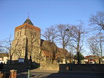
Church of St Mary and St Peter
Wennington, Havering
Church
Medieval
7 January 1955
TQ5398780949 51°30′23″N 0°13′03″E / 51.506497°N 0.217408°E / 51.506497; 0.217408 (Church of St Mary and St Peter)
1079886 Church of St Mary and St Peter More images
Great Tomkyns
Upminster, Havering
House
Modern
7 January 1955
TQ5666989498 51°34′57″N 0°15′35″E / 51.582568°N 0.259824°E / 51.582568; 0.259824 (Great Tomkyns)
1184797 Upload Photo
Barn to North East of Great Tomkyns
Upminster, Havering
Barn
1727
7 January 1955
TQ5668589611 51°35′01″N 0°15′36″E / 51.583579°N 0.260105°E / 51.583579; 0.260105 (Barn to North East of Great Tomkyns)
1358527 Upload Photo
High House Farmhouse
Corbets Tey, Havering
House
c. 1700
7 January 1955
TQ5622585025 51°32′33″N 0°15′05″E / 51.542504°N 0.251435°E / 51.542504; 0.251435 (High House Farmhouse)
1079867 High House Farmhouse
Parish Church of St Edward the Confessor
Romford, Havering
Parish Church
1849
4 July 1952
TQ5119588957 51°34′45″N 0°10′50″E / 51.579201°N 0.180647°E / 51.579201; 0.180647 (Parish Church of St Edward the Confessor)
1358535 Parish Church of St Edward the Confessor More images
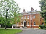
Rainham Hall
Rainham, Havering
House
1729
7 January 1955
TQ5209982164 51°31′05″N 0°11′27″E / 51.517924°N 0.190749°E / 51.517924; 0.190749 (Rainham Hall)
1358506 Rainham Hall More images
Forecourt Railings, Gates and Piers Walls and Vases at Rainham Hall
Rainham, Havering
Gate
Early 18th century
7 January 1955
TQ5208482158 51°31′04″N 0°11′26″E / 51.517874°N 0.19053°E / 51.517874; 0.19053 (Forecourt Railings, Gates and Piers Walls and Vases at Rainham Hall)
1079922 Forecourt Railings, Gates and Piers Walls and Vases at Rainham Hall More images
Stable Block at Rainham Hall
Rainham, Havering
Stable
18th century
7 January 1955
TQ5211582153 51°31′04″N 0°11′28″E / 51.517821°N 0.190974°E / 51.517821; 0.190974 (Stable Block at Rainham Hall)
1183554 Stable Block at Rainham Hall
The Lodge at Rainham Hall
Rainham, Havering
House
Early 18th century
7 January 1955
TQ5209482149 51°31′04″N 0°11′26″E / 51.517791°N 0.19067°E / 51.517791; 0.19067 (The Lodge at Rainham Hall)
1079923 The Lodge at Rainham Hall More images
The Round House
Havering-atte-Bower, Havering
Villa
1792
4 July 1952
TQ5148893136 51°37′00″N 0°11′12″E / 51.61667°N 0.186675°E / 51.61667; 0.186675 (The Round House)
1183562 Upload Photo
The Royal Liberty School
Gidea Park, Havering
Country House
1768-9
14 September 1979
TQ5321289728 51°35′08″N 0°12′36″E / 51.585584°N 0.210069°E / 51.585584; 0.210069 (The Royal Liberty School)
1079885 The Royal Liberty School More images
Upminster Hall
Upminster, Havering
House
17th century
7 January 1955
TQ5659287682 51°33′59″N 0°15′28″E / 51.566274°N 0.257904°E / 51.566274; 0.257904 (Upminster Hall)
1079889 Upload Photo
Upminster Windmill
Upminster, Havering
Smock Mill
Mid 19th century
7 January 1955
TQ5573486725 51°33′28″N 0°14′42″E / 51.557913°N 0.245112°E / 51.557913; 0.245112 (Upminster Windmill)
1079878 Upminster Windmill More images
Wrought Iron Screen and Gates with Piers at Bretons
Hornchurch, Havering
Gate
c. 1740
7 January 1955
TQ5173984853 51°32′32″N 0°11′12″E / 51.542181°N 0.186722°E / 51.542181; 0.186722 (Wrought Iron Screen and Gates with Piers at Bretons)
1358521 Upload Photo
 Media related to Grade I listed buildings in the London Borough of Havering at Wikimedia Commons
 Media related to Grade II* listed buildings in the London Borough of Havering at Wikimedia Commons


