Name
Location
Type
Completed Date designated
Grid ref. Entry number Image
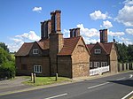
Almshouses
Harefield, Hillingdon
Almshouse
16th century
8 May 1950
TQ0515689824 51°35′51″N 0°29′00″W / 51.597455°N 0.483222°W / 51.597455; -0.483222 (Almshouses)
1358364 Almshouses More images
Cedars House
Hillingdon, Hillingdon
House
c. 1580
8 May 1950
TQ0694883003 51°32′09″N 0°27′34″W / 51.53581°N 0.459434°W / 51.53581; -0.459434 (Cedars House)
1284903 Upload Photo
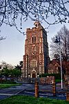
Church of St Dunstan
Cranford, Hillingdon
Church
13th century
27 May 1949
TQ1016078179 51°29′31″N 0°24′53″W / 51.491835°N 0.414648°W / 51.491835; -0.414648 (Church of St Dunstan)
1181190 Church of St Dunstan More images
Church of St Giles
Ickenham, Hillingdon
Parish Church
Late 14th century
8 May 1950
TQ0795086264 51°33′54″N 0°26′38″W / 51.56493°N 0.443993°W / 51.56493; -0.443993 (Church of St Giles)
1080229 Church of St Giles More images
Church of St John
Hillingdon, Hillingdon
Parish Church
13th century
8 May 1950
TQ0691482916 51°32′06″N 0°27′36″W / 51.535035°N 0.45995°W / 51.535035; -0.45995 (Church of St John)
1080160 Church of St John More images
Church of St Laurence
Cowley, Hillingdon
Parish Church
12th century
8 May 1950
TQ0599482043 51°31′38″N 0°28′24″W / 51.527361°N 0.473471°W / 51.527361; -0.473471 (Church of St Laurence)
1286371 Church of St Laurence More images
Church of St Margaret
Uxbridge
14th-15th century
1985–88
8 May 1950
TQ0552584099 51°32′45″N 0°28′47″W / 51.545929°N 0.479614°W / 51.545929; -0.479614 (Church of St Margaret)
1180516 Church of St Margaret More images
Church of St Martin
West Drayton, Hillingdon
Parish Church
13th century
1 March 1950
TQ0616379542 51°30′17″N 0°28′18″W / 51.50485°N 0.471789°W / 51.50485; -0.471789 (Church of St Martin)
1358325 Church of St Martin More images
Church of St Mary
Hayes, Hillingdon
Parish Church
13th century
27 May 1949
TQ0970881077 51°31′05″N 0°25′13″W / 51.51797°N 0.420256°W / 51.51797; -0.420256 (Church of St Mary)
1080233 Church of St Mary More images
Church of St Mary, Harmondsworth
Harmondsworth, Hillingdon
Parish Church
12th century
1 March 1950
TQ0569577808 51°29′22″N 0°28′45″W / 51.489352°N 0.479048°W / 51.489352; -0.479048 (Church of St Mary, Harmondsworth)
1080201 Church of St Mary, Harmondsworth More images
Discotheque Royle
Hillingdon
Cinema
1930–31
15 November 1976
TQ0589583954 51°32′40″N 0°28′28″W / 51.544556°N 0.474324°W / 51.544556; -0.474324 (Discotheque Royle)
1080111 Discotheque Royle More images
Dovecote to North West of Breakspear House
Harefield, Hillingdon
Dovecote
17th century
4 July 1968
TQ0601689692 51°35′46″N 0°28′15″W / 51.596108°N 0.47085°W / 51.596108; -0.47085 (Dovecote to North West of Breakspear House)
1080263 Upload Photo
Footbridge Across River Colne, to North of Denham Court
Denham Court, Hillingdon
Footbridge
c. 1850
30 June 1986
TQ0515587329 51°34′30″N 0°29′02″W / 51.57503°N 0.483983°W / 51.57503; -0.483983 (Footbridge Across River Colne, to North of Denham Court)
1065962 Upload Photo
Fray's Cottage Old Mill House
West Drayton, Hillingdon
House
Late 18th century
1 March 1950
TQ0542979082 51°30′03″N 0°28′57″W / 51.500852°N 0.482498°W / 51.500852; -0.482498 (Fray's Cottage Old Mill House)
1181607 Fray's Cottage Old Mill House More images
Great Barn to West of Manor Farm Yard
Ruislip
Barn
Late 17th century or 18th century
6 September 1974
TQ0897787755 51°34′41″N 0°25′43″W / 51.578133°N 0.42872°W / 51.578133; -0.42872 (Great Barn to West of Manor Farm Yard)
1358359 Great Barn to West of Manor Farm Yard More images
Green End
Northwood, Hillingdon
House
17th century
14 September 1993
TQ0895391704 51°36′49″N 0°25′40″W / 51.613631°N 0.427841°W / 51.613631; -0.427841 (Green End)
1065964 Upload Photo
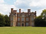
Harefield Park
Harefield, Hillingdon
House
EARLY-MID 18th century
6 September 1974
TQ0493390841 51°36′24″N 0°29′10″W / 51.606637°N 0.486136°W / 51.606637; -0.486136 (Harefield Park)
1080177 Harefield Park More images
Heinz buildings
Hayes, Hillingdon
Commercial Office: full name: Heinz Administrative Headquarters and Former Research Laboratories
Mid 20th century
24 November 1995
TQ0887582471 51°31′50″N 0°25′55″W / 51.530661°N 0.431826°W / 51.530661; -0.431826 (Heinz buildings)
1242724 Heinz buildings
Hillingdon Court
Hillingdon, Hillingdon
Country House
1854-8
16 August 1983
TQ0684883829 51°32′36″N 0°27′38″W / 51.543253°N 0.460624°W / 51.543253; -0.460624 (Hillingdon Court)
1080114 Upload Photo
Mount Vernon Hospital Chapel
Northwood
Chapel
1904
6 September 1974
TQ0785991779 51°36′52″N 0°26′37″W / 51.614516°N 0.443612°W / 51.614516; -0.443612 (Mount Vernon Hospital Chapel)
1358386 Mount Vernon Hospital ChapelMore images
No. 9-15 High Street
Ruislip
Continuous Jetty House
16th century
24 January 1950
TQ0912487593 51°34′36″N 0°25′36″W / 51.576649°N 0.42665°W / 51.576649; -0.42665 (No. 9-15 High Street)
1080204 No. 9-15 High Street
Southlands
West Drayton, Hillingdon
House
Early 18th century
1 March 1950
TQ0588779170 51°30′06″N 0°28′33″W / 51.501558°N 0.475875°W / 51.501558; -0.475875 (Southlands)
1286038 Southlands More images
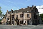
Crown and Treaty Inn
Uxbridge
Inn
1576
8 May 1950
TQ0519884529 51°32′59″N 0°29′03″W / 51.549855°N 0.4842°W / 51.549855; -0.4842 (Crown and Treaty Inn)
1080148 Crown and Treaty InnMore images
The Frays
West Drayton, Hillingdon
House
Late 16th century
6 September 1974
TQ0554679319 51°30′11″N 0°28′51″W / 51.502961°N 0.480742°W / 51.502961; -0.480742 (The Frays)
1358349 Upload Photo
The Market House
Uxbridge
Market House
1788
8 May 1950
TQ0553784107 51°32′46″N 0°28′46″W / 51.545998°N 0.479439°W / 51.545998; -0.479439 (The Market House)
1080208 The Market House More images
The Old Gatehouse
West Drayton, Hillingdon
Manor House
Early 16th century
1 March 1950
TQ0617179491 51°30′16″N 0°28′18″W / 51.50439°N 0.471689°W / 51.50439; -0.471689 (The Old Gatehouse)
1193001 The Old Gatehouse More images
Walls south of Old Gatehouse etc.
West Drayton, Hillingdon: full name: Wall Running South from the Old Gatehouse and West Along Front of Gatehouse Nurseries
Wall
Early 16th century
6 September 1974
TQ0615579469 51°30′15″N 0°28′19″W / 51.504195°N 0.471926°W / 51.504195; -0.471926 (Walls south of Old Gatehouse etc.)
1358326 Walls south of Old Gatehouse etc. More images
Walls around St Martin's
West Drayton, Hillingdon
Wall: full name: Walls Around Saint Martin's Churchyard
16th century
6 September 1974
TQ0618579549 51°30′18″N 0°28′17″W / 51.504909°N 0.47147°W / 51.504909; -0.47147 (Walls around St Martin's)
1286366 Walls around St Martin's More images
Walls of Cooombe House
West Drayton, Hillingdon: full name: Walls to East and South of Garden of Number 28 (coombe House)
Wall
Early 16th century
6 September 1974
TQ0609579466 51°30′15″N 0°28′22″W / 51.504179°N 0.472791°W / 51.504179; -0.472791 (Walls of Cooombe House)
1193014 Walls of Cooombe House More images
 Media related to Grade I listed buildings in the London Borough of Hillingdon at Wikimedia Commons
 Media related to Grade II* listed buildings in the London Borough of Hillingdon at Wikimedia Commons


