Misplaced Pages

Grade I and II* listed buildings in the London Borough of Sutton

Article snapshot taken from Wikipedia with creative commons attribution-sharealike license. Give it a read and then ask your questions in the chat. We can research this topic together.
(Redirected from Grade I and II* listed buildings in Sutton)

Map all coordinates using OpenStreetMap

Download coordinates as:

There are over 9,000 Grade I listed buildings and 20,000 Grade II* listed buildings in England. This page is a list of these buildings in the London Borough of Sutton.

Grade I

Name Location Type Completed Date designated Grid ref.
Geo-coordinates
Entry number Image
Beddington Place (Great Hall only) Beddington, Sutton Bell Tower 1550 21 January 1954 TQ2962165302
51°22′19″N 0°08′21″W / 51.37199°N 0.139187°W / 51.37199; -0.139187 (Beddington Place (Great Hall only))
1065672
Beddington Place (Great Hall only)
More images

Grade II*

Name Location Type Completed Date designated Grid ref.
Geo-coordinates
Entry number Image
Carshalton House Carshalton House 1696–1713 16 March 1954 TQ2755164460
51°21′54″N 0°10′09″W / 51.364891°N 0.169211°W / 51.364891; -0.169211 (Carshalton House)
1065627
Carshalton House
Carshalton House
More images
Carshalton House Water Pavilion Carshalton Orangery Before 1721 16 March 1954 TQ2771464483
51°21′54″N 0°10′01″W / 51.365061°N 0.166863°W / 51.365061; -0.166863 (Carshalton House Water Pavilion)
1183926
Carshalton House Water Pavilion
More images
Carshalton House Grotto Carshalton Grotto Before 1721 16 March 1954 TQ2760764379
51°21′51″N 0°10′06″W / 51.36415°N 0.168437°W / 51.36415; -0.168437 (Carshalton House Grotto)
1357608
Upload Photo
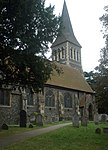
Church of All Saints Carshalton Church 12th century 16 March 1954 TQ2798464469
51°21′54″N 0°09′47″W / 51.364874°N 0.162992°W / 51.364874; -0.162992 (Church of All Saints)
1065683
Church of All Saints
More images
Church of All Saints Sutton Church 19th century 28 August 1953 TQ2586165281
51°22′22″N 0°11′35″W / 51.372646°N 0.193184°W / 51.372646; -0.193184 (Church of All Saints)
1065697
Church of All Saints
More images
Church of St Dunstan Cheam, Sutton Church 13th century 26 January 1971 TQ2428263916
51°21′39″N 0°12′59″W / 51.360726°N 0.216333°W / 51.360726; -0.216333 (Church of St Dunstan)
1065676
Church of St Dunstan
More images
No. 19 Park Hill Sutton House c. 1867 1 March 1974 TQ2755064024
51°21′40″N 0°10′10″W / 51.360973°N 0.169382°W / 51.360973; -0.169382 (No. 19 Park Hill)
1183738
No. 19 Park Hill
No. 19 Park Hill
More images
Church of St Mary the Virgin Beddington, Sutton Church 14th or 15th century 21 January 1954 TQ2956865249
51°22′17″N 0°08′24″W / 51.371525°N 0.139968°W / 51.371525; -0.139968 (Church of St Mary the Virgin)
1065670
Church of St Mary the Virgin
More images
Beddington Place Pigeon House Beddington, Sutton Dovecote Early 18th century 21 January 1954 TQ2954165374
51°22′22″N 0°08′25″W / 51.372655°N 0.14031°W / 51.372655; -0.14031 (Beddington Place Pigeon House)
1065674
Beddington Place Pigeon House
More images
Lumley Chapel Cheam, Sutton Church 12th century 28 August 1953 TQ2429963900
51°21′38″N 0°12′58″W / 51.360578°N 0.216095°W / 51.360578; -0.216095 (Lumley Chapel)
1183440
Lumley Chapel
Lumley Chapel
More images
Whitehall Cheam, Sutton House 16th century 28 August 1953 TQ2422463766
51°21′34″N 0°13′02″W / 51.35939°N 0.217218°W / 51.35939; -0.217218 (Whitehall)
1357580
Whitehall
Whitehall
More images
Church of St Nicholas St Nicholas Road, Sutton Church 1864 1 March 1974 TQ2577164158
51°21′45″N 0°11′42″W / 51.362573°N 0.19487285°W / 51.362573; -0.19487285 (Church of St Nicholas)
1065629
Church of St Nicholas
More images

Grade II

Name Location Type Completed Date designated Grid ref.
Geo-coordinates
Entry number Image
Trinity Church Cheam Road, Sutton Church 1907 1 March 1974 TQ2561364111
51°21′42″N 0°11′44″W / 51.361667°N 0.195556°W / 51.361667; -0.195556 (Trinity Church)
1200708
Trinity Church
Trinity Church
More images

Notes

  1. ^ The date given is the date used by Historic England as significant for the initial building or that of an important part in the structure's description.
  2. ^ Sometimes known as OSGB36, the grid reference is based on the British national grid reference system used by the Ordnance Survey.
  3. ^ The "List Entry Number" is a unique number assigned to each listed building and scheduled monument by Historic England.

External links

London Borough of Sutton
Districts Coat of arms of the London Borough of Sutton

Location of the London Borough of Sutton in Greater London
Attractions
Places of worship
Parks and open spaces
Constituencies
Rail and tram stations
Other topics
Grade I listed buildings in London
Grade II* listed buildings in London
Portals: Categories: