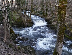
| Haute Loue | |
|---|---|
 | |
  | |
| Location | |
| Country | France |
| Physical characteristics | |
| Source | |
| • location | Dordogne |
| Mouth | |
| • location | Loue |
| • coordinates | 45°22′5″N 1°5′24″E / 45.36806°N 1.09000°E / 45.36806; 1.09000 |
| Length | 18.6 km (11.6 mi) |
| Basin features | |
| Progression | Loue→ Isle→ Dordogne→ Gironde estuary→ Atlantic Ocean |
Haute Loue (French meaning the Upper Loue) is a river in the Dordogne department of France. It is a tributary of the Loue, which is itself a tributary of the Isle. It is 18.6 km (11.6 mi) long.
The source of the river is in the commune of Angoisse. It empties into the Loue southwest of Lanouaille.
References
This article related to a river in France is a stub. You can help Misplaced Pages by expanding it. |