| Khangchendzonga National Park | |
|---|---|
| IUCN category II (national park) | |
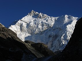
 Mount Kanchenjunga from Goecha La pass, Khangchendzonga National Park, Sikkim Mount Kanchenjunga from Goecha La pass, Khangchendzonga National Park, Sikkim | |
  | |
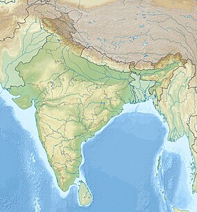
| Location | Mangan district and Gyalshing district, Sikkim, India |
| Nearest town | Chungthang |
| Coordinates | 27°39′22.7″N 88°18′44.3″E / 27.656306°N 88.312306°E / 27.656306; 88.312306 |
| Area | 1,784 km (689 sq mi) |
| Established | 1977 |
| Governing body | Ministry of Environment and Forests, Government of India |
| UNESCO World Heritage Site | |
| Type | Mixed |
| Criteria | iii, vi, vii, x |
| Designated | 2016 (40th session) |
| Reference no. | 1513 |
Khangchendzonga National Park, also Kanchenjunga Biosphere Reserve, is a national park and a biosphere reserve located in Sikkim, India. It was inscribed to the UNESCO World Heritage Sites list in July 2016, becoming the first "Mixed Heritage" site of India. It was included in the UNESCO Man and the Biosphere Programme. The park is named after the mountain Kangchenjunga, which is the third-highest peak in the world at 8,586 m (28,169 ft) tall. The total area of the park is 849.5 km (328.0 sq mi).
Geography

Khangchendzonga National Park covers an area of 849.50 km (327.99 sq mi) in Mangan district and Gyalshing district at an elevation of 1,829 m (6,001 ft) to over 8,550 m (28,050 ft). It is one of the few high-altitude national parks of India and was designated a mixed-criteria UNESCO World Heritage Site in July 2016.
In the north, it adjoins Qomolangma National Nature Preserve in Tibet, and in the west Kanchenjunga Conservation Area in Nepal.
Flora
The vegetation of the park include temperate broadleaf and mixed forests consisting of oaks, fir, birch, maple and willow. Alpine grasses and shrubs occur at higher elevations along with many medicinal plants and herbs.
Fauna
About 550 species of birds occur in the park including blood pheasant, satyr tragopan, osprey, Himalayan griffon, lammergeier, several species of green pigeon, Tibetan snowcock, snow pigeon, impeyan pheasant, Asian emerald cuckoo, sunbirds and eagles. The dhole has been recorded by camera traps at elevations of 2,501–4,100 m (8,205–13,451 ft).
References
- O'Neill, A. (2017). "Sikkim claims India's first mixed-criteria UNESCO World Heritage Site" (PDF). Current Science. 112 (5): 893–994. Archived (PDF) from the original on 29 March 2017. Retrieved 11 May 2017.
- ^ O'Neill, A. R. (2019). "Evaluating high-altitude Ramsar wetlands in the Sikkim Eastern Himalayas". Global Ecology and Conservation. 20 (e00715): 19. doi:10.1016/j.gecco.2019.e00715.
- Bhuju, U. R.; Shakya, P. R.; Basnet, T. B. & Shrestha, S. (2007). "Kanchenjunga Conservation Area". Nepal Biodiversity Resource Book. Protected Areas, Ramsar Sites, and World Heritage Sites. Kathmandu: International Centre for Integrated Mountain Development, Ministry of Environment, Science and Technology, in cooperation with United Nations Environment Programme, Regional Office for Asia and the Pacific. ISBN 978-92-9115-033-5. Archived from the original on 5 May 2021. Retrieved 10 January 2021.
- O'Neill, A. R.; Badola, H.K.; Dhyani, P. P.; Rana, S. K. (2017). "Integrating ethnobiological knowledge into biodiversity conservation in the Eastern Himalayas". Journal of Ethnobiology and Ethnomedicine. 13 (1): 21. doi:10.1186/s13002-017-0148-9. PMC 5372287. PMID 28356115.
- Bashir, T.; Bhattacharya, T.; Poudyal, K.; Roy, M.; Sathyakumar, S. (2014). "Precarious status of the Endangered Dhole Cuon alpinus in the high elevation Eastern Himalayan habitats of Khangchendzonga Biosphere Reserve, Sikkim, India". Oryx. 48 (1): 125–132. doi:10.1017/S003060531200049X.
External links
![]() Khangchendzonga National Park travel guide from Wikivoyage
Khangchendzonga National Park travel guide from Wikivoyage