| This article does not cite any sources. Please help improve this article by adding citations to reliable sources. Unsourced material may be challenged and removed. Find sources: "Lake Oviáchic" – news · newspapers · books · scholar · JSTOR (December 2009) (Learn how and when to remove this message) |
| Lake Ouiachic | |
|---|---|
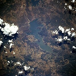
 from space, October 1994 from space, October 1994 | |
 | |
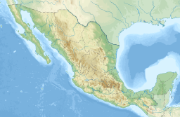
| Location | Sierra Madre Occidental, Cajeme, Sonora, Mexico |
| Coordinates | 27°52′20″N 109°51′50″W / 27.8722°N 109.8640°W / 27.8722; -109.8640 |
| Type | reservoir |
| Primary inflows | Yaqui River |
| Primary outflows | Yaqui River |
| Basin countries | Mexico |
| Max. length | 19.6 km (12.2 mi) |
| Max. width | 7.8 km (4.8 mi) |
| Islands | numerous islands and islets |
Lake Ouiachic (also referred to as the Álvaro Obregón Reservoir) is located in the foothills of the Sierra Madre Occidental and is created by the Álvaro Obregón Dam. Lake Ouiachic is fed by and drained by the Yaqui River. The dam was completed in 1952 with the purpose to regulate water flow of the Yaqui River, prevent floods, and generate electricity. Lake Ouiachic is also an expanding tourist and resort area specializing in fishing, boating, and water skiing.
This article about a location in the Mexican state of Sonora is a stub. You can help Misplaced Pages by expanding it. |