| Laleia River | |
|---|---|
 A braided channel of the river, lined with Savanna and Casuarina A braided channel of the river, lined with Savanna and Casuarina | |
 | |
| Native name |
|
| Location | |
| Country | Timor-Leste |
| Municipalities | |
| Physical characteristics | |
| Source confluence | |
| • location | Manatuto / Viqueque border |
| Mouth | Wetar Strait |
| • location | Suco Lifau (Laleia) |
| • coordinates | 8°29′47″S 126°09′39″E / 8.49633°S 126.16075°E / -8.49633; 126.16075 |
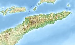
The Laleia River (Portuguese: Ribeira de Laleia or Rio de Laleia, Tetum: Mota Laleia) is a major river in northeastern Timor-Leste. It flows north from the country's central mountains into Wetar Strait.
Etymology

The river shares its name with the village of Laleia [de] (also known as Leleia or Lifau) on its left bank, a short distance south of its mouth. Extending eastwards from the village is a bridge, the Laleia Bridge, which carries National Road A01 (Dili – Com, Lautém) across the river.
Both the village and the bridge are adjacent to the border between Haturalan [de] and Lifau, two of the three sucos of another namesake of the river, Laleia administrative post (the third suco is Cairui [de]).
According to a list prepared by Afonso de Castro [de], governor of the colony of Portuguese Timor from 1859 to 1863, Laleia was one of 47 kingdoms in that colony at the time.
Course
The headwaters of the river are in the portion of Timor-Leste's central mountains ranging from, in the west, the westernmost parts of northern Suco Barique in Barique administrative post, Manatuto municipality, to, in the east, the area surrounding the border between Suco Ossouala [de], Vemasse administrative post, Baucau municipality, and Suco Liaruca [de], Ossu administrative post, Viqueque municipality.
The river flows primarily in a northerly direction; after running through Laleia administrative post, it discharges into Wetar Strait.
Catchment
The river's catchment or drainage basin is located mainly in the municipality of Manatuto; some parts of it are in one or other of the adjacent municipalities of Baucau and Viqueque. It is about 533 km (206 sq mi) in area, with a channel length of 55 km (34 mi).
Timor-Leste has been broadly divided into twelve 'hydrologic units', groupings of climatologically and physiographically similar and adjacent river catchments. The Laleia River catchment is one of the two major catchments in the Laleia hydrologic unit, which is about 1,009.9 km (389.9 sq mi) in total area; the other is the Vemasse River [de] catchment.
Economy
Mining
In November 2022, the Timor-Leste government, through its Council of Ministers, approved the opening of concession areas in three rivers, including the Laleia River, for the mining of industrial minerals to be used in the production of construction materials.
Also approved in November 2022 were tender terms for the award of mining rights in the concession areas.
Each of the three rivers has abundant sediments transported from upstream in its catchment, or created by erosion of its banks. The sediments are deposited as either gravel or sand on the river's braided flood plains. After being deposited, the gravel and sand can be extracted and used primarily in the construction of small- to medium scale projects.
The Laleia River concession has a total estimated surface area of 174 ha (430 acres). It is made up of two zones, one 500 m (1,600 ft) upstream of the Laleia Bridge, and the other extending from 500 m downstream of the bridge to 500 m away from the Wetar Strait shoreline.
See also
References
- "Lifau, Haturalan, Laleia, Manatuto, Timor Leste". mindat.org. Retrieved 11 January 2025.
- "Meeting of the Council of Ministers on August 6, 2020". Government of Timor-Leste (Press release). 6 August 2020. Retrieved 13 January 2025.
- ^ República Democrática de Timor-Leste: Manatuto [Democratic Republic of Timor-Leste: Manatuto] (PDF) (Map). 1:75000 (in Portuguese). Cartography by Instituto Superior Técnico. Lisbon: Timor-Leste GIS Portal. Archived from the original (PDF) on 20 March 2012. Retrieved 11 January 2025.
- Município Manatuto: Esboços Mapa Suco no Aldeia Timor-Leste (PDF) (in Tetum). Dili: Ministério das Finanças / Direcção Geral de Estatística / Direcção Nacional Cartografia Estatísticas. 2019. pp. 34–39. Archived from the original (PDF) on 12 November 2020. Retrieved 11 January 2025.
- "Timor Loro Sae: Um pouco de história" [Timor Loro Sae: A little history]. A.M.O.C. - Associação dos Militares do Oecussi (in Portuguese). Archived from the original on 13 November 2001. Retrieved 12 January 2025.
- República Democrática de Timor-Leste: Baucau [Democratic Republic of Timor-Leste: Baucau] (PDF) (Map). 1:75000 (in Portuguese). Cartography by Instituto Superior Técnico. Lisbon: Timor-Leste GIS Portal. Archived from the original (PDF) on 30 June 2007. Retrieved 12 January 2025.
- República Democrática de Timor-Leste: Viqueque [Democratic Republic of Timor-Leste: Viqueque] (PDF) (Map). 1:75000 (in Portuguese). Cartography by Instituto Superior Técnico. Lisbon: Timor-Leste GIS Portal. Archived from the original (PDF) on 30 June 2007. Retrieved 12 January 2025.
- ^ "Annex I: Geological synopsis and fluvial system in Timor-Leste focusing on selected rivers for large-scale sand and gravel exploration and extraction for export purpose" (PDF). Terms of Reference: Public Tender for Large Scale Exploration and Mining of Sands for Export Purposes (PDF). Dili: Autoridade Nacional do Petróleo e Minerais [de] (ANPM). 2022. Retrieved 10 January 2025.
- ^ Costin, Graham; Powell, Bronwyn (2006). Situation Analysis Report: Timor-Leste (PDF) (Report). Brisbane: International WaterCentre. Retrieved 26 May 2024.
- AQUASTAT Country Profile – Timor-Leste (PDF) (Report). Rome: Food and Agriculture Organization of the United Nations (FAO). 2011. p. 4. Retrieved 25 June 2022.
- ^ Martins, Filomeno (16 November 2022). "Petroleum and Minerals Ministry approves areas for mining activities". Tatoli. Retrieved 10 January 2025.
- ^ "Meeting of the Council of Ministers on November 16th, 2022". Government of Timor-Leste (Press release). 16 November 2022. Retrieved 10 January 2025.
External links
![]() Media related to Laleia River at Wikimedia Commons
Media related to Laleia River at Wikimedia Commons