| Laugar | |
|---|---|
| village | |
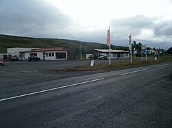
 View of Laugar View of Laugar | |
 | |
| Coordinates: 65°43′18″N 17°21′30″W / 65.72167°N 17.35833°W / 65.72167; -17.35833 | |
| Country | Iceland |
| Region | Northeastern Region |
| Constituency | Northeast Constituency |
| Municipality | Þingeyjarsveit |
| Population | |
| • Total | 109 |
| Postal code(s) | 650 |
| Municipal number | 6613 |
| Website | thingeyjarsveit |
Laugar is a village in the Northeastern Region Iceland, on the Reykjadalsá river, a left tributary of the Laxá í Aðaldal river. Route 1 runs through the village between Akureyri and Reykjahlíð. It is largest village in the municipality of Þingeyjarsveit. In 2018, it had a population of 109 people.
Laugar developed around thermal springs, hence its name, which in Icelandic means "hot springs". Laugar is located on the Diamond Circle tourist route. In its vicinity there are famous tourist attractions: Goðafoss waterfall (approx. 10 km (6.2 mi) to the west) and lake Mývatn (approx. 20 km (12 mi) to the southeast). However, 8 km (5.0 mi) to the north of the village, there is lake Vestmannsvatn.
References
- ^ "Map Viewer". National Land Survey of Iceland. Retrieved 2019-01-01.
- "Municipalities and urban nuclei". Hagstofa Íslands. Retrieved 2019-01-01.
- "Laugar". Visit North Iceland. Archived from the original on 2019-01-02. Retrieved 2019-01-01.
External links
- Official website (in Icelandic)
This Iceland location article is a stub. You can help Misplaced Pages by expanding it. |