| Name
|
Location
|
Date Listed
|
Grid Ref.
|
Geo-coordinates
|
Notes
|
LB Number
|
Image
|
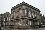
| Albany Street, Sheriff Court-House
|
|
|
|
56°24′41″N 5°28′25″W / 56.41139°N 5.473556°W / 56.41139; -5.473556 (Albany Street, Sheriff Court-House)
|
Category B
|
38801
|
 Upload another image
|
| 6-14 (Even Nos) Alma Crescent
|
|
|
|
56°24′36″N 5°28′41″W / 56.410009°N 5.477922°W / 56.410009; -5.477922 (6-14 (Even Nos) Alma Crescent)
|
Category C(S)
|
38802
|

Upload Photo
|
| Argyll Square, St Columba's Church And Hall With Gatepiers (Formerly United Free Church)
|
|
|
|
56°24′42″N 5°28′25″W / 56.411742°N 5.473491°W / 56.411742; -5.473491 (Argyll Square, St Columba's Church And Hall With Gatepiers (Formerly United Free Church))
|
Category C(S)
|
38813
|
 Upload another image
|
| Corran Esplanade, Great Western Hotel
|
|
|
|
56°25′04″N 5°28′27″W / 56.417672°N 5.474259°W / 56.417672; -5.474259 (Corran Esplanade, Great Western Hotel)
|
Category B
|
38822
|

Upload Photo
|
| Corran Esplanade, Kilchrenan And Glencairn Hotels
|
|
|
|
56°25′13″N 5°28′50″W / 56.420187°N 5.480425°W / 56.420187; -5.480425 (Corran Esplanade, Kilchrenan And Glencairn Hotels)
|
Category C(S)
|
38823
|

Upload Photo
|
| Corran Esplanade, Queens Hotel
|
|
|
|
56°25′15″N 5°28′53″W / 56.420883°N 5.481268°W / 56.420883; -5.481268 (Corran Esplanade, Queens Hotel)
|
Category C(S)
|
38825
|

Upload Photo
|
| Corran Esplanade, Wellpark And Glenrigh Hotels
|
|
|
|
56°25′15″N 5°28′52″W / 56.420728°N 5.481026°W / 56.420728; -5.481026 (Corran Esplanade, Wellpark And Glenrigh Hotels)
|
Category B
|
38828
|

Upload Photo
|
| Corran Esplanade, Westbay Hotel
|
|
|
|
56°25′04″N 5°28′29″W / 56.417902°N 5.474718°W / 56.417902; -5.474718 (Corran Esplanade, Westbay Hotel)
|
Category C(S)
|
38829
|

Upload Photo
|
| 15-17 (Odd Nos) George Street, And 2-3 Queen's Park Place, Single Storey Shops
|
|
|
|
56°24′47″N 5°28′20″W / 56.413168°N 5.472323°W / 56.413168; -5.472323 (15-17 (Odd Nos) George Street, And 2-3 Queen's Park Place, Single Storey Shops)
|
Category C(S)
|
38838
|

Upload Photo
|
| 18 George Street, Palace Hotel
|
|
|
|
56°24′49″N 5°28′19″W / 56.413482°N 5.472044°W / 56.413482; -5.472044 (18 George Street, Palace Hotel)
|
Category C(S)
|
38840
|

Upload Photo
|
| 70 George Street, And Stafford Street
|
|
|
|
56°24′54″N 5°28′21″W / 56.415103°N 5.472581°W / 56.415103; -5.472581 (70 George Street, And Stafford Street)
|
Category B
|
38844
|

Upload Photo
|
| 102-112 (Even Nos) George Street
|
|
|
|
56°24′57″N 5°28′22″W / 56.415934°N 5.472754°W / 56.415934; -5.472754 (102-112 (Even Nos) George Street)
|
Category C(S)
|
38846
|

Upload Photo
|
| Queen's Park Place, (Caledonian Hotel)
|
|
|
|
56°24′46″N 5°28′20″W / 56.41279°N 5.472354°W / 56.41279; -5.472354 (Queen's Park Place, (Caledonian Hotel))
|
Category B
|
38856
|

Upload Photo
|
| 17 And 19 Argyll Square
|
|
|
|
56°24′42″N 5°28′20″W / 56.411715°N 5.472207°W / 56.411715; -5.472207 (17 And 19 Argyll Square)
|
Category C(S)
|
38806
|

Upload Photo
|
| 10-12 (Inclusive Nos) Argyll Square
|
|
|
|
56°24′43″N 5°28′17″W / 56.411911°N 5.471317°W / 56.411911; -5.471317 (10-12 (Inclusive Nos) Argyll Square)
|
Category C(S)
|
38810
|

Upload Photo
|
| 20-22 (Even Nos) Argyll Square
|
|
|
|
56°24′42″N 5°28′21″W / 56.411763°N 5.472422°W / 56.411763; -5.472422 (20-22 (Even Nos) Argyll Square)
|
Category B
|
38811
|

Upload Photo
|
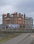
| Corran Esplanade And 1 Stafford Street, Oban Inn
|
|
|
|
56°24′54″N 5°28′25″W / 56.415023°N 5.473514°W / 56.415023; -5.473514 (Corran Esplanade And 1 Stafford Street, Oban Inn)
|
Category B
|
38827
|
 Upload another image
See more images
|
| 28 George Street, King's Arms Flats (Formerly Hotel)
|
|
|
|
56°24′49″N 5°28′20″W / 56.41366°N 5.472092°W / 56.41366; -5.472092 (28 George Street, King's Arms Flats (Formerly Hotel))
|
Category B
|
38842
|

Upload Photo
|
| 94-100 (Even Nos) George Street, And Craigard Road, Balmoral Hotel
|
|
|
|
56°24′57″N 5°28′22″W / 56.415695°N 5.472651°W / 56.415695; -5.472651 (94-100 (Even Nos) George Street, And Craigard Road, Balmoral Hotel)
|
Category C(S)
|
38845
|

Upload Photo
|
| 122-132 (Even Nos) George Street
|
|
|
|
56°24′59″N 5°28′23″W / 56.416386°N 5.47299°W / 56.416386; -5.47299 (122-132 (Even Nos) George Street)
|
Category C(S)
|
38848
|

Upload Photo
|
| George Street And Queen's Park Place, Harbour Walls
|
|
|
|
56°24′49″N 5°28′21″W / 56.413511°N 5.472614°W / 56.413511; -5.472614 (George Street And Queen's Park Place, Harbour Walls)
|
Category C(S)
|
38850
|
 Upload another image
|
| Rockfield Road, Oban Free High Church (Free Church)
|
|
|
|
56°24′44″N 5°28′11″W / 56.412258°N 5.469856°W / 56.412258; -5.469856 (Rockfield Road, Oban Free High Church (Free Church))
|
Category B
|
38857
|
 Upload another image
|
| Rockfield Road, Primary School With Boundary Walls And Play-Shelter
|
|
|
|
56°24′47″N 5°28′12″W / 56.413173°N 5.469923°W / 56.413173; -5.469923 (Rockfield Road, Primary School With Boundary Walls And Play-Shelter)
|
Category B
|
38858
|

Upload Photo
|
| 29 Albany Street, Including Police Station
|
|
|
|
56°24′40″N 5°28′28″W / 56.411°N 5.474315°W / 56.411; -5.474315 (29 Albany Street, Including Police Station)
|
Category C(S)
|
38798
|

Upload Photo
|
| Gallanach Road, The Manorhouse (Hotel) With Lamp Standards, Ice House And Boundary Walls
|
|
|
|
56°24′40″N 5°28′58″W / 56.411191°N 5.482879°W / 56.411191; -5.482879 (Gallanach Road, The Manorhouse (Hotel) With Lamp Standards, Ice House And Boundary Walls)
|
Category B
|
38835
|

Upload Photo
|
| 8-16 (Even Nos) George Street, (Formerly Queen's Hotel)
|
|
|
|
56°24′48″N 5°28′19″W / 56.413307°N 5.471866°W / 56.413307; -5.471866 (8-16 (Even Nos) George Street, (Formerly Queen's Hotel))
|
Category B
|
38839
|

Upload Photo
|
| Hill Street, The Mains With Boundary Wall
|
|
|
|
56°24′46″N 5°28′10″W / 56.412852°N 5.469489°W / 56.412852; -5.469489 (Hill Street, The Mains With Boundary Wall)
|
Category B
|
38852
|

Upload Photo
|
| 1 Shore Street, Claredon Hotel
|
|
|
|
56°24′43″N 5°28′24″W / 56.411969°N 5.473414°W / 56.411969; -5.473414 (1 Shore Street, Claredon Hotel)
|
Category C(S)
|
38859
|

Upload Photo
|
| 23 And 25 Argyll Square, And 1-6 Albany Street
|
|
|
|
56°24′42″N 5°28′22″W / 56.411755°N 5.472697°W / 56.411755; -5.472697 (23 And 25 Argyll Square, And 1-6 Albany Street)
|
Category C(S)
|
38807
|

Upload Photo
|
| 2 Argyll Square And Airds Place, Royal Hotel
|
|
|
|
56°24′44″N 5°28′18″W / 56.412258°N 5.47177°W / 56.412258; -5.47177 (2 Argyll Square And Airds Place, Royal Hotel)
|
Category B
|
38808
|

Upload Photo
|
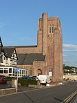
| Corran Esplanade, Cathedral Church Of St Columba, With Boundary Walls (Roman Catholic)
|
|
|
|
56°25′10″N 5°28′44″W / 56.419459°N 5.478834°W / 56.419459; -5.478834 (Corran Esplanade, Cathedral Church Of St Columba, With Boundary Walls (Roman Catholic))
|
Category A
|
38820
|
 Upload another image
See more images
|
| Corran Esplanade, Oban Times Building
|
|
|
|
56°24′57″N 5°28′25″W / 56.415874°N 5.473624°W / 56.415874; -5.473624 (Corran Esplanade, Oban Times Building)
|
Category B
|
38824
|
 Upload another image
|
| Gallanach Road, Dungallan Parks Public Conveniences And Shelter Walls, Steps Balustrades And Lamp Standards
|
|
|
|
56°24′38″N 5°29′09″W / 56.41062°N 5.485908°W / 56.41062; -5.485908 (Gallanach Road, Dungallan Parks Public Conveniences And Shelter Walls, Steps Balustrades And Lamp Standards)
|
Category C(S)
|
38836
|

Upload Photo
|
| 120 George Street
|
|
|
|
56°24′59″N 5°28′23″W / 56.416297°N 5.472965°W / 56.416297; -5.472965 (120 George Street)
|
Category B
|
38847
|

Upload Photo
|
| Nursery Lane And Hamilton Park Terrace
|
|
|
|
56°25′03″N 5°28′22″W / 56.417364°N 5.472738°W / 56.417364; -5.472738 (Nursery Lane And Hamilton Park Terrace)
|
Category C(S)
|
38855
|

Upload Photo
|
| Stafford Street, Oban Distillery
|
|
|
|
56°24′54″N 5°28′18″W / 56.414879°N 5.471603°W / 56.414879; -5.471603 (Stafford Street, Oban Distillery)
|
Category B
|
38864
|

Upload Photo
|
| 19 Stevenson Street, Lindhu House (Former Hall) With Gatepier And Railing
|
|
|
|
56°24′46″N 5°28′14″W / 56.412884°N 5.470611°W / 56.412884; -5.470611 (19 Stevenson Street, Lindhu House (Former Hall) With Gatepier And Railing)
|
Category C(S)
|
38868
|

Upload Photo
|
| Tweeddale Street, Congregational Church
|
|
|
|
56°24′52″N 5°28′15″W / 56.41437°N 5.470843°W / 56.41437; -5.470843 (Tweeddale Street, Congregational Church)
|
Category B
|
38869
|

Upload Photo
|
| 8 And 9 Argyll Square
|
|
|
|
56°24′43″N 5°28′17″W / 56.412006°N 5.471455°W / 56.412006; -5.471455 (8 And 9 Argyll Square)
|
Category C(S)
|
38804
|

Upload Photo
|
| 13 Argyll Square, And Lamp Standard
|
|
|
|
56°24′42″N 5°28′17″W / 56.411662°N 5.471521°W / 56.411662; -5.471521 (13 Argyll Square, And Lamp Standard)
|
Category B
|
38805
|

Upload Photo
|
| Charles Street
|
|
|
|
56°24′55″N 5°28′24″W / 56.415153°N 5.473364°W / 56.415153; -5.473364 (Charles Street)
|
Category B
|
38816
|

Upload Photo
|
| Corran Esplanade, Alexandra Place
|
|
|
|
56°24′57″N 5°28′26″W / 56.41596°N 5.473762°W / 56.41596; -5.473762 (Corran Esplanade, Alexandra Place)
|
Category C(S)
|
38818
|

Upload Photo
|
| Corran Esplanade, Regent Hotel (Formerly Marine Hotel)
|
|
|
|
56°24′56″N 5°28′25″W / 56.415662°N 5.473491°W / 56.415662; -5.473491 (Corran Esplanade, Regent Hotel (Formerly Marine Hotel))
|
Category B
|
38826
|
 Upload another image
|
| 20-26 (Even Nos) George Street, Royal Bank Of Scotland
|
|
|
|
56°24′49″N 5°28′19″W / 56.413571°N 5.472068°W / 56.413571; -5.472068 (20-26 (Even Nos) George Street, Royal Bank Of Scotland)
|
Category B
|
38841
|

Upload Photo
|
| 33 High Street, (Former School Of Industry)
|
|
|
|
56°24′39″N 5°28′21″W / 56.410954°N 5.472429°W / 56.410954; -5.472429 (33 High Street, (Former School Of Industry))
|
Category C(S)
|
38851
|

Upload Photo
|
| North Pier, Piermaster's Offices, With Lamp Standards
|
|
|
|
56°24′53″N 5°28′29″W / 56.414658°N 5.474681°W / 56.414658; -5.474681 (North Pier, Piermaster's Offices, With Lamp Standards)
|
Category C(S)
|
38854
|

Upload Photo
|
| Gallanach Road, Lighthouse Depot Including Gatepiers, Manager's House With Outbuildings To E And Boundary Walls
|
|
|
|
56°24′40″N 5°28′55″W / 56.411206°N 5.482021°W / 56.411206; -5.482021 (Gallanach Road, Lighthouse Depot Including Gatepiers, Manager's House With Outbuildings To E And Boundary Walls)
|
Category C(S)
|
49357
|

Upload Photo
|
| 4-6 (Even Nos) Argyll Square, Royal Bank Of Scotland (Former County Buildings)
|
|
|
|
56°24′43″N 5°28′18″W / 56.412079°N 5.471721°W / 56.412079; -5.471721 (4-6 (Even Nos) Argyll Square, Royal Bank Of Scotland (Former County Buildings))
|
Category B
|
38809
|

Upload Photo
|
| Battery Hill, Mccaig Monument
|
|
|
|
56°24′56″N 5°28′09″W / 56.415692°N 5.469196°W / 56.415692; -5.469196 (Battery Hill, Mccaig Monument)
|
Category B
|
38814
|
 Upload another image
|
| Gallanach Road, Dungallan Hotel With Terrace Walls
|
|
|
|
56°24′36″N 5°29′09″W / 56.409958°N 5.485799°W / 56.409958; -5.485799 (Gallanach Road, Dungallan Hotel With Terrace Walls)
|
Category C(S)
|
38832
|

Upload Photo
|
| Gallanach Road, Kilbowie Lodge
|
|
|
|
56°24′15″N 5°30′01″W / 56.40427°N 5.500374°W / 56.40427; -5.500374 (Gallanach Road, Kilbowie Lodge)
|
Category B
|
38833
|

Upload Photo
|
| George Street, Cathedral Of St John The Divine (Episcopal) With Railings
|
|
|
|
56°25′00″N 5°28′25″W / 56.416687°N 5.473488°W / 56.416687; -5.473488 (George Street, Cathedral Of St John The Divine (Episcopal) With Railings)
|
Category C(S)
|
38849
|
 Upload another image
|
| 1-7 (Inclusive Nos) Shore Street, Cawdor Place Including The Kelvin Hotel
|
|
|
|
56°24′40″N 5°28′32″W / 56.41108°N 5.475636°W / 56.41108; -5.475636 (1-7 (Inclusive Nos) Shore Street, Cawdor Place Including The Kelvin Hotel)
|
Category B
|
38860
|

Upload Photo
|
| 15-19 (Odd Nos) Stafford And George Street
|
|
|
|
56°24′54″N 5°28′23″W / 56.415057°N 5.472933°W / 56.415057; -5.472933 (15-19 (Odd Nos) Stafford And George Street)
|
Category C(S)
|
38863
|

Upload Photo
|
| 1-4 (Inclusive Nos) Victoria Crescent
|
|
|
|
56°25′06″N 5°28′29″W / 56.418314°N 5.474772°W / 56.418314; -5.474772 (1-4 (Inclusive Nos) Victoria Crescent)
|
Category C(S)
|
38872
|

Upload Photo
|
| Croft Road, First Steps Nursery (Former St John's School), Including Playsheds, Boundary Walls And Gatepiers
|
|
|
|
56°25′16″N 5°28′08″W / 56.420996°N 5.468901°W / 56.420996; -5.468901 (Croft Road, First Steps Nursery (Former St John's School), Including Playsheds, Boundary Walls And Gatepiers)
|
Category C(S)
|
49139
|

Upload Photo
|
| Albany Street, Municipal Buildings, With Lamp Standards
|
|
|
|
56°24′42″N 5°28′26″W / 56.411579°N 5.473849°W / 56.411579; -5.473849 (Albany Street, Municipal Buildings, With Lamp Standards)
|
Category B
|
38799
|
 Upload another image
|
| Albany Street, Post Office
|
|
|
|
56°24′40″N 5°28′29″W / 56.411214°N 5.474675°W / 56.411214; -5.474675 (Albany Street, Post Office)
|
Category B
|
38800
|

Upload Photo
|
| Ardconnel Road, Craigvarren House
|
|
|
|
56°24′53″N 5°28′12″W / 56.414743°N 5.470018°W / 56.414743; -5.470018 (Ardconnel Road, Craigvarren House)
|
Category B
|
38803
|

Upload Photo
|
| Argyll Square, Former Clydesdale Bank
|
|
|
|
56°24′44″N 5°28′23″W / 56.4121°N 5.472923°W / 56.4121; -5.472923 (Argyll Square, Former Clydesdale Bank)
|
Category C(S)
|
38812
|

Upload Photo
|
| Benvoulin Road, Manderley
|
|
|
|
56°25′08″N 5°28′06″W / 56.419001°N 5.468232°W / 56.419001; -5.468232 (Benvoulin Road, Manderley)
|
Category B
|
38815
|

Upload Photo
|
| Corran Esplanade, Argyll Hotel
|
|
|
|
56°24′55″N 5°28′25″W / 56.415157°N 5.473543°W / 56.415157; -5.473543 (Corran Esplanade, Argyll Hotel)
|
Category C(S)
|
38819
|

Upload Photo
|
| Drummore Road, Eadar Glinn
|
|
|
|
56°24′09″N 5°28′15″W / 56.402536°N 5.470916°W / 56.402536; -5.470916 (Drummore Road, Eadar Glinn)
|
Category C(S)
|
38831
|

Upload Photo
|
| 42-46 (Even Nos) George Street And 3 Argyll Street, Argyll Mansions
|
|
|
|
56°24′52″N 5°28′20″W / 56.414312°N 5.472265°W / 56.414312; -5.472265 (42-46 (Even Nos) George Street And 3 Argyll Street, Argyll Mansions)
|
Category B
|
38843
|
 Upload another image
|
| North Pier And Corran Esplanade, Columba Hotel
|
|
|
|
56°24′53″N 5°28′26″W / 56.414843°N 5.473838°W / 56.414843; -5.473838 (North Pier And Corran Esplanade, Columba Hotel)
|
Category B
|
38853
|
 Upload another image
|
| 5-11 (Odd Nos) Stevenson Street
|
|
|
|
56°24′47″N 5°28′18″W / 56.413187°N 5.471644°W / 56.413187; -5.471644 (5-11 (Odd Nos) Stevenson Street)
|
Category C(S)
|
38866
|

Upload Photo
|
| 37 And 39 (Odd Nos) Stevenson Street, With Lamp Standard
|
|
|
|
56°24′44″N 5°28′14″W / 56.412239°N 5.470519°W / 56.412239; -5.470519 (37 And 39 (Odd Nos) Stevenson Street, With Lamp Standard)
|
Category C(S)
|
38867
|

Upload Photo
|
| 7 To 9 (Inclusive Nos) Albany Street, Masonic Hall
|
|
|
|
56°24′42″N 5°28′23″W / 56.411569°N 5.472923°W / 56.411569; -5.472923 (7 To 9 (Inclusive Nos) Albany Street, Masonic Hall)
|
Category B
|
38797
|

Upload Photo
|
| Combie Street, Oban Old Parish Church With Wall, Gates And Piers (Church Of Scotland)
|
|
|
|
56°24′36″N 5°28′10″W / 56.41013°N 5.469419°W / 56.41013; -5.469419 (Combie Street, Oban Old Parish Church With Wall, Gates And Piers (Church Of Scotland))
|
Category C(S)
|
38817
|

Upload Photo
|
| Corran Esplanade, Christ Church Dunollie (Church Of Scotland)
|
|
|
|
56°25′09″N 5°28′37″W / 56.419168°N 5.477039°W / 56.419168; -5.477039 (Corran Esplanade, Christ Church Dunollie (Church Of Scotland))
|
Category B
|
38821
|
 Upload another image
|
| Dalriach Road, Maternity Hospital (Formerly Gleneuchar House)
|
|
|
|
56°24′59″N 5°28′17″W / 56.416473°N 5.471489°W / 56.416473; -5.471489 (Dalriach Road, Maternity Hospital (Formerly Gleneuchar House))
|
Category B
|
38830
|

Upload Photo
|
| Gallanach Road, Kilbowie Lodge Stables
|
|
|
|
56°24′15″N 5°29′56″W / 56.404223°N 5.498846°W / 56.404223; -5.498846 (Gallanach Road, Kilbowie Lodge Stables)
|
Category C(S)
|
38834
|

Upload Photo
|
| South Pier, Piermaster's House
|
|
|
|
56°24′40″N 5°28′47″W / 56.411021°N 5.479636°W / 56.411021; -5.479636 (South Pier, Piermaster's House)
|
Category B
|
38862
|

Upload Photo
|
| Station Road, Bank Of Scotland
|
|
|
|
56°24′45″N 5°28′22″W / 56.412519°N 5.472718°W / 56.412519; -5.472718 (Station Road, Bank Of Scotland)
|
Category B
|
38865
|

Upload Photo
|
| 3 Tweeddale Street, Woodside Hotel
|
|
|
|
56°24′49″N 5°28′16″W / 56.413592°N 5.471°W / 56.413592; -5.471 (3 Tweeddale Street, Woodside Hotel)
|
Category B
|
38870
|

Upload Photo
|
| 9 Tweeddale Street
|
|
|
|
56°24′49″N 5°28′16″W / 56.41367°N 5.47112°W / 56.41367; -5.47112 (9 Tweeddale Street)
|
Category C(S)
|
38871
|

Upload Photo
|
| Breadalbane Street, The Argyllshire Gathering Halls And The Gathering Restaurant
|
|
|
|
56°25′06″N 5°28′23″W / 56.41827°N 5.473129°W / 56.41827; -5.473129 (Breadalbane Street, The Argyllshire Gathering Halls And The Gathering Restaurant)
|
Category C(S)
|
47127
|

Upload Photo
|


