Map all coordinates using OpenStreetMap
Download coordinates as:
| This list is incomplete; you can help by adding missing items. (February 2011) |
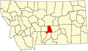
There are at least 9 named mountains in Golden Valley County, Montana.
- Antelope Butte, 46°12′37″N 109°01′46″W / 46.21028°N 109.02944°W / 46.21028; -109.02944 (Antelope Butte), el. 3,993 feet (1,217 m)
- Chinamans Hat, 46°12′52″N 109°31′44″W / 46.21444°N 109.52889°W / 46.21444; -109.52889 (Chinamans Hat), el. 4,068 feet (1,240 m)
- Haystack Butte, 46°12′37″N 109°07′23″W / 46.21028°N 109.12306°W / 46.21028; -109.12306 (Haystack Butte), el. 3,901 feet (1,189 m)
- Lost Peak, 46°43′48″N 109°15′42″W / 46.73000°N 109.26167°W / 46.73000; -109.26167 (Lost Peak), el. 8,192 feet (2,497 m)
- Mount Sinai, 46°10′25″N 109°14′17″W / 46.17361°N 109.23806°W / 46.17361; -109.23806 (Mount Sinai), el. 4,386 feet (1,337 m)
- O'Brien Hill, 46°10′15″N 109°26′12″W / 46.17083°N 109.43667°W / 46.17083; -109.43667 (O'Brien Hill), el. 4,642 feet (1,415 m)
- Red Hill, 46°43′55″N 109°11′12″W / 46.73194°N 109.18667°W / 46.73194; -109.18667 (Red Hill), el. 6,155 feet (1,876 m)
- Sahara Hill, 46°40′39″N 109°05′08″W / 46.67750°N 109.08556°W / 46.67750; -109.08556 (Sahara Hill), el. 5,341 feet (1,628 m)
- Tepee Point, 46°44′56″N 109°22′17″W / 46.74889°N 109.37139°W / 46.74889; -109.37139 (Tepee Point), el. 8,399 feet (2,560 m)
See also
Notes
- "Antelope Butte". Geographic Names Information System. United States Geological Survey, United States Department of the Interior.
- "Chinamans Hat". Geographic Names Information System. United States Geological Survey, United States Department of the Interior.
- "Haystack Butte". Geographic Names Information System. United States Geological Survey, United States Department of the Interior.
- "Lost Peak". Geographic Names Information System. United States Geological Survey, United States Department of the Interior.
- "Mount Sinai". Geographic Names Information System. United States Geological Survey, United States Department of the Interior.
- "O'Brien Hill". Geographic Names Information System. United States Geological Survey, United States Department of the Interior.
- "Red Hill". Geographic Names Information System. United States Geological Survey, United States Department of the Interior.
- "Sahara Hill". Geographic Names Information System. United States Geological Survey, United States Department of the Interior.
- "Tepee Point". Geographic Names Information System. United States Geological Survey, United States Department of the Interior.
| Municipalities and communities of Golden Valley County, Montana, United States | ||
|---|---|---|
| County seat: Ryegate | ||
| Towns |  | |
| CDP | ||