| This article does not cite any sources. Please help improve this article by adding citations to reliable sources. Unsourced material may be challenged and removed. Find sources: "R217 highway" Russia – news · newspapers · books · scholar · JSTOR (May 2019) (Learn how and when to remove this message) |
 Federal Highway R217
 | |
|---|---|
| Федеральная автомобильная дорога Р217 | |
| Caucasus Highway | |
 | |
| Route information | |
| Part of | |
| Part of | |
| Length | 1,118 km (695 mi) |
| History | Formerly M29 before 2018 |
| Major junctions | |
| North end | |
| South end | Azeri border near Yarag-Kazmalyar |
| Location | |
| Country | Russia |
| Highway system | |
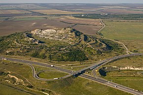
The Russian route R217, also known as the Caucasus Highway, is a trunk road that extends from Krasnodar to Chechnya and Dagestan, terminating at Russia's border with Azerbaijan. Its length is 1118 km. The route is part of European route E50 from Pavlovskaya to Makhachkala, European route E117 from Mineralnye Vody to Beslan, and European route E119 from Makhachkala to the Azeri border. The portion from Khasavyurt to the Azeri border is also part of AH8. Before 2018 the route was designated M29.
Major towns along the road include Kropotkin, Nevinnomyssk, Mineralnye Vody, Pyatigorsk, Nalchik, Beslan, Grozny, Gudermes, Khasavyurt, Makhachkala, and Derbent. After skirting the Greater Caucasus, the route continues as the M1 to Baku.

This Russian road or road transport-related article is a stub. You can help Misplaced Pages by expanding it. |