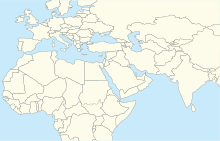
| Marmul Airport | |||||||||||
|---|---|---|---|---|---|---|---|---|---|---|---|
| Summary | |||||||||||
| Airport type | Public | ||||||||||
| Serves | Marmul | ||||||||||
| Elevation AMSL | 909 ft / 277 m | ||||||||||
| Coordinates | 18°08′20″N 55°10′40″E / 18.13889°N 55.17778°E / 18.13889; 55.17778 | ||||||||||
| Map | |||||||||||
    | |||||||||||
| Runways | |||||||||||
| |||||||||||
| Source: Google Maps GCM | |||||||||||
Marmul Airport (IATA: OMM, ICAO: OOMX) is an airport serving the Petroleum Development Oman (PDO) operations at the Marmul heavy oil field in the Dhofar Governorate of Oman. The airport is 6 kilometres (3.7 mi) southwest of the main PDO camp.
The Marmul VOR-DME (Ident: MRL) is located on the field.
Climate
| Climate data for Marmul Airport, elevation 273 m (896 ft), (2005–2019 normals, extremes 2005–2019) | |||||||||||||
|---|---|---|---|---|---|---|---|---|---|---|---|---|---|
| Month | Jan | Feb | Mar | Apr | May | Jun | Jul | Aug | Sep | Oct | Nov | Dec | Year |
| Record high °C (°F) | 32.3 (90.1) |
36.6 (97.9) |
39.8 (103.6) |
42.5 (108.5) |
47.3 (117.1) |
47.1 (116.8) |
47.6 (117.7) |
47.1 (116.8) |
45.2 (113.4) |
41.6 (106.9) |
35.6 (96.1) |
31.0 (87.8) |
47.6 (117.7) |
| Mean daily maximum °C (°F) | 26.1 (79.0) |
28.9 (84.0) |
33.0 (91.4) |
36.9 (98.4) |
39.9 (103.8) |
42.5 (108.5) |
43.1 (109.6) |
42.0 (107.6) |
38.9 (102.0) |
35.1 (95.2) |
31.1 (88.0) |
27.8 (82.0) |
35.4 (95.8) |
| Daily mean °C (°F) | 19.2 (66.6) |
21.7 (71.1) |
24.8 (76.6) |
28.5 (83.3) |
31.3 (88.3) |
34.3 (93.7) |
35.1 (95.2) |
33.6 (92.5) |
30.1 (86.2) |
27.3 (81.1) |
24.2 (75.6) |
20.5 (68.9) |
27.6 (81.6) |
| Mean daily minimum °C (°F) | 12.5 (54.5) |
15.3 (59.5) |
17.3 (63.1) |
21.4 (70.5) |
23.9 (75.0) |
26.8 (80.2) |
27.7 (81.9) |
26.7 (80.1) |
23.1 (73.6) |
20.6 (69.1) |
18.0 (64.4) |
14.1 (57.4) |
20.6 (69.1) |
| Record low °C (°F) | 4.4 (39.9) |
6.4 (43.5) |
9.2 (48.6) |
14.5 (58.1) |
18.4 (65.1) |
22.0 (71.6) |
22.6 (72.7) |
19.4 (66.9) |
15.2 (59.4) |
14.5 (58.1) |
11.5 (52.7) |
7.6 (45.7) |
4.4 (39.9) |
| Average precipitation mm (inches) | 0.2 (0.01) |
5.0 (0.20) |
2.0 (0.08) |
27.8 (1.09) |
22.3 (0.88) |
1.7 (0.07) |
0.7 (0.03) |
8.6 (0.34) |
0.1 (0.00) |
4.7 (0.19) |
1.5 (0.06) |
1.5 (0.06) |
76.1 (3.01) |
| Average precipitation days (≥ 1.0 mm) | 0.1 | 0.4 | 0.3 | 1.1 | 1.7 | 0.3 | 0.3 | 0.3 | 0.0 | 0.4 | 0.4 | 0.3 | 5.6 |
| Source: Starlings Roost Weather | |||||||||||||
See also
References
- Google Maps - Marmul
- Airport information for Marmul Airport at Great Circle Mapper.
- Marmul VOR
- "MARMUL Climate: 1991–2020". Starlings Roost Weather. Retrieved 25 December 2024.
External links
- OurAirports - Marmul Airport
- Marmul - FallingRain
- Accident history for Marmul Airport at Aviation Safety Network
| Airports in Oman | |
|---|---|
| Major international | |
| Minor international | |
| Domestic | |
| Unscheduled | |
This article about the geography of Oman is a stub. You can help Misplaced Pages by expanding it. |
This article about transport in Oman is a stub. You can help Misplaced Pages by expanding it. |