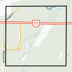
Place in Manitoba, Canada
| National Mills | |
|---|---|
 Community boundaries Community boundaries | |
 | |
| Coordinates: 52°49′26″N 101°35′02″W / 52.824°N 101.584°W / 52.824; -101.584 | |
| Country | Canada |
| Province | Manitoba |
| Region | Northern Manitoba |
National Mills is a community in the Canadian province of Manitoba. It is part of a group of five communities in the region, all built to serve logging operations in the Porcupine Provincial Forest. The others are Powell, Baden, Red Deer Lake, and the largest, Barrows, where the nearest school and fire service are located. The community contains four housing units.
Demographics
In the 2021 Census of Population conducted by Statistics Canada, National Mills had a population of 0 living in 0 of its 0 total private dwellings, a change of nan% from its 2016 population of . With a land area of 2.62 km (1.01 sq mi), it had a population density of 0.0/km (0.0/sq mi) in 2021.
References
- "National Mills" (PDF). Government of Manitoba. May 2016. Retrieved September 29, 2020.
- "Population and dwelling counts: Canada and designated places". Statistics Canada. February 9, 2022. Retrieved September 3, 2022.
This Manitoba location article is a stub. You can help Misplaced Pages by expanding it. |