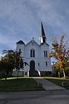
Name on the Register
Image
Date listed
Location
City or town
Description
1
Brownington Village Historic District
Brownington Village Historic District May 9, 1973(#73000197 )
Hinman and Brownington Centers Rd.44°50′19″N 72°10′10″W / 44.838611°N 72.169444°W / 44.838611; -72.169444 (Brownington Village Historic District) Brownington
2
Crystal Lake Falls Historic District
Crystal Lake Falls Historic District More images
July 7, 1994(#94000699 )
Roughly, Water St. from Church St. to Main St., Main from Water to Duck Pond Rd. and West St. from Cemetery Rd. to Main44°44′47″N 72°10′38″W / 44.746389°N 72.177222°W / 44.746389; -72.177222 (Crystal Lake Falls Historic District) Barton
3
Crystal Lake State Park
Crystal Lake State Park More images
August 30, 2005(#05000949 )
96 Bellwater Ave.44°44′59″N 72°10′10″W / 44.749722°N 72.169444°W / 44.749722; -72.169444 (Crystal Lake State Park) Barton
4
Derby House Hotel
Derby House Hotel September 3, 1998(#98001150 )
Junction of VT 105 (Main St.) and West St.44°56′52″N 72°08′04″W / 44.947778°N 72.134444°W / 44.947778; -72.134444 (Derby House Hotel) Derby
5
Jerry E. Dickerman House
Jerry E. Dickerman House More images
July 11, 2001(#01000732 )
36 Field Ave.44°56′10″N 72°12′38″W / 44.936111°N 72.210556°W / 44.936111; -72.210556 (Jerry E. Dickerman House) Newport
6
District Number Four School
District Number Four School August 2, 2001(#01000825 )
116 N. Craftsbury Rd.44°38′16″N 72°22′31″W / 44.637778°N 72.375278°W / 44.637778; -72.375278 (District Number Four School) Craftsbury
7
Fox Hall
Fox Hall September 27, 1984(#84003468 )
Fox Hall Ln., off Peene Hill Rd.44°46′24″N 72°04′24″W / 44.773367°N 72.073412°W / 44.773367; -72.073412 (Fox Hall) Westmore
8
Goodrich Memorial Library
Goodrich Memorial Library More images
November 23, 1983(#83004228 )
Main and Field St.44°56′09″N 72°12′37″W / 44.935833°N 72.210278°W / 44.935833; -72.210278 (Goodrich Memorial Library) Newport
9
Greensboro Depot
Greensboro Depot April 21, 1975(#75000144 )
Western side of Main St. at railroad crossing44°32′47″N 72°15′53″W / 44.546389°N 72.264722°W / 44.546389; -72.264722 (Greensboro Depot) Greensboro Bend
10
Haskell Free Library and Opera House
Haskell Free Library and Opera House More images
September 8, 1976(#76000143 )
Caswell Ave.45°00′22″N 72°05′55″W / 45.006111°N 72.098611°W / 45.006111; -72.098611 (Haskell Free Library and Opera House) Derby Line
11
William Hayden House
William Hayden House More images
January 31, 1978(#78000238 )
South of Albany on VT 14 44°42′36″N 72°23′26″W / 44.71°N 72.390556°W / 44.71; -72.390556 (William Hayden House) Albany
12
Holland Congregational Church
Upload image December 4, 1986(#86003411 )
W. Holland Rd.44°58′09″N 72°02′14″W / 44.969167°N 72.037222°W / 44.969167; -72.037222 (Holland Congregational Church) Holland
13
House at 68 Highland Avenue
House at 68 Highland Avenue July 20, 2000(#00000831 )
68 Highland Ave.44°55′57″N 72°13′18″W / 44.9325°N 72.221667°W / 44.9325; -72.221667 (House at 68 Highland Avenue) Newport
14
Irasburg Town Hall
Irasburg Town Hall November 21, 1994(#94001334 )
Junction of VT 14 and VT 58 , east of Creek Rd.44°48′09″N 72°16′43″W / 44.8025°N 72.278611°W / 44.8025; -72.278611 (Irasburg Town Hall) Irasburg
15
L. P. Jenne Block
L. P. Jenne Block September 3, 1998(#98001151 )
Junction of VT 105 (Main St.) and West St.44°56′50″N 72°08′04″W / 44.947222°N 72.134444°W / 44.947222; -72.134444 (L. P. Jenne Block) Derby
16
King Block
King Block June 20, 2002(#02000663 )
117 High St.44°44′58″N 72°10′37″W / 44.749469°N 72.176907°W / 44.749469; -72.176907 (King Block) Barton
17
Lakeview Inn
Lakeview Inn February 4, 2000(#00000062 )
295 Breezy Ave.44°34′18″N 72°17′55″W / 44.571667°N 72.298611°W / 44.571667; -72.298611 (Lakeview Inn) Greensboro
18
Newport Downtown Historic District
Newport Downtown Historic District September 28, 2006(#06000898 )
Main, Coventry, Central, 2nd, Summer, 3rd, School, Bayview, Eastern, Field, Seymour, and Fyfe44°56′15″N 72°12′35″W / 44.9375°N 72.209722°W / 44.9375; -72.209722 (Newport Downtown Historic District) Newport
19
Orleans County Courthouse and Jail Complex
Orleans County Courthouse and Jail Complex More images
November 23, 1984(#84000336 )
Main St.44°56′06″N 72°12′39″W / 44.934963°N 72.210790°W / 44.934963; -72.210790 (Orleans County Courthouse and Jail Complex) Newport
20
Orne Covered Bridge
Orne Covered Bridge More images
November 20, 1974(#74000328 )
Back Coventry Rd., over the Black River 44°51′38″N 72°16′28″W / 44.860556°N 72.274444°W / 44.860556; -72.274444 (Orne Covered Bridge) Irasburg
21
River Road Covered Bridge
River Road Covered Bridge More images
November 19, 1974(#74000249 )
South of North Troy off VT 101 , over the Missisquoi River 44°57′21″N 72°23′39″W / 44.955833°N 72.394167°W / 44.955833; -72.394167 (River Road Covered Bridge) North Troy
22
J. S. Sweeney Store, Barn, Livery and Hall
J. S. Sweeney Store, Barn, Livery and Hall August 18, 1992(#92000993 )
Junction of VT 105 and Town Highway 3 (Main St.)44°50′16″N 71°59′24″W / 44.837778°N 71.99°W / 44.837778; -71.99 (J. S. Sweeney Store, Barn, Livery and Hall) Charleston
23
U.S. Courthouse, Post Office and Customs House
U.S. Courthouse, Post Office and Customs House December 12, 1976(#76000144 )
217 Main St.44°56′07″N 72°12′37″W / 44.935278°N 72.210278°W / 44.935278; -72.210278 (U.S. Courthouse, Post Office and Customs House) Newport
24
U.S. Inspection Station-Beebe Plain, Vermont
U.S. Inspection Station-Beebe Plain, Vermont September 10, 2014(#14000608 )
3136 Beebe Rd.45°00′20″N 72°08′30″W / 45.0056°N 72.1418°W / 45.0056; -72.1418 (U.S. Inspection Station-Beebe Plain, Vermont) Derby
25
U.S. Inspection Station-Derby Line, Vermont
U.S. Inspection Station-Derby Line, Vermont September 10, 2014(#14000609 )
84 Main St.45°00′17″N 72°06′01″W / 45.0046°N 72.1003°W / 45.0046; -72.1003 (U.S. Inspection Station-Derby Line, Vermont) Derby
26
U.S. Inspection Station-North Troy, Vermont
U.S. Inspection Station-North Troy, Vermont September 10, 2014(#14000610 )
743 VT 243 45°00′21″N 72°24′54″W / 45.0057°N 72.4151°W / 45.0057; -72.4151 (U.S. Inspection Station-North Troy, Vermont) Troy
27
Ai J. White Duplex
Ai J. White Duplex August 4, 2011(#11000516 )
343 Main St.44°56′04″N 72°12′46″W / 44.934466°N 72.212710°W / 44.934466; -72.212710 (Ai J. White Duplex) Newport


