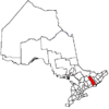
Township in Ontario, Canada
| Faraday | |
|---|---|
| Township (lower-tier) | |
| Township of Faraday | |
 Municipal office of Faraday Twp. along Hwy. 28 Municipal office of Faraday Twp. along Hwy. 28 | |
 | |
| Coordinates: 45°00′N 77°55′W / 45.000°N 77.917°W / 45.000; -77.917 | |
| Country | Canada |
| Province | Ontario |
| County | Hastings |
| Settled | 1857 |
| Incorporated | before 1901 |
| Government | |
| • Type | Township |
| • Reeve | Dennis J. Purcell |
| • Federal riding | Prince Edward—Hastings |
| • Prov. riding | Prince Edward—Hastings |
| Area | |
| • Land | 217.44 km (83.95 sq mi) |
| Population | |
| • Total | 1,612 |
| • Density | 7.4/km (19/sq mi) |
| Time zone | UTC-5 (EST) |
| • Summer (DST) | UTC-4 (EDT) |
| Postal Code | K0L 1C0 |
| Area code(s) | 613 and 343 |
| Website | www |
Faraday is a township in the Canadian province of Ontario, located within Hastings County adjacent to the town of Bancroft.
History
The township of Faraday was first settled in 1857, when iron ore deposits were discovered.
Prior to the 1922 discovery of uranium, mica, feldspar, and other minerals were mined on a small scale in the area. Inspired by finds of gold in nearby Eldorado (now Madoc) in 1886–7 and onwards, many people moved to the area hoping to find gold.
The Barker Quarries operated south of Marble Lake sporadically from 1908 into the late 1930s, providing marble for government buildings in Ottawa and Casa Loma and the Royal Ontario Museum in Toronto.
After the Second World War and the invention of atomic energy, global demand for uranium increased, and the Canadian government permitted uranium prospecting.

Arthur H. Shore, an independent prospector, first found uranium at his lot in Faraday township in 1948 or 1949. He founded Faraday Uranium Mines Limited in 1949 but injured himself shortly afterwards. The mine was active from 1957 to 1964 and then reopened as the Madawaksa Mine from 1975 to 1982.
The Greyhawk Uranium mine was active from 1955 to 1959 and reopened from 1962 to 1982.
The mines attracted workers to the area, and housing for mine executives was built in Faraday and for workers in nearby Bancroft. The closure of the mines after the global supply of uranium diminished created significant hardship for the area.
Main article: Uranium mining in the Bancroft areaCommunities

The township of Faraday comprises a number of villages and hamlets, including Bow Lake, Faraday, Monck Road, and Paudash.
Demographics
In the 2021 Census of Population conducted by Statistics Canada, Faraday had a population of 1,612 living in 755 of its 1,290 total private dwellings, a change of 15.1% from its 2016 population of 1,401. With a land area of 217.44 km (83.95 sq mi), it had a population density of 7.4/km (19.2/sq mi) in 2021.
Canada census – Faraday community profile| 2021 | 2016 | 2011 | |
|---|---|---|---|
| Population | 1,612 (+15.1% from 2016) | 1401 (-4.6% from 2011) | 1468 (-7.0% from 2006) |
| Land area | 217.44 km (83.95 sq mi) | 219.62 km (84.80 sq mi) | 217.97 km (84.16 sq mi) |
| Population density | 7.4/km (19/sq mi) | 6.4/km (17/sq mi) | 6.7/km (17/sq mi) |
| Median age | 57.2 (M: 57.6, F: 56.8) | 54.6 (M: 54.8, F: 54.2) | |
| Private dwellings | 1,290 (total) 755 (occupied) | 1261 (total) | 1224 (total) |
| Median household income | $64,000 |
|
|
| |||||||||||||||||||||||||||||||||||||||||||||||||||||||||||||||
| Population counts are not adjusted for boundary changes. Source: Statistics Canada | |||||||||||||||||||||||||||||||||||||||||||||||||||||||||||||||||
Mother tongue (2021):
- English as first language: 94.4%
- French as first language: 1.2%
- English and French as first language: 0.3%
- Other as first language: 3.7%
See also
References
- ^ "Faraday, Ontario (Code 3512058) Census Profile". 2021 census. Government of Canada - Statistics Canada. Retrieved 2024-10-23.
- Middleton, Jesse E (1927). The Province of Ontario: a History: 1615-1927.
- A.H. Lang, J. W. Griffith, H. R Steacy (1962). Canadian Deposits of Uranium and Thorium (PDF). Yukon University: Geological Survey of Canada - Department of Mines and Technical Surveys. p. 175.
{{cite book}}: CS1 maint: multiple names: authors list (link) - ^ Reynolds, Nila (1979). Bancroft. A Bonanza of Memories. The Bancroft Centennial Committee. pp. 184–193, 223.
- "Mineral Deposit Inventory Record MDI31F04SW00047: Faraday Lots 41-42 Hastings Road W, Hastings Road West". www.geologyontario.mndm.gov.on.ca. Retrieved 2021-11-21.
- Proulx, Michèle (1997). The Uranium Mining lndustry of the Bancroft Area: an Environmental History and Heritage Assessment (PDF). Trent University. p. 23.
- ^ "Madawaska Mine (Faraday Mine), Faraday Township, Hastings County, Ontario, Canada". www.mindat.org. Retrieved 2021-11-21.
- "2021 Community Profiles". 2021 Canadian census. Statistics Canada. February 4, 2022. Retrieved 2023-10-19.
- "2016 Community Profiles". 2016 Canadian census. Statistics Canada. August 12, 2021. Retrieved 2018-02-19.
- "2011 Community Profiles". 2011 Canadian census. Statistics Canada. March 21, 2019. Retrieved 2012-03-01.
- "2006 Community Profiles". 2006 Canadian census. Statistics Canada. August 20, 2019.
- "2001 Community Profiles". 2001 Canadian census. Statistics Canada. July 18, 2021.
- 1996, 2001, 2006, 2011, 2016 census
External links
| Places adjacent to Faraday, Ontario | ||||||||||||||||
|---|---|---|---|---|---|---|---|---|---|---|---|---|---|---|---|---|
| ||||||||||||||||
| Hastings County, Ontario | ||
|---|---|---|
| Cities |  | |
| Towns | ||
| Townships | ||
| First Nations | ||
| Indian reserves | ||
| ||