| This article needs additional citations for verification. Please help improve this article by adding citations to reliable sources. Unsourced material may be challenged and removed. Find sources: "Preston & Cherrybrook, Nova Scotia" – news · newspapers · books · scholar · JSTOR (January 2017) (Learn how and when to remove this message) |

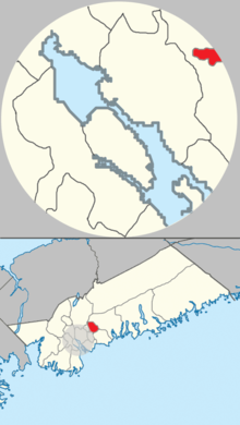
Preston & Cherrybrook is a community and planning area of the Halifax Regional Municipality in Nova Scotia, Canada. It includes the villages of Preston, East Preston, North Preston, and Cherry Brook. The area was settled by African Nova Scotians following the American Revolutionary War.
References
- "Community Plans". Halifax. Halifax Regional Municipality. Retrieved 10 October 2015.
| Halifax, Nova Scotia | |||||||
|---|---|---|---|---|---|---|---|
| Politics |
| ||||||
| Services and agencies | |||||||
| Articles of interest | |||||||
| Education |
| ||||||
| Neighbourhoods & communities |
| ||||||
44°43′30″N 63°28′26″W / 44.725°N 63.474°W / 44.725; -63.474
This Nova Scotia location article is a stub. You can help Misplaced Pages by expanding it. |