| Rien | |
|---|---|
| Village | |
 | |
 Flag Flag Coat of arms Coat of arms | |
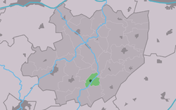
 Location in the former Littenseradiel municipality Location in the former Littenseradiel municipality | |
  | |
| Coordinates: 53°5′44″N 5°39′26″E / 53.09556°N 5.65722°E / 53.09556; 5.65722 | |
| Country | |
| Province | |
| Municipality | |
| Area | |
| • Total | 2.28 km (0.88 sq mi) |
| Elevation | 0.1 m (0.3 ft) |
| Population | |
| • Total | 100 |
| • Density | 44/km (110/sq mi) |
| Postal code | 8641 |
| Dialing code | 0515 |
Rien is a village in Súdwest-Fryslân municipality in the province of Friesland, the Netherlands. It had a population of around 110 in January 2017.
History
The village was first mentioned in 1527 as Reensterzyl, and means "water border". Rien started as a satellite of Lytsewierrum near a sluice.
Rien was home to 321 people in 1840. It was award village status in 1954. Before 2018, the village was part of the Littenseradiel municipality and before 1984 it belonged to Hennaarderadeel municipality.
Gallery
References
- ^ "Kerncijfers wijken en buurten 2021". Central Bureau of Statistics. Retrieved 6 April 2022.
- "Postcodetool for 8641WS". Actueel Hoogtebestand Nederland (in Dutch). Het Waterschapshuis. Retrieved 6 April 2022.
- Aantal inwoners per dorp Archived 2017-04-21 at the Wayback Machine - Littenseradiel
- "Rien - (geografische naam)". Etymologiebank (in Dutch). Retrieved 6 April 2022.
- ^ "Rien". Plaatsengids (in Dutch). Retrieved 6 April 2022.
External links
![]() Media related to Rien, Friesland at Wikimedia Commons
Media related to Rien, Friesland at Wikimedia Commons
This Friesland location article is a stub. You can help Misplaced Pages by expanding it. |


