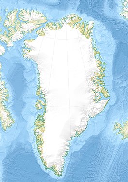
| Rink Glacier | |
|---|---|
| Rink Gletscher | |
 | |
| Type | Tidewater glacier |
| Location | NW Greenland |
| Coordinates | 76°12′N 61°9′W / 76.200°N 61.150°W / 76.200; -61.150 |
| Width | 6 km (3.7 mi) |
| Terminus | Melville Bay |
| Status | Retreating |
Rink Glacier (Danish: Rink Gletscher), is a glacier in NW Greenland. Administratively it belongs to the Avannaata municipality.
This glacier was named after Danish geologist and explorer of Greenland Hinrich Johannes Rink (1819 - 1893).
Geography
The Rink Glacier is located in the Lauge Koch Coast, Melville Bay. It originates in the western Greenland ice sheet and flows southwestwards between the Døcker Smith Glacier to the west and the Peary Glacier to the east. Its terminus lies ENE of Cape Murdoch, northeast of the Fisher Islands and north of the Balgoni Islands in Melville Bay.
 |
See also
References
- Warming, glacier melt and surface energy budget
- ^ "Rink Gletscher". Mapcarta. Retrieved 20 June 2019.
- Geological Survey of Denmark and Greenland Bulletin 20 - GEUS
- GoogleEarth
External links
This Greenland location article is a stub. You can help Misplaced Pages by expanding it. |