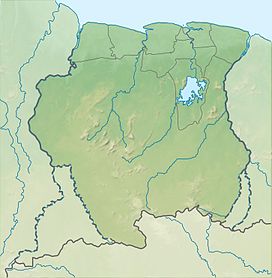
| Roseveltpiek | |
|---|---|
 Roseveltpiek as seen from Magneetrots Roseveltpiek as seen from Magneetrots | |
| Highest point | |
| Elevation | 644 m (2,113 ft) |
| Coordinates | 3°21′12″N 55°11′8″W / 3.35333°N 55.18556°W / 3.35333; -55.18556 |
| Geography | |
 | |
| Location | Sipaliwini District, Suriname |
| Parent range | Oranje Mountains |
Roseveltpiek is a mountain in Suriname at 644 metres (2,113 ft). It is located in the Sipaliwini District. The mountain is named after Johan Cateau van Rosevelt. The Rosevelpiek as well as the Tebutop, the Magneetrots, and the Kasikasima were first mapped in 1904 during the Tapanahony expedition.
References
- "Josephina Leentje Haver". Suriname.nu (in Dutch). Retrieved 25 June 2020.
- J.B.Ch. Wekker (1983). HISTORIE, TECHNIEKEN EN MAATSCHAPPELIJKE ACHTERGRONDEN DER KARTERINGSWERKZAAMHEDEN IN SURINAME SINDS 1667. Rijkscommissie voor Geodesie. p. 104. ISBN 9061322286.
This Suriname location article is a stub. You can help Misplaced Pages by expanding it. |