| This article is an orphan, as no other articles link to it. Please introduce links to this page from related articles; try the Find link tool for suggestions. (August 2023) |
| Uplaz | |
|---|---|
 Uplaz as seen from the Henryk Arctowski Polish Antarctic Station, in 1984. Uplaz as seen from the Henryk Arctowski Polish Antarctic Station, in 1984. | |
| Highest point | |
| Elevation | 4 m (13 ft) |
| Coordinates | 62°09′40″S 58°28′20″W / 62.16111°S 58.47222°W / -62.16111; -58.47222 |
| Geography | |
  | |
| Location | King George Island |
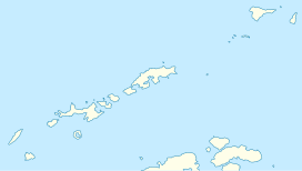
Uplaz (Polish: Upłaz) is a ridge on the King George Island, in the archipelago of the South Shetland Islands. It is located near the shore of Admiralty Bay, to the southwest of Jasnorzewski Gardens meadow and the Henryk Arctowski Polish Antarctic Station. Its peak is 4 m (13.1 ft) above mean sea level.
Name
It was named Upłaz in 1980 by the scientists of the Polish expedition. It was named after upłaz, a Polish-language term for a flat or shallow, grassy part of a slope, after such formations present in the Tatra Mountains in southern Poland. In English, the name was anglinised to Uplaz.
References
- ^ "Uplaz". data.aad.gov.au.
- ^ Nazewnictwo geograficzne świata, issue 8: Antarktyka. Warsaw: Komisja Standaryzacji Nazw Geograficznych poza Granicami Rzeczypospolitej Polskiej, 2006. (in Polish)