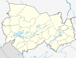
| Verkh-Uryum Верх-Урюм | |
|---|---|
| Settlement | |
 | |
  | |
| Coordinates: 54°29′24″N 78°35′31″E / 54.49000°N 78.59194°E / 54.49000; 78.59194 | |
| Country | Russia |
| Region | Novosibirsk Oblast |
| District | Zdvinsky District |
Verkh-Uryum (Russian: Верх-Урюм) is a settlement (a selo) in Zdvinsky District of Novosibirsk Oblast, Russia. The administrative center of Verkh-Uryumsky Selsoviet.
Geography
Verkh-Uryum is located by the southeastern shore of lake Uryum, a fluvial lake of the Chulym.
Economy
JSC Uryumskoye
JSC Uryumskoye operates in the settlement. The company is engaged in crop and livestock production.
As of February 1, 2021, the farm contains 1,524 head of cattle, including 550 dairy cows.
In 2020, Gross milk production amounted to 2.8 thousand tons (63% higher than in 2019). The milk yield per forage cow for 2020 is 5736 kg (1474 kg (35%) higher than in 2019).
On February 19, 2021, the first stage of the construction of the farm was completed (300 head of cattle).
The sown area is 8.6 thousand hectares, of which grain and leguminous crops occupy 3.3 thousand hectares.
References
- ^ "Новая животноводческая ферма на 300 голов открылась в Здвинском районе. Правительство Новосибирской области". Archived from the original on 2021-12-29. Retrieved 2021-12-29.
- "N-44 Topographic Chart (in Russian)". Archived from the original on 25 December 2023. Retrieved 28 November 2024.
- Google Earth.
This Novosibirsk Oblast location article is a stub. You can help Misplaced Pages by expanding it. |