| This article needs additional citations for verification. Please help improve this article by adding citations to reliable sources. Unsourced material may be challenged and removed. Find sources: "Wadrilltal" – news · newspapers · books · scholar · JSTOR (November 2013) (Learn how and when to remove this message) |
| Wadrilltal | |
|---|---|
| Ortsteil of Wadern | |
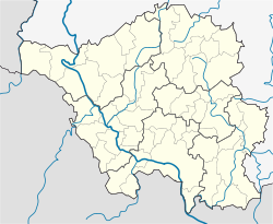
| Location of Wadrilltal | |
  | |
| Coordinates: 49°35′N 6°53′E / 49.583°N 6.883°E / 49.583; 6.883 | |
| Country | Germany |
| State | Saarland |
| District | Merzig-Wadern |
| Town | Wadern |
| Area | |
| • Total | 16.35 km (6.31 sq mi) |
| Elevation | 322 m (1,056 ft) |
| Population | |
| • Total | 1,974 |
| • Density | 120/km (310/sq mi) |
| Time zone | UTC+01:00 (CET) |
| • Summer (DST) | UTC+02:00 (CEST) |
| Postal codes | 66687 |
| Dialling codes | 06871 |
| Vehicle registration | MZG |
Wadrilltal is a quarter (Stadtteil) of the town Wadern, in Merzig-Wadern district, Saarland, in the south-west of Germany. It is situated on the small river Wadrill. Wadrilltal is known for its large forests and for its hiking trails.
References
- "Einwohner der Gemeinden und Ortsteile Stand 31.12.2020". Landkreis Goslar. Retrieved 24 September 2021.
External links
This Saarland location article is a stub. You can help Misplaced Pages by expanding it. |