| Revision as of 15:11, 2 March 2013 editAddbot (talk | contribs)Bots2,838,809 editsm Bot: Migrating 3 interwiki links, now provided by Wikidata on d:q3556018← Previous edit |
Latest revision as of 07:51, 4 May 2024 edit undoGoodmans238 (talk | contribs)Extended confirmed users1,266 edits Rescuing 1 sources and tagging 0 as dead.) #IABot (v2.0.9.5Tag: IABotManagementConsole [1.3] |
| (14 intermediate revisions by 13 users not shown) |
| Line 13: |
Line 13: |
|
| pushpin_mapsize = 250px |
|
| pushpin_mapsize = 250px |
|
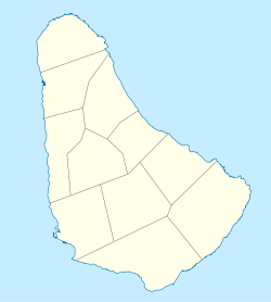
| pushpin_map_caption = Location on a map of Barbados parishes |
|
| pushpin_map_caption = Location on a map of Barbados parishes |
|
|
| coordinates = {{coord|13|15|N|59|34|W|type:city_region:BB|display=inline,title}} |
|
| latd = 13 | latm = 15 | lats = | latNS = N |
|
|
| longd = 59 | longm = 34 | longs = | longEW = W |
|
|
| coordinates_footnotes =<ref>{{cite web |
|
| coordinates_footnotes =<ref>{{cite web |
|
|
| url = https://www.google.com/maps/place/%D7%92%D7%A8%D7%99%D7%A0%D7%9C%D7%A0%D7%93%2C+%D7%91%D7%A8%D7%91%D7%93%D7%95%D7%A1/%4013.2544304%2C-59.5712614%2C16z/data%3D%213m1%214b1%214m5%213m4%211s0x8c43ee9aa9bba34f%3A0x5033f3dd5b39e78a%218m2%213d13.2551041%214d-59.5743195 |
|
| url = http://maps.google.com/maps/place?ftid=0x8c43f6c2fa4cf93d:0x7dc1e66a95867069 |
|
|
| title = Greenland, Barbados |
|
| title = Greenland, Barbados |
|
| publisher = ] |
|
| publisher = ] |
|
| accessdate = 9 December 2012 |
|
| accessdate = 9 December 2012 |
|
|
| archive-date = 26 May 2020 |
|
|
| archive-url = https://web.archive.org/web/20200526220620/https://www.google.com/maps/place/%D7%92%D7%A8%D7%99%D7%A0%D7%9C%D7%A0%D7%93%2C+%D7%91%D7%A8%D7%91%D7%93%D7%95%D7%A1/%4013.2544304%2C-59.5712614%2C16z/data%3D%213m1%214b1%214m5%213m4%211s0x8c43ee9aa9bba34f%3A0x5033f3dd5b39e78a%218m2%213d13.2551041%214d-59.5743195 |
|
|
| url-status = live |
|
}}</ref> |
|
}}</ref> |
|
| coordinates_type = type:city_region:BB |
|
|
| coordinates_display = yes |
|
|
| subdivision_type = Country |
|
| subdivision_type = Country |
|
| subdivision_name = ] |
|
| subdivision_name = ] |
| Line 34: |
Line 34: |
|
| elevation_footnotes = |
|
| elevation_footnotes = |
|
| elevation_m = 1 |
|
| elevation_m = 1 |
|
| population_footnotes = <ref> |
|
| population_footnotes = <ref>{{cite web|url=http://www.world-gazetteer.com/wg.php?x=&men=gcis&lng=en&des=wg&srt=npan&col=abcdefghinoq&msz=1500&geo=-28 |title=World Gazetteer World Gazetteer |archiveurl=https://archive.today/20130111112942/http://www.world-gazetteer.com/wg.php?x=&men=gcis&lng=en&des=wg&srt=npan&col=abcdefghinoq&msz=1500&geo=-28 |archivedate=11 January 2013 |url-status=dead }}</ref> |
|
| population_as_of = 2012 |
|
| population_as_of = 2012 |
|
| population_total = 508 |
|
| population_total = 508 |
