| Revision as of 13:10, 17 February 2018 edit88.140.17.233 (talk) camp← Previous edit | Latest revision as of 21:06, 26 October 2024 edit undoMonkbot (talk | contribs)Bots3,695,952 editsm Task 20: replace {lang-??} templates with {langx|??} ‹See Tfd› (Replaced 1);Tag: AWB | ||
| (12 intermediate revisions by 10 users not shown) | |||
| Line 1: | Line 1: | ||
| {{Use dmy dates|date=August 2023}} | |||
| {{Infobox French commune | {{Infobox French commune | ||
| |name = Cadours | |name = Cadours | ||
| Line 5: | Line 6: | ||
| |caption = Cadours | |caption = Cadours | ||
| |image coat of arms = Blason ville fr Cadours (Haute-Garonne).svg | |image coat of arms = Blason ville fr Cadours (Haute-Garonne).svg | ||
| |region = Midi-Pyrénées | |||
| |department = Haute-Garonne | |||
| |arrondissement = Toulouse | |arrondissement = Toulouse | ||
| |canton = Léguevin | |canton = Léguevin | ||
| |INSEE = 31098 | |INSEE = 31098 | ||
| |postal code = 31480 | |postal code = 31480 | ||
| |mayor = Didier Laffont<ref>{{cite web|title=Répertoire national des élus: les maires|url=https://www.data.gouv.fr/fr/datasets/r/2876a346-d50c-4911-934e-19ee07b0e503|publisher=data.gouv.fr, Plateforme ouverte des données publiques françaises|date=13 September 2022|language=fr}}</ref> | |||
| |mayor = Alain Julian | |||
| |term = |
|term = 2020–2026 | ||
| |intercommunality = |
|intercommunality = Hauts Tolosans | ||
| |coordinates = {{coord|43.7292|1.0506|format=dms|display=inline,title}} | |coordinates = {{coord|43.7292|1.0506|format=dms|display=inline,title}} | ||
| |elevation m = 250 | |elevation m = 250 | ||
| Line 19: | Line 18: | ||
| |elevation max m = 242 | |elevation max m = 242 | ||
| |area km2 = 10.58 | |area km2 = 10.58 | ||
| |population = |
|population = {{France metadata Wikidata|population_total}} | ||
| |population date = |
|population date = {{France metadata Wikidata|population_as_of}} | ||
| |population footnotes = {{France metadata Wikidata|population_footnotes}} | |||
| }} | }} | ||
| ''' |
'''Cadours''' ({{IPA|fr|kaduʁ}}; {{langx|oc|Cadors}}) is a ] in the ] ] in southwestern ]. | ||
| The town hosted the ] between 1948 and 1961. | |||
| ==Population== | ==Population== | ||
| Line 36: | Line 37: | ||
| 2008|1045 | 2008|1045 | ||
| }} | }} | ||
| {{clear |
{{clear left}} | ||
| == Monuments == | == Monuments == | ||
| Line 45: | Line 46: | ||
| Cadours - Monument aux Morts.jpg| The War Memorial. | Cadours - Monument aux Morts.jpg| The War Memorial. | ||
| </gallery> | </gallery> | ||
| ==Personalities== | |||
| *] (1906-1950) was a Grand Prix motor racing driver. | |||
| *] (1931-1958) was an Australian]] professional Grand Prix motorcycle road racer. | |||
| ==See also== | ==See also== | ||
| Line 54: | Line 51: | ||
| ==References== | ==References== | ||
| * | |||
| {{reflist}} | {{reflist}} | ||
| {{commons category}} | |||
| {{commonscat}} | |||
| {{Haute-Garonne communes}} | {{Haute-Garonne communes}} | ||
| {{authority control}} | |||
| ] | ] | ||
| {{HauteGaronne-geo-stub}} | {{HauteGaronne-geo-stub}} | ||
Latest revision as of 21:06, 26 October 2024
Commune in Occitania, France
| Cadours | |
|---|---|
| Commune | |
 Cadours Cadours | |
 Coat of arms Coat of arms | |
| Location of Cadours | |
  | |
| Coordinates: 43°43′45″N 1°03′02″E / 43.7292°N 1.0506°E / 43.7292; 1.0506 | |
| Country | France |
| Region | Occitania |
| Department | Haute-Garonne |
| Arrondissement | Toulouse |
| Canton | Léguevin |
| Intercommunality | Hauts Tolosans |
| Government | |
| • Mayor (2020–2026) | Didier Laffont |
| Area | 10.58 km (4.08 sq mi) |
| Population | 1,134 |
| • Density | 110/km (280/sq mi) |
| Time zone | UTC+01:00 (CET) |
| • Summer (DST) | UTC+02:00 (CEST) |
| INSEE/Postal code | 31098 /31480 |
| Elevation | 147–242 m (482–794 ft) (avg. 250 m or 820 ft) |
| French Land Register data, which excludes lakes, ponds, glaciers > 1 km (0.386 sq mi or 247 acres) and river estuaries. | |
Cadours (French pronunciation: [kaduʁ]; Occitan: Cadors) is a commune in the Haute-Garonne department in southwestern France. The town hosted the Circuit de Cadours between 1948 and 1961.
Population
| Year | Pop. | ±% |
|---|---|---|
| 1962 | 687 | — |
| 1968 | 737 | +7.3% |
| 1975 | 776 | +5.3% |
| 1982 | 687 | −11.5% |
| 1990 | 694 | +1.0% |
| 1999 | 696 | +0.3% |
| 2008 | 1,045 | +50.1% |
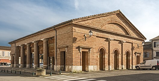
Monuments
See also
References
- "Répertoire national des élus: les maires" (in French). data.gouv.fr, Plateforme ouverte des données publiques françaises. 13 September 2022.
- "Populations de référence 2022" (in French). The National Institute of Statistics and Economic Studies. 19 December 2024.
This Haute-Garonne geographical article is a stub. You can help Misplaced Pages by expanding it. |


