| Revision as of 04:55, 23 May 2023 editManticore (talk | contribs)Extended confirmed users, Pending changes reviewers, Rollbackers17,231 edits Undid revision 1156422111 by 93.45.156.253 (talk) unsourced changes to figuresTag: Undo← Previous edit |
Latest revision as of 21:15, 14 November 2024 edit undoJJMC89 bot III (talk | contribs)Bots, Administrators3,671,173 editsm Moving Category:Minority Concentrated Districts in India to Category:Minority concentrated districts in India per Misplaced Pages:Categories for discussion/Speedy |
| (44 intermediate revisions by 24 users not shown) |
| Line 3: |
Line 3: |
|
{{Use Indian English|date=June 2017}} |
|
{{Use Indian English|date=June 2017}} |
|
{{Infobox settlement |
|
{{Infobox settlement |
|
| name = Udham Singh Nagar district |
|
| name = Udham Singh Nagar |
|
| nickname = |
|
| nickname = |
|
| settlement_type = ] of ] |
|
| settlement_type = ] of ] |
|
| image_skyline = {{Photomontage |
|
| image_skyline = {{Photomontage |
|
|size = 250 |
|
|size = 250 |
|
|photo1a = The ruins of Temple by the Pandava's in Kashipur.jpg |
|
|photo1a = The ruins of Temple by the Pandava's in Kashipur.jpg |
| Line 14: |
Line 14: |
|
|photo3a = Sunset at Crops Research Center, Pantnagar.jpg |
|
|photo3a = Sunset at Crops Research Center, Pantnagar.jpg |
|
}} |
|
}} |
|
| image_alt = |
|
| image_alt = |
|
| image_caption = Clockwise from top-left: Palace of ], Gurudwara Nanakana Sahib in ], Baigul Dam, Crops Research Center at ], Metropolis city in ] |
|
| image_caption = Clockwise from top-left: Palace of ], Gurudwara Nanakana Sahib in ], Baigul Dam, Crops Research Center at ], Metropolis city in ] |
|
| image_map = Udham Singh Nagar in Uttarakhand (India).svg |
|
| image_map = Udham Singh Nagar in Uttarakhand (India).svg |
|
| image_map1 = |
|
| image_map1 = |
|
| map_alt = |
|
| map_alt = |
|
| map_caption = Location in Uttarakhand |
|
| map_caption = Location in Uttarakhand |
|
| coordinates = {{coord|28.98|N|79.40|E|display=inline,title}} |
|
| coordinates = {{coord|28.98|N|79.40|E|display=inline,title}} |
|
| subdivision_type = Country |
|
| subdivision_type = Country |
|
| subdivision_name = {{flag|India}} |
|
| subdivision_name = {{flag|India}} |
|
| subdivision_type1 = ] |
|
| subdivision_type1 = ] |
|
| subdivision_name1 = {{flagicon image|..Uttarakhand Flag(INDIA).png}} ] |
|
| subdivision_name1 = ] |
|
| subdivision_type2 = Division |
|
| subdivision_type2 = Division |
|
| subdivision_name2 = ] |
|
| subdivision_name2 = ] |
|
| established_title = <!-- Established --> |
|
| established_title = <!-- Established --> |
|
| established_date = |
|
| established_date = |
|
| founder = |
|
| founder = Udham Singh Nagar has been carved out of Nainital. |
|
| named_for = |
|
| named_for = ] |
|
| seat_type = Headquarters |
|
| seat_type = Headquarters |
|
| seat = ] |
|
| seat = ] |
|
| government_type = |
|
| government_type = |
|
| governing_body = |
|
| governing_body = |
|
| unit_pref = Metric |
|
| unit_pref = Metric |
|
|
| area_footnotes = <ref>{{cite web|title=DISTRICT UDHAM SINGH NAGAR AT A GLANCE|url=https://www.cgwb.gov.in/old_website/District_Profile/Uttarakhand/UdhamSinghNagar.pdf|access-date=2024-05-10 |language=en-US}}</ref> |
|
| area_footnotes = |
|
|
| area_rank = |
|
| area_rank = |
|
| area_total_km2 = 2908 |
|
| area_total_km2 = 3055 |
|
| elevation_footnotes = |
|
| elevation_footnotes = |
|
| elevation_m = |
|
| elevation_m = |
|
| population_total = 1,648,902 |
|
| population_total = 1,648,902 |
|
| population_as_of = 2011 |
|
| population_as_of = 2011 |
|
| population_rank = |
|
| population_rank = |
|
| population_density_km2 = auto |
|
| population_density_km2 = auto |
|
| population_demonym = |
|
| population_demonym = |
|
| population_footnotes = <ref name="Cesnsus2011Gov"/> |
|
| population_footnotes = <ref name="Cesnsus2011Gov"/> |
|
| demographics_type1 = Languages |
|
| demographics_type1 = Languages |
|
| demographics1_title1 = Official |
|
| demographics1_title1 = Official |
|
| demographics1_info1 = ]<ref>{{cite web|title=52nd Report of the Commissioner for Linguistic Minorities in India|url=http://nclm.nic.in/shared/linkimages/NCLM52ndReport.pdf|website=nclm.nic.in|publisher=]|access-date=22 December 2018 |page=18|url-status=dead|archive-url=https://web.archive.org/web/20170525141614/http://nclm.nic.in/shared/linkimages/NCLM52ndReport.pdf|archive-date=25 May 2017}}</ref> |
|
| demographics1_title2 = Additional official |
|
| demographics1_title2 = Additional official |
|
| demographics1_info2 = ]<ref>{{cite news|last=Trivedi |first=Anupam |title=Sanskrit is second official language in Uttarakhand |url=http://www.hindustantimes.com/india/sanskrit-is-second-official-language-in-uttarakhand/story-wxk51l8Re4vNxofrr7FAJK.html |newspaper=Hindustan Times |date=19 January 2010 |access-date=30 August 2017}}</ref><ref>{{cite news|title=Sanskrit second official language of Uttarakhand|url=http://www.thehindu.com/todays-paper/tp-national/tp-otherstates/Sanskrit-second-official-language-of-Uttarakhand/article15965492.ece |work=The Hindu |date=21 January 2010 |access-date=30 August 2017}}</ref> |
|
| demographics1_title3 = Regional |
|
| demographics1_title3 = Regional |
|
| demographics1_info3 = ]<ref>{{cite web |title=Kumaoni |url=https://www.ethnologue.com/language/kfy |website=Ethnologue |access-date=28 November 2020}}</ref> |
|
| demographics1_info3 = ], ], ], ], ], ], ] |
|
| timezone1 = ] |
|
| timezone1 = ] |
|
| utc_offset1 = +5:30 |
|
| utc_offset1 = +5:30 |
|
| postal_code_type = <!-- ] --> |
|
| postal_code_type = <!-- ] --> |
|
| postal_code = |
|
| postal_code = |
|
| registration_plate = UK 06, UK 18 |
|
| registration_plate = UK 06, UK 18 |
|
| website = {{URL|usnagar.nic.in}} |
|
| website = {{URL|usnagar.nic.in}} |
|
| footnotes = |
|
| footnotes = |
|
|
| leader_title = ] |
|
|
| leader_name = Mr. Uday Raj Singh, ]<ref>{{Cite web |title=District Magistrate Of Udham Singh Nagar {{!}} District Udham Singh Nagar, Government Of Uttarakhand {{!}} India |url=https://usnagar.nic.in/whos-who/ |access-date=2024-05-10 |language=en-US}}</ref> |
|
}} |
|
}} |
|
|
|
|
|
'''Udham Singh Nagar District''' is a district of ] state in northern ]. ] is the district headquarters. This district consists of nine ]s named ], ], ], ], ], ], ], ], ]. The district is located in the ] region, and is part of ]. It is bounded on the north by ], on the northeast by ], on the east by ], and on the south and west by ], ], ], ] and ] of ] state. The district was created on 29 September 1995,<ref>{{Cite book|last=धामी|first=भगवान सिंह|title=यूकेपीडिया|publisher=समय साक्ष्य|year=2021|isbn=978-93-90743-32-2|location=देहरादून|pages=162}}</ref><ref>{{Cite book|last=सकलानी|first=शक्ति प्रसाद|title=तराई रुद्रपुर का इतिहास और विकास|publisher=गौरव प्रकाशन|year=1996|location=दिल्ली|pages=473}}</ref> by ] out of Nainital District. It is named for freedom fighter and Indian revolutionary ].<ref name="Singh 2015">{{cite web | last=Singh | first=Anand Raj | title=Mayawati may create new district to tame old foe | website=The New Indian Express | date=12 March 2015 | url=http://www.newindianexpress.com/nation/article398789.ece | access-date=14 May 2016}}</ref> |
|
'''Udham Singh Nagar''' is a district of ] state in northern ]. ] is the district headquarter. The district consists of nine ]s named ], ], ], ], ], ], ], ], ]. The district is located in the ] region, and is part of ]. It is bounded on the north by ], on the northeast by ], on the east by ], and on the south and west by ], ], ], ] and ] of ] state. The district was created on 29 September 1995,<ref>{{Cite book|last=धामी|first=भगवान सिंह|title=यूकेपीडिया|publisher=समय साक्ष्य|year=2021|isbn=978-93-90743-32-2|location=देहरादून|pages=162}}</ref><ref>{{Cite book|last=सकलानी|first=शक्ति प्रसाद|title=तराई रुद्रपुर का इतिहास और विकास|publisher=गौरव प्रकाशन|year=1996|location=दिल्ली|pages=473}}</ref> by ] out of Nainital District. It is named for freedom fighter and Indian revolutionary ].<ref name="Singh 2015">{{cite web | last=Singh | first=Anand Raj | title=Mayawati may create new district to tame old foe | website=The New Indian Express | date=12 March 2015 | url=http://www.newindianexpress.com/nation/article398789.ece | archive-url=https://web.archive.org/web/20160604045449/http://www.newindianexpress.com/nation/article398789.ece | url-status=dead | archive-date=4 June 2016 | access-date=14 May 2016}}</ref> |
|
|
|
|
|
As of 2011, it is the third most populous district of Uttarakhand (out of ]), after ] and ].<ref name="Cesnsus2011Gov"/> |
|
As of 2011, it is the third most populous district of Uttarakhand (out of ]), after ] and ].<ref name="Cesnsus2011Gov"/> |
|
|
|
|
|
==Tehsils in Udham Singh Nagar district== |
|
==Tehsils in Udham Singh Nagar district== |
| ⚫ |
# ] |
|
|
# ] |
|
# ] |
|
⚫ |
# ] |
|
# ] |
|
# ] |
|
# ] |
|
# ] |
| Line 78: |
Line 80: |
|
# ] |
|
# ] |
|
|
|
|
|
==Cities in Udham Singh Nagar district== |
|
==Cities in Udham Singh Nagar== |
|
# ] |
|
# ] |
|
# ] |
|
# ] |
|
⚫ |
# ] |
|
⚫ |
# ] |
|
⚫ |
# ] |
|
# ] |
|
# ] |
|
# ] |
|
# ] |
| Line 86: |
Line 91: |
|
# ] |
|
# ] |
|
# ] |
|
# ] |
| ⚫ |
# ] |
|
| ⚫ |
# ] |
|
|
# ] |
|
# ] |
|
⚫ |
# ] |
| ⚫ |
# ] |
|
| ⚫ |
# ] |
|
|
|
|
|
|
==Administrative divisions== |
|
==Administrative divisions== |
| Line 224: |
Line 226: |
|
|Northeast = ] |
|
|Northeast = ] |
|
|East = {{NEP|Nepal}} |
|
|East = {{NEP|Nepal}} |
|
|Southeast = |
|
|Southeast = ] |
|
|South = |
|
|South = ] |
|
|Southwest = |
|
|Southwest = ] |
|
|West = |
|
|West = ] |
|
|Northwest = |
|
|Northwest = ] |
|
}} |
|
}} |
|
|
|
|
| Line 242: |
Line 244: |
|
] |
|
] |
|
] |
|
] |
|
] |
|
] |


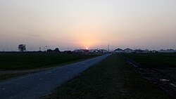
 Clockwise from top-left: Palace of Dronacharya, Gurudwara Nanakana Sahib in Kashipur, Baigul Dam, Crops Research Center at Pantnagar, Metropolis city in Rudrapur
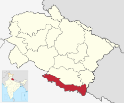
 Location in Uttarakhand