| Revision as of 20:23, 7 December 2024 editTranspoman (talk | contribs)Extended confirmed users, Pending changes reviewers41,542 edits Replacing geodata: {{coord missing|Massachusetts}}← Previous edit | Latest revision as of 21:46, 7 December 2024 edit undoPi.1415926535 (talk | contribs)Autopatrolled, Extended confirmed users, New page reviewers49,086 edits →Works cited: +coords | ||
| Line 211: | Line 211: | ||
| * {{cite book| title = Historical sketch of Mother Brook, Dedham, Mass: compiled from various records and papers, showing the diversion of a portion of the Charles River into the Neponset River and the manufactures on the stream, from 1639 to 1900| url = https://books.google.com/books?id=zUMlLghlcGoC&q=Historical+sketch+of+Mother+Brook,+Dedham,+Mass| first = Erastus| last = Worthington| year = 1900| publisher =C.G. Wheeler| location = Dedham, MA}} | * {{cite book| title = Historical sketch of Mother Brook, Dedham, Mass: compiled from various records and papers, showing the diversion of a portion of the Charles River into the Neponset River and the manufactures on the stream, from 1639 to 1900| url = https://books.google.com/books?id=zUMlLghlcGoC&q=Historical+sketch+of+Mother+Brook,+Dedham,+Mass| first = Erastus| last = Worthington| year = 1900| publisher =C.G. Wheeler| location = Dedham, MA}} | ||
| {{Coord|42.24548|-71.15127|display=title}} | |||
| {{coord missing|Massachusetts}} | |||
| ] | ] | ||
Latest revision as of 21:46, 7 December 2024

7 South Stone Mill Drive is a condominium complex built out of Dedham Granite. Before being converted into residential use in the 1980s, it was a Mother Brook mill that made a variety of products.
History
The building is located at the fourth privilege on Mother Brook and was used to make a variety of products in the 19th century, including copper cents, paper, cotton, wool, carpets, and handkerchiefs. In the 1780s another mill, connected by the same wheel, was constructed on the site to produce wire for the new nation's nascent textile industry. The first mill on this site burned in 1809, but was rebuilt with a new raceway and foundation.
The second mill began producing nails in 1814, and five years later its owner, Ruggles Whiting of Boston, sold it to the owner of the first mill, George Bird, who began using the whole site to manufacture paper. In 1823 it switched to cotton, using the machinery of the former Norfolk Cotton Company. In 1835 a new stone mill was erected. It stands today, and was converted into a condominium complex in 1986–87. Unlike the other mills, which were constructed in a strictly utilitarian style, this factory boasted a date stone reading "1835" and a dome-roofed cupola over the mill bell. Together they stood as a testament to the primacy of the mills in the neighborhood.
The mill at the fourth privilege, under the ownership of Bussey and with his agent, George H. Kuhn, was among the first to install water-powered broad looms. The looms enabled raw wool to enter the mills, be spun into thread, and then weaved into finished fabric, all under a single roof.
| Year | Owner | Manager | Product | Notes | Image |
|---|---|---|---|---|---|
| 1832 | John Lemist and Ezra W. Taft | In 1835, the stone mill which now stands upon the site was erected using Dedham Granite and was supplied with new machinery for the manufacture of cotton goods. The original building stood three stories high and measured 100' long by 40' wide. It had a gable roof with a clerestory monitor that brought light into the attic. The stone bell tower was capped with columns supporting a domed cupola. The Corporation prospered under Mr Taft's management. By the middle of the century it was producing 650,000 yards of cotton a year. Ezra W. Taft continued to be the agent and manager of the corporation for about 30 years. An unused building nearby was used by Edward Holmes and Thomas Dunbar beginning in 1846 for their wheelwright business using steam power. Taft's paper mill mill burned on July 17, 1846. | |||
| ~1835 | James Reed and Ezra W. Taft | ||||
| 1863 | Thomas Barrows | Wool | Barrows enlarged the mill and installed turbines and a steam engine. | ||
| 1872 | Merchants Woolen Company | ||||
| 1875 | Royal O. Storrs and Frederick R. Storrs | Went out of business | |||
| 1882 | Merchants Woolen Company | ||||
| 1894 | J. Eugene Cochrane | Carpets and handkerchiefs | Third and fourth privileges under common ownership | ||
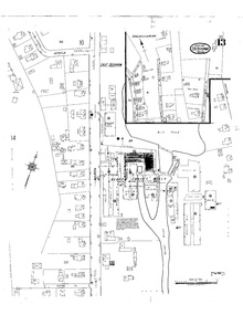
| 1897 | Cochrane Manufacturing Company | Norfolk Mills |  | ||
| After 1917 | Closed |  | |||
| Before 1927 | United Waste Company | Wool, reclaimed fabric, and cloth recycling | This was the final industrial use of the property. | ||
| 1930s | Shoddy wool | ||||
| 1986 | Bergmeyer Development Co. | Re-purposed for 86 condominiums | Purchase price was $1.6 million. A 25' waterfall runs through the complex. Fires burned various sections of the complex in the 1980s. |  | |
| Present day | Stone Mill Condominiums |    |
Notes
- The general contractor was the Kaplan Corp., the landscape architects was Weinmayr Associates, and the financing was provided by the Mutual Bank.
References
- ^ Worthington 1900, p. 6.
- ^ Tritsch 1986, p. 13.
- ^ Worthington 1900, p. 7.
- ^ In Celebration of the Construction of the Mother Brook in Dedham, Dedham Historical Society, September 2016
- ^ Neiswander, Judy (May 1, 2020). "Tales from Mother Brook: Part 3 - The Early Mills". The Dedham Times. Vol. 28, no. 18. p. 6.
- ^ Worthington 1900, pp. 6–7.
- Clarke 1903, p. 1.
- Clarke 1903, p. 13.
- Tritsch 1986, p. 14.
- ^ "Norfolk Manufacturing Company Cotton Mill, 90 Milton Street, Dedham, Norfolk County, MA". Library of Congress. Retrieved October 13, 2016.
- ^ Worthington 1900, p. 12.
- ^ Dedham Historical Society 2001, p. 38.
- ^ Yudis, Anthony J. (January 31, 1987). "Neglected Mill at Dedham Brook Revived as Condos". The Boston Globe. p. 35. ProQuest 294394528. Retrieved March 20, 2015.
- Worthington 1900, pp. 12–13.
- Worthington 1900, p. 13.
- "Dedham's Policy is to "Sit Tight"". The Boston Globe. April 2, 1909. p. 11. Retrieved March 17, 2015.
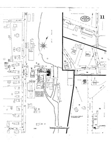
- Insurance Maps of Dedham, Massachusetts (PDF) (Map). Sanborn Map Company. September 1917. p. 13.
- Insurance Maps of Dedham, Massachusetts (Map). Sanborn Map Company. July 1927. p. 15.
- Davison 1948, p. 1068.
- ^ Andrews, Allan R. (May 3, 1984). "Dedham Warehouse Destroyed in Six-Alarm Fire; Two Injured". The Boston Globe. p. 1. ProQuest 294255767. Retrieved March 20, 2015.
- "Dedham Units Planned". The Boston Globe. September 12, 1986. p. 56. ProQuest 294363163. Retrieved March 20, 2015.
- Preer, Robert (September 6, 2009). "Brook Cleanup has Local Spirit Flowing". The Boston Globe. p. South 1. Retrieved March 20, 2015.
- ^ Neiswander, Judy (May 15, 2020). "Tales from Mother Brook: Part 5 - Citizens". The Dedham Times. Vol. 28, no. 20. p. 8.
- Sconyers, Jake and Stewart, Nikki (December 18, 2017). "Episode 59: Corn, Cotton, and Condos; 378 Years on the Mother Brook". Hub History (Podcast). Retrieved December 26, 2017.
{{cite podcast}}: CS1 maint: multiple names: authors list (link)
Works cited
- Clarke, Wm. Horatio (1903). Mid-Century Memories of Dedham. Dedham Historical Society.
{{cite book}}: CS1 maint: location missing publisher (link)
- Davison (1948). Davison's Textile Blue Book: United States and Canada. Vol. 84. Davison Publishing Company.
- Dedham Historical Society (2001). Images of America: Dedham. Arcadia Publishing. ISBN 978-0-7385-0944-0. Retrieved August 11, 2019.
- Hurd, Duane Hamilton (1884). History of Norfolk County, Massachusetts: With Biographical Sketches of Many of Its Pioneers and Prominent Men. J. W. Lewis & Company. Retrieved August 11, 2019.
- Hanson, Robert Brand (1976). Dedham, Massachusetts, 1635-1890. Dedham Historical Society.
- Tritsch, Electa Kane (1986). Building Dedham. Dedham Historical Society.
- Worthington, Erastus (1900). Historical sketch of Mother Brook, Dedham, Mass: compiled from various records and papers, showing the diversion of a portion of the Charles River into the Neponset River and the manufactures on the stream, from 1639 to 1900. Dedham, MA: C.G. Wheeler.
42°14′44″N 71°09′05″W / 42.24548°N 71.15127°W / 42.24548; -71.15127
Categories: