| Revision as of 20:04, 26 December 2024 editDankJae (talk | contribs)Extended confirmed users38,301 edits more modern sources use the anglicisation as it is used on maps, so remove parenthesisTag: 2017 wikitext editor← Previous edit | Latest revision as of 21:00, 29 December 2024 edit undoDm4244 (talk | contribs)Extended confirmed users1,095 edits Single-letter name correction | ||
| (One intermediate revision by one other user not shown) | |||
| Line 13: | Line 13: | ||
| | constituency_westminster = ] | | constituency_westminster = ] | ||
| | community_wales = ] | | community_wales = ] | ||
| | local_name = Llanbedr | |||
| }} | }} | ||
| '''Llanbedr''', also spelled '''Llanbeder''', is a hamlet in ]. It is at the eastern part of ] and is also part of the historical parish of Langstone. | '''Llanbedr''', also spelled '''Llanbeder''', is a hamlet in ]. It is at the eastern part of ] and is also part of the historical parish of Langstone. | ||
Latest revision as of 21:00, 29 December 2024
Hamlet in Newport, Wales "Llanbeder" redirects here. Not to be confused with Llanbedr. For other uses, see Llanbedr (disambiguation).Hamlet in Wales
Llanbedr
| |
|---|---|
| Hamlet | |
 | |
| Community | |
| Principal area | |
| Country | Wales |
| Sovereign state | United Kingdom |
| Police | Gwent |
| Fire | South Wales |
| Ambulance | Welsh |
| UK Parliament | |
| 51°36′43″N 2°53′20″W / 51.612°N 2.889°W / 51.612; -2.889 | |
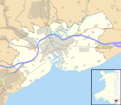
Llanbedr, also spelled Llanbeder, is a hamlet in Newport, Wales. It is at the eastern part of Langstone and is also part of the historical parish of Langstone.
Geography
The northern part of the old tithe area of Llanbedr is made up of coarse, buff sandstone (the elevated land of Kemys Graig which dominates the landscape is sandstone of the Brownstone formation) and the southern part, where most dwellings are, is soft and brown sandstone. There is a small raised area of river-deposited gravel on the alluvium at the very south of the hamlet area, within Llanbedr Farm, just south of the A48 Chepstow road which cuts across the land. Elevations range from 200 metres in the north to 25 metres in the south.
History
Llanbedr was bounded to the east and west by south-flowing streams from Kemeys Graig and to the south by the stream of which they were tributaries; to the north and east of it was the parish of Kemeys Inferior, the northern boundary being Coed-y-Caeru Lane. To the south is the hamlet of Llandevaud and to the east is the rest of the parish of Langstone. The fields and waterways which delineated the area still follow the same historical outline.
The ruins of St. Peter's church lie south of the A48 by Llanbedr Hall and were already in use as a barn in the late 19th century. Children of the hamlet used to attend school at Llandevaud. The house at Little Caerlicyn is recorded as a terrestrial Heritage Asset. On the opposite side of the stream boundary at the south are the remains of the old Llandevaud corn mill. Immediately northwest of the hamlet area across Coed-y-Caerau Lane are a series of scheduled monuments of Iron Age, Roman and WWII origin.
Human geography and local government
Llanbedr is part of the ward of Bishton and Langstone in Newport, in the 'Langstone 3' area which had a population of 1356 in 2013. The crime rate and social deprivation indicators are very low. About 30% of households have dependent children and 21% are sole occupiers. Student performance is above average for the city of Newport.
The member of parliament for the area is Jessica Morden of the Labour Party, representing the Newport East constituency.
Portals:References
- "Sheet ST 39 SE Monmouthshire". British Geological Survey. Retrieved 25 December 2024.
- ^ "Plan of the hamlet of Llanbedr in the parish of Langstone and county of Monmouth". National Library of Wales. Retrieved 25 December 2024.
- "DataMap Wales". DataMap Wales. Retrieved 26 December 2024.
- "Monmouthshire Sheet XXIX". National Library of Scotland. Retrieved 25 December 2024.
- "Tithe map of Llanbedr [Llanbeder] (hamlet in the parish of Langstone), Monmouthshire". The National Archives. Retrieved 25 December 2024.
- Kelly's Directory of Monmouthshire and South Wales. Kelly's Direct Ltd. 1920. p. 86.
- Kelly's Directory of Monmouthshire and South Wales. Kelly's Direct Ltd. 1901. p. 86.
- "Little Caerlicyn". Coflein. Retrieved 26 December 2024.
- "Llandevaud Mill". Coflein. Retrieved 26 December 2024.
- "Coed-y-Caerau, Enclosures; Pen Toppen Ash Roman Fortwebsite=Coflein". Retrieved 20 October 2024.
- "Kemys Craig Roman Fort". Roman Britain. Retrieved 1 November 2024.
- "Monmouthsire XXIX". National Library of Scotland. Retrieved 2 November 2024.
- "Scheduled Monuments- Full Report". Cadw. Retrieved 3 December 2024.
- "Newport Ward Profile Langstone" (PDF). Cyngor Dinas Casnewydd. Retrieved 13 November 2024.
- "Jessica Morden". UK Parliament. Retrieved 13 November 2024.