| Revision as of 11:50, 12 March 2006 editSlaciner (talk | contribs)122 editsNo edit summary | Latest revision as of 01:08, 29 September 2023 edit undoZeki Mert Kuku (talk | contribs)10 edits Eryaman is affilated to Etimesgut districtTags: Mobile edit Mobile app edit iOS app edit | ||
| (62 intermediate revisions by 40 users not shown) | |||
| Line 1: | Line 1: | ||
| {{Infobox Turkey place | |||
| ] | |||
| | type = neighbourhood | |||
| | province = Ankara | |||
| | district = Etimesgut | |||
| | name = Eryaman | |||
| | population_total = 30275 | |||
| | population_as_of = 2022 | |||
| | coordinates = {{coord|39|58|N|32|37|E|display=it|region:TR_type:city_source:GNS-enwiki}} | |||
| | image_skyline = Eryaman Göksu Parkı gece fotoğrafı.jpg | |||
| | image_caption = ] in Eryaman | |||
| }} | |||
| '''Eryaman''' is a neighbourhood in the municipality and district of ], ], ].<ref>, Turkey Civil Administration Departments Inventory. Retrieved 22 May 2023.</ref> Its population is 30,275 (2022).<ref>{{Cite web |title=Address-based population registration system (ADNKS) results dated 31 December 2022, Favorite Reports|url=https://biruni.tuik.gov.tr/medas/?kn=95&locale=en |access-date=22 May 2023|publisher=]|language=en|format=XLS}}</ref> It is located 28 km west of the city centre of Ankara. | |||
| ] located here is a public park and neighborhood that surrounds the small natural lake <ref>{{cite web |title=Çevre Koruma ve Kontrol |url=https://www.ankara.bel.tr/cevrekorumavekontrol/peyzaj-uygulama/prestij-parklari/goksu-parki |website=T.C. Ankara Büyükşehir Belediyesi |publisher=T.C. Ankara Büyükşehir Belediyesi |access-date=21 March 2023}}</ref> | |||
| A district in '''Etimesgut''', Ankara city, Turkey. Western Ankara. 25 km. to city centre. 25 minutes by car. | |||
| ==See also== | |||
| Population: 100.000 | |||
| * ] | |||
| ==Image gallery== | |||
| <gallery> | |||
| Image:Eryaman Göksu Parkı, gece fotoğrafı.jpg|A view from ] | |||
| Image:Eryaman Güzelkent Sakarya Zaferi caddesi.jpg|Güzelkent, Sakarya Zaferi Street | |||
| Image:Eryaman Güzelkent TBMM caddesi.jpg|Güzelkent, TBMM Street | |||
| Image:Güzelkent eryaman.jpg|Üçşehitler avenue | |||
| Image:Yavuz selim mahallesi eryaman karlı sokak.jpg|A view from the snowy 543rd Street | |||
| Image:Yavuz selim mahallesi eryaman.jpg| A snowy and snowy view in Yavuz Selim neighborhood, Eryaman | |||
| Image:Eryaman Güzelkent üçşehitler caddesi.jpg|Üçşehitler avenue | |||
| Image:Karlı güzelkent görünümü.jpg|Snowy 519th street | |||
| </gallery> | |||
| ==References== | |||
| {{Reflist}} | |||
| ==External links== | |||
| * {{cite web|url=http://www.etimesgut.gov.tr/sayfa.asp?id=105|title=General information on Etimesgut|author=Governorship of Etimesgut, Turkey|language=Turkish|url-status=dead|archiveurl=https://web.archive.org/web/20080315053548/http://www.etimesgut.gov.tr/sayfa.asp?id=105|archivedate=2008-03-15}} | |||
| * {{in lang|tr}} | |||
| {{Etimesgut District}} | |||
| ] | |||
| {{Etimesgut-geo-stub}} | |||
Latest revision as of 01:08, 29 September 2023
Neighbourhood in Etimesgut, Ankara, Turkey| Eryaman | |
|---|---|
| Neighbourhood | |
 Göksu Park in Eryaman Göksu Park in Eryaman | |
  | |
| Coordinates: 39°58′N 32°37′E / 39.967°N 32.617°E / 39.967; 32.617 | |
| Country | Turkey |
| Province | Ankara |
| District | Etimesgut |
| Population | 30,275 |
| Time zone | UTC+3 (TRT) |
Eryaman is a neighbourhood in the municipality and district of Etimesgut, Ankara Province, Turkey. Its population is 30,275 (2022). It is located 28 km west of the city centre of Ankara.
Göksu Park located here is a public park and neighborhood that surrounds the small natural lake
See also
Image gallery
-
 A view from Göksu Park
-
 Güzelkent, Sakarya Zaferi Street
-
 Güzelkent, TBMM Street
-
 Üçşehitler avenue
-
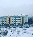
 A view from the snowy 543rd Street
-
 A snowy and snowy view in Yavuz Selim neighborhood, Eryaman
-
 Üçşehitler avenue
-
 Snowy 519th street
References
- Mahalle, Turkey Civil Administration Departments Inventory. Retrieved 22 May 2023.
- "Address-based population registration system (ADNKS) results dated 31 December 2022, Favorite Reports" (XLS). TÜİK. Retrieved 22 May 2023.
- "Çevre Koruma ve Kontrol". T.C. Ankara Büyükşehir Belediyesi. T.C. Ankara Büyükşehir Belediyesi. Retrieved 21 March 2023.
External links
- Governorship of Etimesgut, Turkey. "General information on Etimesgut" (in Turkish). Archived from the original on 2008-03-15.
- Local news portal of Eryaman (in Turkish)
| Neighbourhoods of Etimesgut District | |
|---|---|
|
This geographical article about a location in Etimesgut, Turkey is a stub. You can help Misplaced Pages by expanding it. |