| Revision as of 15:17, 5 January 2015 editParishan (talk | contribs)Autopatrolled, Extended confirmed users13,427 editsNo edit summary← Previous edit | Latest revision as of 12:32, 22 November 2024 edit undoPi bot (talk | contribs)Bots, IP block exemptions67,872 editsm Changing locally defined but nonexistent Commons category (Category:Cultural heritage monuments in Mariamadzor, Nagorno-Karabakh) to the one from Wikidata (Category:Məmməddərə) | ||
| (43 intermediate revisions by 21 users not shown) | |||
| Line 1: | Line 1: | ||
| ⚫ | {{coord|39|34|21|N|47|00|07|E|display=title}} | ||
| {{Infobox settlement | {{Infobox settlement | ||
| |official_name = |
| official_name = Mammaddara / Mariamadzor | ||
| |native_name = |
| native_name = Məmməddərə / Մարիամաձոր | ||
| | image_skyline = Եկեղեցի Ս. Մինաս,1601թ., Church of St Minas, 1601.jpg | |||
| |pushpin_map =NKR | |||
| | |
| image_caption = Church of St. Minas from 1601 near the village | ||
| | |
| image_size = 300px | ||
| | |
| pushpin_map = Azerbaijan | ||
| ⚫ | | pushpin_mapsize = 300 | ||
| ⚫ | |subdivision_type1 |
||
| | subdivision_type = Country | |||
| ⚫ | |subdivision_name1 = |
||
| | |
| subdivision_name = {{flag|Azerbaijan}} | ||
| ⚫ | | subdivision_type1 = ] | ||
| ⚫ | | |
||
| ⚫ | | subdivision_name1 = ] | ||
| |established_title = | |||
| | |
| leader_title = | ||
| | |
| leader_name = | ||
| | |
| established_title = | ||
| | |
| established_date = | ||
| ⚫ | | area_total_km2 = | ||
| ⚫ | |population_total = |
||
| | area_footnotes = | |||
| |population_density_km2 = | |||
| | population_footnotes = <ref name=2015statistics>{{Cite web|url=https://artsakhlib.am/en/2018/06/06/%D5%BF%D5%A5%D5%B2%D5%A5%D5%AF%D5%A1%D5%BF%D5%B8%D6%82-%D5%AC%D5%B2%D5%B0-%D5%BE%D5%A1%D6%80%D5%B9%D5%A1%D5%BF%D5%A1%D6%80%D5%A1%D5%AE%D6%84%D5%A1%D5%B5%D5%AB%D5%B6-%D5%B4%D5%AB%D5%A1%D5%BE%D5%B8/|title=Directory of socio-economic characteristics of NKR administrative-territorial units (2015)|author=Hakob Ghahramanyan}}</ref> | |||
| ⚫ | |timezone =] | ||
| | |
| population_as_of = 2015 | ||
| ⚫ | | population_total = 245 | ||
| |timezone_DST =] | |||
| | |
| population_density_km2 = auto | ||
| ⚫ | | timezone = ] | ||
| |latd=39 |latm=34 |lats=21 |latNS=N | |||
| | utc_offset = +4 | |||
| |longd=47|longm=00 |longs=07 |longEW=E | |||
| | |
| timezone_DST = | ||
| | |
| utc_offset_DST = | ||
| ⚫ | | coordinates = {{coord|39|34|21|N|47|00|07|E|region:AZ<!--NKR-->|display=inline,title}} | ||
| ⚫ | | |
||
| | elevation_m = | |||
| | area_code = | |||
| | website = | |||
| }} | }} | ||
| '''Məmməddərə''' ({{lang-hy|Մարիամածոր}} ''Mariamadzor'', ''Mamedadzor'' and ''Mamedazur'') is a village in the ] of ] (''de jure'') or the ] of the unrecognised ] (''de facto''). | |||
| '''Mammaddara''' ({{langx|az|Məmməddərə}}) or '''Mariamadzor''' ({{langx|hy|Մարիամաձոր}}) is a village in the ] of ], in the ] region of ]. The village had an ethnic ]-majority population prior to the ], and also had an Armenian majority in 1989.<ref>{{cite web |url=https://drugoivzgliad.com/karabach-mir-i-voina-a-zubov/ |title=Андрей Зубов. Карабах: Мир и Война |author=Андрей Зубов |date= |website=drugoivzgliad.com |publisher= |access-date= |quote=}}</ref> | |||
| == History == | |||
| During the ] period, the village was part of the ] of the ]. After the ], the village was administrated as part of the ] of the breakaway ]. The village came under the control of Azerbaijan on 15 October 2020, during the ]. | |||
| == Historical heritage sites == | |||
| Historical heritage sites in and around the village include a cemetery and ] from between the 16th and 19th centuries, and the church of ] ({{langx|hy|Սուրբ Մինաս|Surb Minas}}) built in 1601.<ref name="2015statistics"/> | |||
| == Demographics == | |||
| The village had 258 inhabitants in 2005,<ref name="2005nkrcensus">{{Cite web|url=http://census.stat-nkr.am/nkr/1-1.pdf|title=The Results of the 2005 Census of the Nagorno-Karabakh Republic|website=National Statistic Service of the Republic of Artsakh}}</ref> and 245 inhabitants in 2015.<ref name="2015statistics"/> | |||
| == Gallery == | |||
| <gallery mode="packed" heights="240"> | |||
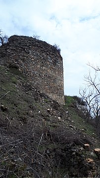
| Վնեսա բերդ, Fortress Vnesa.jpg|Vnesa Fortress near the village, from between the 10th and 12th centuries<ref name="2015statistics"/> | |||
| </gallery> | |||
| == References == | == References == | ||
| {{Reflist}} | |||
| ⚫ | *{{GEOnet2|32FA881504393774E0440003BA962ED3}} | ||
| == External links == | |||
| ⚫ | {{Khojavend |
||
| {{Commons category|Məmməddərə}} | |||
| ⚫ | * {{GEOnet2|32FA881504393774E0440003BA962ED3}} | ||
| ⚫ | {{Khojavend District}} | ||
| {{Hadrut Province}} | {{Hadrut Province}} | ||
| {{Portal bar|Geography}} | |||
| ⚫ | {{DEFAULTSORT:Mammaddara}} | ||
| ⚫ | {{DEFAULTSORT: |
||
| ] | ] | ||
| ] | ] | ||
| {{Khojavend-geo-stub}} | {{Khojavend-geo-stub}} | ||
Latest revision as of 12:32, 22 November 2024
Place in Khojavend, Azerbaijan| Mammaddara / Mariamadzor Məmməddərə / Մարիամաձոր | |
|---|---|
 Church of St. Minas from 1601 near the village Church of St. Minas from 1601 near the village | |
 | |
| Coordinates: 39°34′21″N 47°00′07″E / 39.57250°N 47.00194°E / 39.57250; 47.00194 | |
| Country | |
| District | Khojavend |
| Population | |
| • Total | 245 |
| Time zone | UTC+4 (AZT) |
Mammaddara (Azerbaijani: Məmməddərə) or Mariamadzor (Armenian: Մարիամաձոր) is a village in the Khojavend District of Azerbaijan, in the disputed region of Nagorno-Karabakh. The village had an ethnic Armenian-majority population prior to the 2020 Nagorno-Karabakh war, and also had an Armenian majority in 1989.
History
During the Soviet period, the village was part of the Hadrut District of the Nagorno-Karabakh Autonomous Oblast. After the First Nagorno-Karabakh War, the village was administrated as part of the Hadrut Province of the breakaway Republic of Artsakh. The village came under the control of Azerbaijan on 15 October 2020, during the 2020 Nagorno-Karabakh war.
Historical heritage sites
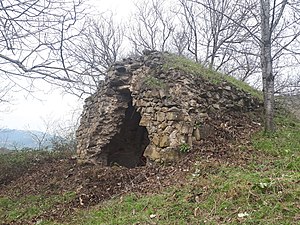
Historical heritage sites in and around the village include a cemetery and khachkar from between the 16th and 19th centuries, and the church of St. Minas (Armenian: Սուրբ Մինաս, romanized: Surb Minas) built in 1601.
Demographics
The village had 258 inhabitants in 2005, and 245 inhabitants in 2015.
Gallery
References
- ^ Hakob Ghahramanyan. "Directory of socio-economic characteristics of NKR administrative-territorial units (2015)".
- Андрей Зубов. "Андрей Зубов. Карабах: Мир и Война". drugoivzgliad.com.
- "The Results of the 2005 Census of the Nagorno-Karabakh Republic" (PDF). National Statistic Service of the Republic of Artsakh.
External links
Portal:
This Khojavend District location article is a stub. You can help Misplaced Pages by expanding it. |


