| Revision as of 02:31, 16 February 2023 edit68.193.227.80 (talk) →References← Previous edit |
Revision as of 22:37, 23 February 2023 edit undoGaius Cornelius (talk | contribs)Administrators164,008 editsm General formatting any tidying.Tag: AWBNext edit → |
| Line 92: |
Line 92: |
|
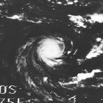
=== Tropical Disturbance Andree === |
|
=== Tropical Disturbance Andree === |
|
{{Infobox Hurricane Small |
|
{{Infobox Hurricane Small |
|
| Basin = SWI |
|
| Basin = SWI |
|
| Image = Andree 1970-09-19 0850Z.png |
|
| Image = Andree 1970-09-19 0850Z.png |
|
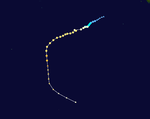
| Track = Andree 1970 track.png |
|
| Track = Andree 1970 track.png |
|
| Formed = September 16 |
|
| Formed = September 16 |
|
| Dissipated = September 19 |
|
| Dissipated = September 19 |
|
| Pressure = |
|
| Pressure = |
|
| 10-min winds = 25 |
|
| 10-min winds = 25 |
|
| 1-min winds = 30 |
|
| 1-min winds = 30 |
|
}} |
|
}} |
|
{{clear}} |
|
{{clear}} |
| Line 105: |
Line 105: |
|
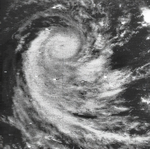
=== Moderate Tropical Storm Betsy === |
|
=== Moderate Tropical Storm Betsy === |
|
{{Infobox Hurricane Small |
|
{{Infobox Hurricane Small |
|
| Basin = SWI |
|
| Basin = SWI |
|
| Image = Betsy 1970-10-06 0818Z.png |
|
| Image = Betsy 1970-10-06 0818Z.png |
|
| Track = Betsy 1970 track.png |
|
| Track = Betsy 1970 track.png |
|
| Formed = October 1 |
|
| Formed = October 1 |
|
| Dissipated = October 8 |
|
| Dissipated = October 8 |
|
| Pressure = |
|
| Pressure = |
|
| 10-min winds = 35 |
|
| 10-min winds = 35 |
|
| 1-min winds = 35 |
|
| 1-min winds = 35 |
|
}} |
|
}} |
|
{{clear}} |
|
{{clear}} |
| Line 118: |
Line 118: |
|
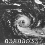
=== Moderate Tropical Storm Andrea–Claudine === |
|
=== Moderate Tropical Storm Andrea–Claudine === |
|
{{Infobox Hurricane Small |
|
{{Infobox Hurricane Small |
|
| Basin = SWI |
|
| Basin = SWI |
|
| Image = Andrea-Claudine 1970-11-04 0545Z.png |
|
| Image = Andrea-Claudine 1970-11-04 0545Z.png |
|
| Track = Andrea-Claudine 1970 track.png |
|
| Track = Andrea-Claudine 1970 track.png |
|
| Formed = November 10 <small>(Crossed 80°E)</small> |
|
| Formed = November 10 <small>(Crossed 80°E)</small> |
|
| Dissipated = November 13 |
|
| Dissipated = November 13 |
|
| Pressure = 970<!-- Pressure taken when winds were unknown--> |
|
| Pressure = 970<!-- Pressure taken when winds were unknown--> |
|
| 10-min winds = 35 |
|
| 10-min winds = 35 |
|
| 1-min winds = 35 |
|
| 1-min winds = 35 |
|
}} |
|
}} |
|
* Andrea-Claudine, 10 November to 13 November 1970 in central Indian Ocean |
|
* Andrea-Claudine, 10 November to 13 November 1970 in central Indian Ocean |
| Line 132: |
Line 132: |
|
=== Intense Tropical Cyclone Hilary–Dominique === |
|
=== Intense Tropical Cyclone Hilary–Dominique === |
|
{{Infobox Hurricane Small |
|
{{Infobox Hurricane Small |
|
| Basin = SWI |
|
| Basin = SWI |
|
| Image = Hilary-Dominique 1970-12-19 0703Z.png |
|
| Image = Hilary-Dominique 1970-12-19 0703Z.png |
|
| Track = Hilary-Dominique 1970 track.png |
|
| Track = Hilary-Dominique 1970 track.png |
|
| Formed = December 12 |
|
| Formed = December 12 |
|
| Dissipated = December 28 |
|
| Dissipated = December 28 |
|
| Pressure = |
|
| Pressure = |
|
| 10-min winds = 90 |
|
| 10-min winds = 90 |
|
| 1-min winds = 100 |
|
| 1-min winds = 100 |
|
}} |
|
}} |
|
* Hilary, 11 to 18 December 1970 in central Indian Ocean |
|
* Hilary, 11 to 18 December 1970 in central Indian Ocean |
| Line 146: |
Line 146: |
|
=== Moderate Tropical Storm Edith === |
|
=== Moderate Tropical Storm Edith === |
|
{{Infobox Hurricane Small |
|
{{Infobox Hurricane Small |
|
| Basin = SWI |
|
| Basin = SWI |
|
| Image = Edith 1971-01-18 0933Z.png |
|
| Image = Edith 1971-01-18 0933Z.png |
|
| Track = SWI Edith 1971 track.png |
|
| Track = SWI Edith 1971 track.png |
|
| Formed = January 5 |
|
| Formed = January 5 |
|
| Dissipated = January 10 |
|
| Dissipated = January 10 |
|
| Pressure = |
|
| Pressure = |
|
| 10-min winds = 35 |
|
| 10-min winds = 35 |
|
| 1-min winds = 35 |
|
| 1-min winds = 35 |
|
}} |
|
}} |
|
{{clear}} |
|
{{clear}} |
| Line 159: |
Line 159: |
|
=== Tropical Cyclone Felicie === |
|
=== Tropical Cyclone Felicie === |
|
{{Infobox Hurricane Small |
|
{{Infobox Hurricane Small |
|
| Basin = SWI |
|
| Basin = SWI |
|
| Image = Felicie 1971-02-01 0904Z.png |
|
| Image = Felicie 1971-02-01 0904Z.png |
|
| Track = Felicie 1971 track.png |
|
| Track = Felicie 1971 track.png |
|
| Formed = January 17 |
|
| Formed = January 17 |
|
| Dissipated = February 6 |
|
| Dissipated = February 6 |
|
| Pressure = |
|
| Pressure = |
|
| 10-min winds = 65 |
|
| 10-min winds = 65 |
|
| 1-min winds = 75 |
|
| 1-min winds = 75 |
|
}} |
|
}} |
|
Cyclone Felicie was a slow moving cyclone that made a large number of landfalls in Madagascar, 4, in addition to a single landfall in Mozambique, which reportedly killed 30 people. The storm followed a very erratic track due to unusual steering patterns, and went through many cycles of strengthening and weakening as it slowly trudged to the south. Felicie reached Tropical Cyclone status three separate times, before finally becoming extratropical southwest of Madagascar.<ref>{{cite report|series=Global tropical/extratropical cyclone climatic atlas|title=Tropical Storm Felice, 17 January- 5 February|year=1996|work=National Climatic Data Center|access-date=February 11, 2019|url={{GTECCA url|basin=SWI|year=1971_2}}}}</ref> |
| Line 173: |
Line 173: |
|
=== Tropical Cyclone Myrtle–Ginette === |
|
=== Tropical Cyclone Myrtle–Ginette === |
|
{{Infobox Hurricane Small |
|
{{Infobox Hurricane Small |
|
| Basin = SWI |
|
| Basin = SWI |
|
| Image = Myrtle-Ginette 1971-01-21 0645Z.png |
|
| Image = Myrtle-Ginette 1971-01-21 0645Z.png |
|
| Track = Myrtle-Ginette 1971 track.png |
|
| Track = Myrtle-Ginette 1971 track.png |
|
| Formed = January 15 |
|
| Formed = January 15 |
|
| Dissipated = January 31 |
|
| Dissipated = January 31 |
|
| Pressure = |
|
| Pressure = |
|
| 10-min winds = 80 |
|
| 10-min winds = 80 |
|
| 1-min winds = 90 |
|
| 1-min winds = 90 |
|
}} |
|
}} |
|
On January 19, Severe Tropical Cyclone Myrtle entered the South-West Indian Ocean; therefore, it was assigned a second name, Ginette. The next day, Ginette reached hurricane status and developed a clear eye as it traveled generally west-southwestward. On January 22, Ginette curved southwestward and came within {{convert|72|km|mi|abbr=off|sp=us}} of the island of Rodrigues. On Rodrigues, winds as high as {{convert|150|km/h|mph|abbr=on}} were recorded along with a minimum barometric pressure of {{convert|989|mbar|inHg|abbr=on}}. Throughout the next two days, Ginette approached the island of Reunion, causing stormy weather that lasted until January 29. In Reunion, swells associated with Ginette reached {{convert|6|m|ft|abbr=off|sp=us}} at times. On January 25, Ginette became stationary while located south of Reunion. The next day, Ginette encountered a ridge which caused it to execute a small clockwise loop. After completing the loop, Ginette accelerated southeastward and gradually weakened. By January 31, Ginette had transitioned into an extratropical cyclone.<ref>{{cite report|url={{GTECCA url|basin=SWI|year=1971_1}}|title=Hurricane Ginette, 17–31 January|access-date=February 12, 2019|series=Global tropical/extratropical cyclone climatic atlas|year=1996|work=National Climatic Data Center}}</ref> |
| Line 187: |
Line 187: |
|
=== Tropical Cyclone Helga === |
|
=== Tropical Cyclone Helga === |
|
{{Infobox Hurricane Small |
|
{{Infobox Hurricane Small |
|
| Basin = SWI |
|
| Basin = SWI |
|
| Image = Helga 1971-02-07 0803Z.png |
|
| Image = Helga 1971-02-07 0803Z.png |
|
| Track = Helga 1971 track.png |
|
| Track = Helga 1971 track.png |
|
| Formed = February 2 |
|
| Formed = February 2 |
|
| Dissipated = February 15 |
|
| Dissipated = February 15 |
|
| Pressure = |
|
| Pressure = |
|
| 10-min winds = 80 |
|
| 10-min winds = 80 |
|
| 1-min winds = 90 |
|
| 1-min winds = 90 |
|
}} |
|
}} |
|
On February 8, Helga passed southeast of Réunion and Mauritius, bringing heavy rainfall to the former island, reaching {{convert|926|mm|in|abbr=on}} at Commerson. Two people died on the island due to drowning.<ref>{{cite report|series=Global tropical/extratropical cyclone climatic atlas|title=Hurricane Helga, 3–12 February|year=1996|work=National Climatic Data Center|access-date=February 11, 2019|url={{GTECCA url|basin=SWI|year=1971_4}}}}</ref> |
| Line 201: |
Line 201: |
|
=== Tropical Cyclone Tilly-Iphigenie === |
|
=== Tropical Cyclone Tilly-Iphigenie === |
|
{{Infobox Hurricane Small |
|
{{Infobox Hurricane Small |
|
| Basin = SWI |
|
| Basin = SWI |
|
| Track = Tilly-Iphigenie 1971 track.png |
|
| Track = Tilly-Iphigenie 1971 track.png |
|
| Formed = February 14 (entered basin) |
|
| Formed = February 14 (entered basin) |
|
| Dissipated = February 17 |
|
| Dissipated = February 17 |
|
| Pressure = 970 |
|
| Pressure = 970 |
|
| 10-min winds = 65 |
|
| 10-min winds = 65 |
|
| 1-min winds = 65 |
|
| 1-min winds = 65 |
|
}} |
|
}} |
|
{{clear}} |
|
{{clear}} |
| Line 213: |
Line 213: |
|
=== Tropical Cyclone Joelle === |
|
=== Tropical Cyclone Joelle === |
|
{{Infobox Hurricane Small |
|
{{Infobox Hurricane Small |
|
| Basin = SWI |
|
| Basin = SWI |
|
| Image = Joelle 1971-02-17 0917Z.png |
|
| Image = Joelle 1971-02-17 0917Z.png |
|
| Track = Joelle 1971 track.png |
|
| Track = Joelle 1971 track.png |
|
| Formed = February 15 |
|
| Formed = February 15 |
|
| Dissipated = February 25 |
|
| Dissipated = February 25 |
|
| Pressure = |
|
| Pressure = |
|
| 10-min winds = 65 |
|
| 10-min winds = 65 |
|
| 1-min winds = 65 |
|
| 1-min winds = 65 |
|
}} |
|
}} |
|
{{clear}} |
|
{{clear}} |
| Line 226: |
Line 226: |
|
=== Tropical Cyclone Kalinka === |
|
=== Tropical Cyclone Kalinka === |
|
{{Infobox Hurricane Small |
|
{{Infobox Hurricane Small |
|
| Basin = SWI |
|
| Basin = SWI |
|
| Image = Kalinka 1971-02-20 0700Z.png |
|
| Image = Kalinka 1971-02-20 0700Z.png |
|
| Track = Kalinka 1971 track.png |
|
| Track = Kalinka 1971 track.png |
|
| Formed = February 16 |
|
| Formed = February 16 |
|
| Dissipated = February 26 |
|
| Dissipated = February 26 |
|
| Pressure = |
|
| Pressure = |
|
| 10-min winds = 75 |
|
| 10-min winds = 75 |
|
| 1-min winds = 85 |
|
| 1-min winds = 85 |
|
}} |
|
}} |
|
{{clear}} |
|
{{clear}} |
| Line 239: |
Line 239: |
|
=== Tropical Cyclone Yvonne–Lise === |
|
=== Tropical Cyclone Yvonne–Lise === |
|
{{Infobox Hurricane Small |
|
{{Infobox Hurricane Small |
|
| Basin = SWI |
|
| Basin = SWI |
|
| Image = Yvonne-Lise 1971-02-26 0746Z.png |
|
| Image = Yvonne-Lise 1971-02-26 0746Z.png |
|
| Track = Yvonne-Lise 1971 track.png |
|
| Track = Yvonne-Lise 1971 track.png |
|
| Formed = February 21 |
|
| Formed = February 21 |
|
| Dissipated = March 3 |
|
| Dissipated = March 3 |
|
| Pressure = |
|
| Pressure = |
|
| 10-min winds = 70 |
|
| 10-min winds = 70 |
|
| 1-min winds = 80 |
|
| 1-min winds = 80 |
|
}} |
|
}} |
|
{{clear}} |
|
{{clear}} |
| Line 252: |
Line 252: |
|
=== Intense Tropical Cyclone Maggie–Muriel === |
|
=== Intense Tropical Cyclone Maggie–Muriel === |
|
{{Infobox Hurricane Small |
|
{{Infobox Hurricane Small |
|
| Basin = SWI |
|
| Basin = SWI |
|
| Image = Maggie-Muriel 1971-03-15 0714Z.png |
|
| Image = Maggie-Muriel 1971-03-15 0714Z.png |
|
| Track = Maggie-Muriel 1971 track.png |
|
| Track = Maggie-Muriel 1971 track.png |
|
| Formed = March 7 |
|
| Formed = March 7 |
|
| Dissipated = March 18 |
|
| Dissipated = March 18 |
|
| Pressure = 951 |
|
| Pressure = 951 |
|
| 10-min winds = 90 |
|
| 10-min winds = 90 |
|
| 1-min winds = 100 |
|
| 1-min winds = 100 |
|
}} |
|
}} |
|
* Maggie/Muriel, 7 to 20 March 1971 in central Indian Ocean |
|
* Maggie/Muriel, 7 to 20 March 1971 in central Indian Ocean |
| Line 266: |
Line 266: |
|
=== Tropical Cyclone Nelly === |
|
=== Tropical Cyclone Nelly === |
|
{{Infobox Hurricane Small |
|
{{Infobox Hurricane Small |
|
| Basin = SWI |
|
| Basin = SWI |
|
| Image = Nelly 1971-03-17 0917Z.png |
|
| Image = Nelly 1971-03-17 0917Z.png |
|
| Track = Nelly 1971 track.png |
|
| Track = Nelly 1971 track.png |
|
| Formed = March 12 |
|
| Formed = March 12 |
|
| Dissipated = March 22 |
|
| Dissipated = March 22 |
|
| Pressure = |
|
| Pressure = |
|
| 10-min winds = 65 |
|
| 10-min winds = 65 |
|
| 1-min winds = 75 |
|
| 1-min winds = 75 |
|
}} |
|
}} |
|
{{clear}} |
|
{{clear}} |
Cyclone Felicie was a slow moving cyclone that made a large number of landfalls in Madagascar, 4, in addition to a single landfall in Mozambique, which reportedly killed 30 people. The storm followed a very erratic track due to unusual steering patterns, and went through many cycles of strengthening and weakening as it slowly trudged to the south. Felicie reached Tropical Cyclone status three separate times, before finally becoming extratropical southwest of Madagascar.
On January 19, Severe Tropical Cyclone Myrtle entered the South-West Indian Ocean; therefore, it was assigned a second name, Ginette. The next day, Ginette reached hurricane status and developed a clear eye as it traveled generally west-southwestward. On January 22, Ginette curved southwestward and came within 72 kilometers (45 miles) of the island of Rodrigues. On Rodrigues, winds as high as 150 km/h (93 mph) were recorded along with a minimum barometric pressure of 989 mbar (29.2 inHg). Throughout the next two days, Ginette approached the island of Reunion, causing stormy weather that lasted until January 29. In Reunion, swells associated with Ginette reached 6 meters (20 feet) at times. On January 25, Ginette became stationary while located south of Reunion. The next day, Ginette encountered a ridge which caused it to execute a small clockwise loop. After completing the loop, Ginette accelerated southeastward and gradually weakened. By January 31, Ginette had transitioned into an extratropical cyclone.
On February 8, Helga passed southeast of Réunion and Mauritius, bringing heavy rainfall to the former island, reaching 926 mm (36.5 in) at Commerson. Two people died on the island due to drowning.
 Season summary map


