| Revision as of 14:19, 26 August 2008 editArditbido (talk | contribs)903 edits revert vandalism← Previous edit | Revision as of 14:22, 26 August 2008 edit undoZakronian (talk | contribs)788 edits Undid revision 234355747 by Arditbido (talk)Next edit → | ||
| Line 33: | Line 33: | ||
| |elevation_max = | |elevation_max = | ||
| }} | }} | ||
| '''Parga''' ({{lang-el|Πάργα |
'''Parga''' ({{lang-el|Πάργα}}), is a town and a municipality located in the northwestern part of ] in northwestern ] being surrounded entirely by the prefecture of ] and is the only municipality in Greece that is surrounded by another prefecture. It is on a road linking Anthousa and ]. It is located about 40 km S of ], SW of ], 65 km NW of ], 90 km W of ] and about 50 km NW of ] and about 60 km NE of ]. The settlement dates back to ancient times and was called '''Ypargos'''. When the Slavs invaded the area, it became '''Paragiros''', '''Paragaia''' or '''Paragea''', '''Ypagogos''' or '''Epagogos''' or '''Epargos''' where its named after the ] word ''prag'' meaning port. It was home to a minority of ] before 1944, when they were expelled for collaborating with Nazi forces.<ref>James Pettifer and Miranda Vickers </ref> | ||
Revision as of 14:22, 26 August 2008
Settlement in Greece| Parga Πάργα | |
|---|---|
| Settlement | |
| Country | Greece |
| Administrative region | Epirus |
| Elevation | 32 m (105 ft) |
| Population | |
| • Total | 4,033 |
| Time zone | UTC+2 (EET) |
| • Summer (DST) | UTC+3 (EEST) |
| Postal code | 480 60 |
| Area code(s) | 26840 |
| Vehicle registration | ΡΖ |
| Website | parga.gr |
Parga (Template:Lang-el), is a town and a municipality located in the northwestern part of Preveza in northwestern Greece being surrounded entirely by the prefecture of Thesprotia and is the only municipality in Greece that is surrounded by another prefecture. It is on a road linking Anthousa and GR-19. It is located about 40 km S of Igoumenitsa, SW of Ioannina, 65 km NW of Preveza, 90 km W of Arta and about 50 km NW of Vonitsa and about 60 km NE of Lefkada. The settlement dates back to ancient times and was called Ypargos. When the Slavs invaded the area, it became Paragiros, Paragaia or Paragea, Ypagogos or Epagogos or Epargos where its named after the Slavic word prag meaning port. It was home to a minority of Cham Albanians before 1944, when they were expelled for collaborating with Nazi forces.
Communities
- Agia (westernmost place in the prefecture)
- Agia Kyriaki
- Anthousa
- Parga
- Trikorfo
Nearest places
- Anthousa, W
- Livadari, N
- Agia Kyriaki, E
Historical population
| Year | Communal population | Change (town) | Municipal population |
|---|---|---|---|
| 1981 | 1,892 | - | - |
| 1991 | 1,699 | -193/-10.20% | 3,569 |


Parga has a school, a lyceum, a gymnasium, a church, a post office, banks, a port situated in the central part which ferries to, a beach in the central and the eastern part of Parga, taverns and a square (plateia).
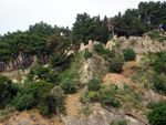
Parga is situated on a hillside with a road linking Anthousa and GR-19. A promontory and a rocky hill with some types of pine trees with tall ones on a top is situated in the west and a small promontory with trees to the east. In Parga's bay, between the town beach and the harbour, there is an islet on which is a chapel and jetty, the island can be easily visited by swimming the short distance from the town beach. Lake Kalodiki is situated to the east and is like a pond which is used for frogs.
Parga is surrounded by mountainous countryside, which is rocky and bushy in the east while it is forested and grassy to the northwest.
A view of Paxoi and parts of southern Corfu can be seen and sometimes Lefkada as well.
In 1570, a Venetian fortress was established on the rocky headland to the north of the town, which separates Parga's bay and harbour from the long sandy crescent shaped Valtos beach, there are excellent views of both bays from the now ruined fortress. There are daily tourists from the island of Corfu and to Paxoi.
Transportation
The town of Parga is linked with direct suburban buses (KTEL) to other Greek cities or towns such Igoumenitsa, Preveza and Athens. There are also non-direct connections to Thessaloniki and Ioannina, although during summer there is a direct bus to Ioannina. The closest airports to Parga are these of Aktion/Preveza (75 km) with direct flights from/to Athens, Thessaloniki and some Greek Islands and charters from abroad, of Ioannina (120 km) with direct flights from/to Athens, and Corfu's (49 km + car-ferry from Igoumenitsa) with direct flights from/to Athens, Thessaloniki, Europe and Greek Islands. In Parga there also cab that can be used so as to move at the local beaches and places of interest.
See also
- List of communities of Preveza
- Apartments/rooms (in Greek/English)
People from Parga
- Pargali Ibrahim Pasha, one of the most notable grand viziers of the Ottoman Empire
External links
- municipality of parga
- Parga Tourist anf Travel Guide
- [http://avli.ooopa.gr/ Villa Avli apartments
- tourist guide
| North: Margariti | |||
| West: Ionian Sea |
Parga | East: Fanari? | |
| South: Ionian Sea |
- De Facto Population of Greece Population and Housing Census of March 18th, 2001 (PDF 39 MB). National Statistical Service of Greece. 2003.
- James Pettifer and Miranda Vickers