| Revision as of 19:00, 12 March 2011 editUlric1313 (talk | contribs)Extended confirmed users, Pending changes reviewers, Rollbackers185,073 edits dab← Previous edit | Revision as of 07:02, 6 April 2011 edit undoWoohookitty (talk | contribs)Administrators611,225 editsm WPCleaner (v0.99) Repairing link to disambiguation page - (You can help) - TibetanNext edit → | ||
| Line 210: | Line 210: | ||
| ! ] | ! ] | ||
| ! ] | ! ] | ||
| ! ] | ! ] | ||
| ! ] | ! ] | ||
| ! Population<br>(2003 est.) | ! Population<br>(2003 est.) | ||
Revision as of 07:02, 6 April 2011
Autonomous prefectures in Qinghai, China| Haibei 海北 | |
|---|---|
| Autonomous prefectures | |
| Haibei Tibetan Autonomous Prefecture | |
| Chinese transcription(s) | |
| • Simplified | 海北 |
| • Pinyin | Hǎiběi |
 The territory of Haibei prefecture-level city (yellow) within Qinghai The territory of Haibei prefecture-level city (yellow) within Qinghai | |
| Country | China |
| Province | Qinghai |
| Time zone | UTC+8 (China Standard) |
Haibei Tibetan Autonomous Prefecture (simplified Chinese: 海北藏族自治州; pinyin: Hǎiběi Zàngzú Zìzhìzhōu; Template:Lang-bo; Wylie: Mtsho-byang Bod-rigs rang-skyong-khul) is an autonomous prefecture of Qinghai province in China. The prefecture has an area of 39,354 km² and its capital is Haiyan County. The placename literally means "north of the Qinghai Lake."
Demographics
According to the 2000 census, Haibei has 258,922 inhabitants with a population density of 6.58 inhabitants/km².
Ethnic groups in Haibei, 2000 census
| Nationality | Population | Percentage |
|---|---|---|
| Han | 94,841 | 36.63% |
| Hui | 79,190 | 30.58% |
| Tibetan | 62,520 | 24.15% |
| Mongol | 13,087 | 5.05% |
| Tu | 7,806 | 3.01% |
| Salar | 901 | 0.35% |
| Others | 577 | 0.23% |
Subdivisions
The prefecture is subdivided into 4 county-level divisions: 3 counties and 1autonomous county:
| Map | ||||||||
|---|---|---|---|---|---|---|---|---|

| ||||||||
| # | Name | Hanzi | Hanyu Pinyin | Tibetan | Wylie | Population (2003 est.) |
Area (km²) | Density (/km²) |
| 1 | Haiyan County | 海晏县 | Hǎiyàn Xiàn | ཧའེ་ཡན་རྫོང་ | ha'e yan rdzong | 30,000 | 4,348 | 7 |
| 2 | Qilian County | 祁连县 | Qílián Xiàn | ཆི་ལེན་རྫོང་ | chi len rdzong | 50,000 | 15,610 | 3 |
| 3 | Gangca County | 刚察县 | Gāngchá Xiàn | རྐང་ཚ་རྫོང་ | rkang tsha rdzong | 40,000 | 12,500 | 3 |
| 4 | Menyuan Hui Autonomous County | 门源回族自治县 | Ményuán Huízú Zìzhìxiàn |
མོང་ཡོན་ཧུའེ་རིགས་རང་སྐྱོང་རྫོང་ | mong yon hu'e rigs rang skyong rdzong |
150,000 | 6,896 | 22 |
| County-level divisions of Qinghai Province | |||||||||||||
|---|---|---|---|---|---|---|---|---|---|---|---|---|---|
| Prefecture-level cities |
| ||||||||||||
| Autonomous prefectures |
| ||||||||||||
| |||||||||||||
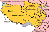
| Tibetan-designated autonomous areas in China | |||||||||
|---|---|---|---|---|---|---|---|---|---|
| Regions |
|  | |||||||
| Prefectures and counties |
| ||||||||
36°58′04″N 100°54′07″E / 36.9678°N 100.902°E / 36.9678; 100.902
This Tibet location article is a stub. You can help Misplaced Pages by expanding it. |