| Revision as of 17:07, 15 January 2013 editNanahuatl (talk | contribs)Extended confirmed users7,548 edits removed Category:Neighbourhoods of Fatih; added Category:Quarters in Istanbul using HotCat← Previous edit | Revision as of 17:07, 15 January 2013 edit undoNanahuatl (talk | contribs)Extended confirmed users7,548 edits added Category:Fatih using HotCatNext edit → | ||
| Line 16: | Line 16: | ||
| ] | ] | ||
| ] | ] | ||
| ] | |||
| {{Marmara-geo-stub}} | {{Marmara-geo-stub}} | ||
Revision as of 17:07, 15 January 2013
| This article does not cite any sources. Please help improve this article by adding citations to reliable sources. Unsourced material may be challenged and removed. Find sources: "Kumkapı" – news · newspapers · books · scholar · JSTOR (January 2013) (Learn how and when to remove this message) |


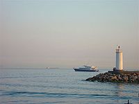
Kumkapı (meaning 'sand gate' in Turkish) is a quarter of the Fatih district of Istanbul. It is located along the northern shore of Marmara Sea. Up to recent times, Kumkapı was mostly inhabited by Turkish Armenians, who still have a community school and several churches there. It is also where the seat of the Armenian Patriarchate of Constantinople is located.
History
In the Byzantine period, the area was known in Greek as Kontoskàlion.
Transportation
Kumkapı has a station on the suburban railway line Sirkeci-Halkalı and also is easily accessible by sea. The quarter is famous for its many fish restaurants; therefore attracting many local and foreign tourists round the year.
41°00′N 28°58′E / 41.000°N 28.967°E / 41.000; 28.967
This article about a Marmara Region of Turkey location is a stub. You can help Misplaced Pages by expanding it. |