| Revision as of 15:12, 13 March 2022 editDušan Kreheľ (bot) (talk | contribs)7,016 edits The position of image.← Previous edit | Revision as of 00:22, 1 April 2022 edit undoDušan Kreheľ (bot) (talk | contribs)7,016 edits Infobox.Next edit → | ||
| Line 37: | Line 37: | ||
| <!-- area --> | <!-- area --> | ||
| | area_footnotes = | | area_footnotes = | ||
| | area_total_km2 = 5.13<ref name="area">{{Cite web |url=http://datacube.statistics.sk/#!/view/sk/VBD_DEM/om7014rr/v_om7014rr_00_00_00_sk |title=Hustota obyvateľstva - obce |language=sk |date= |
| area_total_km2 = 5.13<ref name="area">{{Cite web |url=http://datacube.statistics.sk/#!/view/sk/VBD_DEM/om7014rr/v_om7014rr_00_00_00_sk |title=Hustota obyvateľstva - obce |language=sk |date=2022-03-31 |website=www.statistics.sk |publisher= Statistical Office of the Slovak Republic|access-date=2022-03-31}}</ref> | ||
| | area_total_sq_mi = 1.98<ref name="area"/> | | area_total_sq_mi = 1.98<ref name="area"/> | ||
| | area_land_sq_mi = | | area_land_sq_mi = | ||
| Line 43: | Line 43: | ||
| <!-- elevation --> | <!-- elevation --> | ||
| | elevation_footnotes = | | elevation_footnotes = | ||
| | elevation_m = 320<ref name="base_info">{{Cite web |url=http://datacube.statistics.sk/#!/view/sk/VBD_SK_WIN/om5001rr/v_om5001rr_00_00_00_sk |title=Základná charakteristika |language=sk |date=2015-04-17 |website=www.statistics.sk |publisher= Statistical Office of the Slovak Republic|access-date= |
| elevation_m = 320<ref name="base_info">{{Cite web |url=http://datacube.statistics.sk/#!/view/sk/VBD_SK_WIN/om5001rr/v_om5001rr_00_00_00_sk |title=Základná charakteristika |language=sk |date=2015-04-17 |website=www.statistics.sk |publisher= Statistical Office of the Slovak Republic|access-date=2022-03-31}}</ref> | ||
| | elevation_ft = 1,050<ref name="base_info"/> | | elevation_ft = 1,050<ref name="base_info"/> | ||
| | population_as_of = {{abbr| |
| population_as_of = {{abbr|2021|Population: 2020-12-31. Population density & Total area: 2020-06-30/-07-01. Elevation, Postal code & Area code (last updated): 2015-04-17.}} | ||
| | population_footnotes = | | population_footnotes = | ||
| | population_total = |
| population_total = 92<ref>{{Cite web |url=http://datacube.statistics.sk/#!/view/sk/VBD_DEM/om7101rr/v_om7101rr_00_00_00_sk |title=Počet obyvateľov podľa pohlavia - obce (ročne) |language=sk |date=2022-03-31 |website=www.statistics.sk |publisher= Statistical Office of the Slovak Republic|access-date=2022-03-31}}</ref> | ||
| | population_density_km2 = |
| population_density_km2 = 18.01<ref name="pd">{{Cite web |url=http://datacube.statistics.sk/#!/view/sk/VBD_DEM/om7014rr/v_om7014rr_00_00_00_sk |title=Hustota obyvateľstva - obce |language=sk |date=2022-03-31 |website=www.statistics.sk |publisher= Statistical Office of the Slovak Republic|access-date=2022-03-31}}</ref> | ||
| | population_density_sq_mi= 6. |
| population_density_sq_mi= 6.95<ref name="pd"/> | ||
| | population_demonym = | | population_demonym = | ||
| <!-- time zone(s) --> | <!-- time zone(s) --> | ||
Revision as of 00:22, 1 April 2022
| This article does not cite any sources. Please help improve this article by adding citations to reliable sources. Unsourced material may be challenged and removed. Find sources: "Selce, Krupina District" – news · newspapers · books · scholar · JSTOR (December 2009) (Learn how and when to remove this message) |
| Selce | |
|---|---|
| Municipality | |
  | |
| Coordinates: 48°15′20″N 19°02′30″E / 48.2556°N 19.0417°E / 48.2556; 19.0417 | |
| Country | |
| Region | Banská Bystrica |
| District | Krupina |
| First mentioned | 1303 |
| Area | |
| • Total | 5.13 km (1.98 sq mi) |
| Elevation | 320 m (1,050 ft) |
| Population | |
| • Total | 92 |
| Postal code | 962 51 |
| Area code | +421 45 |
| Car plate | KA |
| Website | www.obecselce.sk |
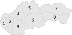
Selce is a village and municipality in the Krupina District of the Banská Bystrica Region of Slovakia.

Rerefences
- "Počet obyvateľov podľa pohlavia - obce (ročne)". www.statistics.sk (in Slovak). Statistical Office of the Slovak Republic. 2022-03-31. Retrieved 2022-03-31.
- ^ "Hustota obyvateľstva - obce [om7014rr_ukaz: Rozloha (Štvorcový meter)]". www.statistics.sk (in Slovak). Statistical Office of the Slovak Republic. 2022-03-31. Retrieved 2022-03-31.
- ^ "Základná charakteristika". www.statistics.sk (in Slovak). Statistical Office of the Slovak Republic. 2015-04-17. Retrieved 2022-03-31.
- ^ "Hustota obyvateľstva - obce". www.statistics.sk (in Slovak). Statistical Office of the Slovak Republic. 2022-03-31. Retrieved 2022-03-31.
External links
This Banská Bystrica Region geography article is a stub. You can help Misplaced Pages by expanding it. |