Browse history interactively ← Previous edit Next edit → Content deleted Content addedVisual Wikitext Inline Revision as of 15:29, 20 December 2024
River in France
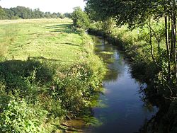
La Vere is a river in northwestern France, flowing through the department of Orne . It is 24.78 km long. Its source is in Landigou , and it flows into the river Noireau in the commune of Saint-Pierre-du-Regard and through Suisse Normande . It flows through these other communes Athis-Val de Rouvre , Aubusson , Caligny , Flers , La Lande-Patry , Landigou , Messei , Montilly-sur-Noireau , Saint-Georges-des-Groseillers , Sainte-Honorine-la-Chardonne & La Selle-la-Forge many of which are in the area known as Suisse Normande .
A Lavoir on La Vere in teh commune of La-Lande-Patry La Vere flowing around Flers Chateau References
^ Sandre . "Fiche cours d'eau - La vere (I24-0410)" .
"Map of Suisse Normande" (PDF).
Categories :
Text is available under the Creative Commons Attribution-ShareAlike License. Additional terms may apply.
**DISCLAIMER** We are not affiliated with Wikipedia, and Cloudflare.
The information presented on this site is for general informational purposes only and does not constitute medical advice.
You should always have a personal consultation with a healthcare professional before making changes to your diet, medication, or exercise routine.
AI helps with the correspondence in our chat.
We participate in an affiliate program. If you buy something through a link, we may earn a commission 💕
↑
 La Vere flowing between Saint-Georges-des-Groseillers and La Lande-Patry


