| Revision as of 15:58, 22 December 2024 editAizoaceae2 (talk | contribs)238 editsmNo edit summaryTag: Visual edit← Previous edit | Revision as of 16:02, 22 December 2024 edit undoAizoaceae2 (talk | contribs)238 editsmNo edit summaryTag: Visual editNext edit → | ||
| Line 1: | Line 1: | ||
| {{Infobox Site of Special Scientific Interest|name= |
{{Infobox Site of Special Scientific Interest|name=Hollows Farm Section|aos=Cumbria|gridref={{gbmappingsmall|NY249170}}|coordinates={{coord|54.543|-3.162|region:GB_scale:25000|display=inline,title}}|area={{cvt|5.9|acre|km2 sqmi|sigfig=2}}|notifydate=1987}} | ||
| '''Hollows Farm Section''' is a ] (SSSI)<ref name=":0">{{Cite web |title=SSSI detail |url=https://designatedsites.naturalengland.org.uk/SiteDetail.aspx?SiteCode=S1000203&SiteName=Hollows%20farm%20section&countyCode=&responsiblePerson=&SeaArea=&IFCAArea= |access-date=2024-12-22 |website=designatedsites.naturalengland.org.uk}}</ref><ref>{{Cite web |title=Protected Planet {{!}} Hollows Farm Section |url=https://www.protectedplanet.net/136369 |access-date=2024-12-22 |website=Protected Planet}}</ref> within the ]. It is located 2km north of ] in the valley of the ]. This protected area is important because of its geology as it is a location where there is a junction between the ] and the ]. | '''Hollows Farm Section''' is a ] (SSSI)<ref name=":0">{{Cite web |title=SSSI detail |url=https://designatedsites.naturalengland.org.uk/SiteDetail.aspx?SiteCode=S1000203&SiteName=Hollows%20farm%20section&countyCode=&responsiblePerson=&SeaArea=&IFCAArea= |access-date=2024-12-22 |website=designatedsites.naturalengland.org.uk}}</ref><ref>{{Cite web |title=Protected Planet {{!}} Hollows Farm Section |url=https://www.protectedplanet.net/136369 |access-date=2024-12-22 |website=Protected Planet}}</ref> within the ]. It is located 2km north of ] in the valley of the ]. This protected area is important because of its geology as it is a location where there is a junction between the ] and the ]. | ||
Revision as of 16:02, 22 December 2024
| Site of Special Scientific Interest | |
 | |
| Location | Cumbria |
|---|---|
| Grid reference | NY249170 |
| Coordinates | 54°32′35″N 3°09′43″W / 54.543°N 3.162°W / 54.543; -3.162 |
| Area | 5.9 acres (0.024 km; 0.0092 sq mi) |
| Notification | 1987 |
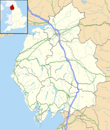
Hollows Farm Section is a Site of Special Scientific Interest (SSSI) within the Lake District National Park. It is located 2km north of Borrowdale in the valley of the River Derwent. This protected area is important because of its geology as it is a location where there is a junction between the Skiddaw Group and the Borrowdale Volcanic Group.
This protected area includes part of Scarbrow Wood and borders Buttermere Fells SSSI.
Geology
Some of the outcrops in Scarbrow Wood within Hollows Farm Section SSSI exhibit both slates from the Skiddaw Group and overlying tuffs (rocks made of volcanic ash) of the Borrowdale Volcanic Group. These outcrops show that a single set of cleavage surfaces pass undisturbed from slates to tuffs. This cleavage has been deformed by later folds.
Land ownership
All of the land within Hollows Farm Section SSSI is owned by the National Trust.
References
- ^ "SSSI detail". designatedsites.naturalengland.org.uk. Retrieved 2024-12-22.
- "Protected Planet | Hollows Farm Section". Protected Planet. Retrieved 2024-12-22.
- "Mapping the habitats of England's ten largest institutional landowners". Who owns England?. 2020-10-06. Retrieved 2024-12-22.