| Revision as of 14:17, 30 August 2011 editDinybot (talk | contribs)346 editsm r2.4.1) (robot Adding: cs:Telgárt← Previous edit | Revision as of 14:35, 14 April 2012 edit undoTony1 (talk | contribs)Autopatrolled, Extended confirmed users, Pending changes reviewers, Template editors276,002 editsm MOS:DASH using script, align date formats using script]], redress overlinking using scriptNext edit → | ||
| Line 1: | Line 1: | ||
| {{Use dmy dates|date=April 2012}} | |||
| {{Geobox | Settlement | {{Geobox | Settlement | ||
| <!-- *** Heading *** --> | <!-- *** Heading *** --> | ||
| Line 27: | Line 28: | ||
| | river = | | river = | ||
| <!-- *** Locations *** --> | <!-- *** Locations *** --> | ||
| | location = | |||
| | elevation = 881 | | elevation = 881 | ||
| | lat_d = 48 | | lat_d = 48 | ||
| Line 49: | Line 49: | ||
| <!-- *** Population *** --> | <!-- *** Population *** --> | ||
| | population = 1531 | | population = 1531 | ||
| | population_date = |
| population_date = 31 December 2004 | ||
| | population_density = auto | | population_density = auto | ||
| <!-- *** History & management *** --> | <!-- *** History & management *** --> | ||
| | established = |
| established = 1326 | ||
| | established_type = First mentioned | | established_type = First mentioned | ||
| | mayor = | | mayor = | ||
| Line 81: | Line 81: | ||
| <!-- Processed by Geoboxer 3.0 on 2007-11-15T05:27:41+01:00 --> }} | <!-- Processed by Geoboxer 3.0 on 2007-11-15T05:27:41+01:00 --> }} | ||
| '''Telgárt''' (called ''Švermovo'' in |
'''Telgárt''' (called ''Švermovo'' in 1948–1990) is a village and municipality in ], in the ] of central ]. | ||
| ==History== | ==History== | ||
| In ] the village was first mentioned in |
In ] the village was first mentioned in 1326 or in 1549 . | ||
| ==Geography== | ==Geography== | ||
Revision as of 14:35, 14 April 2012
Telgárt (called Švermovo in 1948–1990) is a village and municipality in Brezno District, in the Banská Bystrica Region of central Slovakia.
History
In historical records the village was first mentioned in 1326 or in 1549 .
Geography
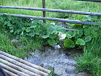
The village lies at an altitude of 881 metres and covers an area of 55.974km². It has population of about 1,531 people. The Hron river rises in the cadastral area of the village, under the Kráľova hoľa mountain.

| Municipalities of Brezno District | ||
|---|---|---|
This Banská Bystrica Region geography article is a stub. You can help Misplaced Pages by expanding it. |