| Revision as of 14:51, 2 December 2013 editPofka (talk | contribs)Extended confirmed users21,543 editsNo edit summary← Previous edit | Revision as of 19:29, 2 May 2014 edit undoOrestek (talk | contribs)Autopatrolled, Extended confirmed users9,047 editsNo edit summaryNext edit → | ||
| Line 32: | Line 32: | ||
| '''Rusnė''' ({{lang-de|Ruß}}) is a border town in ], ], located on the ] in the ], 9 km south-west from ]. | '''Rusnė''' ({{lang-de|Ruß}}) is a border town in ], ], located on the ] in the ], 9 km south-west from ]. | ||
| ==History== | |||
| Rusnė was first mentioned in historical sources in 14th century. In 1419 the first church was built in Rusnė, and in 1553 a Lithuanian parish school was established.<ref> Accessed September 16, 2006</ref> In 1863 the Rusnė synagogue opened. | Rusnė was first mentioned in historical sources in 14th century. In 1419 the first church was built in Rusnė, and in 1553 a Lithuanian parish school was established.<ref> Accessed September 16, 2006</ref> In 1863 the Rusnė synagogue opened. | ||
| In 1946 Rusnė received municipal rights, and in 1967 the whole Island of Rusnė was given this status. | In 1946 Rusnė received municipal rights, and in 1967 the whole Island of Rusnė was given this status. | ||
| ==Geography== | |||
| Some parts of the town of Rusnė near ] are located below the sea level<ref name=Nemunas_Water_Route>{{cite book|title=Nemunas Water Route:Your Guide To The River Nemuna|year=2007|publisher=State Tourism Department under the Ministry of the Economy|page=158}}</ref> and are the lowest in Lithuania. | Some parts of the town of Rusnė near ] are located below the sea level<ref name=Nemunas_Water_Route>{{cite book|title=Nemunas Water Route:Your Guide To The River Nemuna|year=2007|publisher=State Tourism Department under the Ministry of the Economy|page=158}}</ref> and are the lowest in Lithuania. | ||
| Line 44: | Line 46: | ||
| ==Tourism== | ==Tourism== | ||
| Rusnė town and Rusnė island is very popular place for ], as Nemunas delta is rich in various kinds of fish, and tourism infrastructure is built up in recent years. It is also a popular place for ]. | Rusnė town and Rusnė island is very popular place for ], as Nemunas delta is rich in various kinds of fish, and tourism infrastructure is built up in recent years. It is also a popular place for ]. | ||
| ===Kursenieki=== | |||
| {{details|Kursenieki}} | |||
| ].]] | |||
| While today the ], also known as Kuršininkai are a nearly extinct ] ethnic group living along the ], in ] Kuršininkai settlement spanned from ] to ], including in the area of the ]. The Kuršininkai were eventually assimilated by the ], except along the Curonian Spit where some still live. The Kuršininkai were considered ] until after ] when ] gained independence from the ], a consideration based on linguistic arguments. This was the rationale for Latvian claims over the Curonian Spit, ], and other territories of ] which would be later dropped. | |||
| ==Notable residents== | ==Notable residents== | ||
Revision as of 19:29, 2 May 2014
Place in Lithuania| Rusnė | |
|---|---|
 | |
 Coat of arms Coat of arms | |
| Country | |
| County | |
| Municipality | Šilutė district municipality |
| Elderate | Rusnė elderate |
| Population | |
| • Total | 1,642 |
| Time zone | UTC+2 (EET) |
| • Summer (DST) | UTC+3 (EEST) |
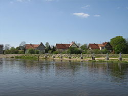
Rusnė (Template:Lang-de) is a border town in Šilutė district, Lithuania, located on the Rusnė Island in the Nemunas Delta, 9 km south-west from Šilutė.
History
Rusnė was first mentioned in historical sources in 14th century. In 1419 the first church was built in Rusnė, and in 1553 a Lithuanian parish school was established. In 1863 the Rusnė synagogue opened.
In 1946 Rusnė received municipal rights, and in 1967 the whole Island of Rusnė was given this status.
Geography
Some parts of the town of Rusnė near Lake Dumblė are located below the sea level and are the lowest in Lithuania.
Rusnė is on the Russian border, which is marked by the Skirvytė river.

Tourism
Rusnė town and Rusnė island is very popular place for angling, as Nemunas delta is rich in various kinds of fish, and tourism infrastructure is built up in recent years. It is also a popular place for birdwatching.
Kursenieki
Further information: Kursenieki
While today the Kursenieki, also known as Kuršininkai are a nearly extinct Baltic ethnic group living along the Curonian Spit, in 1649 Kuršininkai settlement spanned from Memel (Klaipėda) to Danzig (Gdańsk), including in the area of the Nemunas Delta. The Kuršininkai were eventually assimilated by the Germans, except along the Curonian Spit where some still live. The Kuršininkai were considered Latvians until after World War I when Latvia gained independence from the Russian Empire, a consideration based on linguistic arguments. This was the rationale for Latvian claims over the Curonian Spit, Memel, and other territories of East Prussia which would be later dropped.
Notable residents
- Heinrich Ancker (1850-1900), member of the Reichstag
- Gerhard Gregor (1906–1981), musician
- Rudolf Jenett (1914–1998), majorgeneral of the der Bundeswehr
- Charlotte Keyser (1890-1966), writer
Image gallery
-
View of Rusnė from Pakalnė and Neman confluence
-
Rusnė housing
-
Old Rusnė rectory, now a post office
-
Ethnographic museum near Rusnė
-
House in the Rusnė central square
-
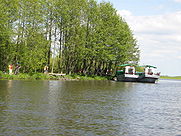
Anglers on Rusnė island
-
Neringa street
-
 Lutheran church in Rusnė
-
 The church (1809) in Rusnė
References
- Nemunas Delta Regional Park website Accessed September 16, 2006
- ^ Nemunas Water Route:Your Guide To The River Nemuna. State Tourism Department under the Ministry of the Economy. 2007. p. 158.
| Klaipėda County | ||
|---|---|---|
| Municipalities |  | |
| Cities | ||
| Towns | ||
| Villages | ||
This Lithuanian location article is a stub. You can help Misplaced Pages by expanding it. |