| Revision as of 03:13, 9 March 2017 editJJMC89 bot (talk | contribs)Bots1,161,340 edits Migrate {{Infobox settlement}} coordinates parameters to {{Coord}}, see Misplaced Pages:Coordinates in infoboxes← Previous edit | Revision as of 12:11, 2 April 2017 edit undoInternetArchiveBot (talk | contribs)Bots, Pending changes reviewers5,380,795 edits Rescuing 1 sources and tagging 0 as dead. #IABot (v1.3beta4)Next edit → | ||
| Line 31: | Line 31: | ||
| | elevation_footnotes = | | elevation_footnotes = | ||
| | elevation_m = | | elevation_m = | ||
| | population_footnotes = <ref>{{cite web|url=http://www.world-gazetteer.com/wg.php?x=&men=gcis&lng=en&des=wg&srt=npan&col=abcdefghinoq&msz=1500&geo=-28|title=World Gazetteer World Gazetteer|archiveurl= |
| population_footnotes = <ref>{{cite web|url=http://www.world-gazetteer.com/wg.php?x=&men=gcis&lng=en&des=wg&srt=npan&col=abcdefghinoq&msz=1500&geo=-28 |title=World Gazetteer World Gazetteer |archiveurl=https://archive.is/20130111112942/http://www.world-gazetteer.com/wg.php?x=&men=gcis&lng=en&des=wg&srt=npan&col=abcdefghinoq&msz=1500&geo=-28 |archivedate=11 January 2013 |deadurl=yes |df= }}</ref> | ||
| | population_as_of = 2012 | | population_as_of = 2012 | ||
| | population_total = 478 | | population_total = 478 | ||
Revision as of 12:11, 2 April 2017
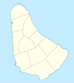
Town in Saint Thomas, Barbados| Hillaby | |
|---|---|
| Town | |
 | |
| Coordinates: 13°12′07″N 59°35′00″W / 13.20194°N 59.58333°W / 13.20194; -59.58333 | |
| Country | Barbados |
| Parish | Saint Thomas |
| Population | |
| • Total | 478 |
| Time zone | UTC-4 (Eastern Caribbean Time Zone) |
| Area code | +1 246 |
Hillaby is a community on the borders of parishes Saint Thomas and Saint Andrew in Barbados. Historically it has always been referred to as Hillaby in St. Thomas it is the top third of the village which is in St. Andrew, with the greater area in St. Thomas.
References
- "Bathsheba, Barbados". Google Maps. Retrieved 9 December 2012.
- "World Gazetteer World Gazetteer". Archived from the original on 11 January 2013.
{{cite web}}: Unknown parameter|deadurl=ignored (|url-status=suggested) (help) - Sir Robert Hermann Schomburgk (1848). The History of Barbados: Comprising a Geographical and Statistical Description of the Island; a Sketch of the Historical Events Since the Settlement; and an Account of Its Geology and Natural Productions. Longman, Brown, Green and Longmans. pp. 703–.
This Barbados location article is a stub. You can help Misplaced Pages by expanding it. |