| Revision as of 05:01, 6 January 2018 editAnnam Imperatoria (talk | contribs)32 editsNo edit summary← Previous edit | Revision as of 05:32, 6 January 2018 edit undoWilliamThweatt (talk | contribs)Autopatrolled, Extended confirmed users, Pending changes reviewers, Rollbackers11,289 edits →References: fixing after category move to common English nameNext edit → | ||
| Line 90: | Line 90: | ||
| {{TakeoProvince}} | {{TakeoProvince}} | ||
| {{Districts of Cambodia}} | {{Districts of Cambodia}} | ||
| ] | ] | ||
| ] | ] | ||
| ] | ] | ||
Revision as of 05:32, 6 January 2018
District in Takéo, Cambodia| Angkor Borei ស្រុកអង្គរបុរី | |
|---|---|
| District (srok) | |
 | |
 | |
| Coordinates: 10°59′42″N 104°58′29″E / 10.99500°N 104.97472°E / 10.99500; 104.97472 | |
| Country | |
| Province | Takéo |
| Communes | 6 |
| Villages | 34 |
| Time zone | +7 |
| Geocode | 2101 |
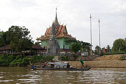
Template:Contains Khmer text Angkor Borei District (Template:Lang-km) is a district located in Takéo Province, in southern Cambodia. According to the 1998 census of Cambodia, it had a population of 44,980.
History

This ancient city was an important settlement of the Kingdom of Funan and may have been its capital. I may have been the Thinae, or Sinae Metropolis located by Claudius Ptolemy as the farthest known city to the east in his Geography. The site was first excavated during the year 1996 and was again excavated in 1999 as part of the Lower Mekong Archaeological Project. During the 1996 excavation the University of Hawaii and Royal University of Fine Arts initiated the excavation and focused on the sociopolitical complexity during 500BC - AD 500. This first excavation, however, was just a preliminary research. The first objectives were as followed:
1) Documentation of the site's layout and the range of its archaeological features
2) Evaluation of the integrity of subsurface materials and description of the site's stratigraphy
3) collection of samples for dating portions of the archaeological site
4) reconstructing the hydrology and natural environment of the early historic period in this region
In this site various archaeological methods were used such as surface survey and mapping, test excavations, auger sampling and coring, and trenching with a backhoe.
It is the birthplace of Norodom, King of Cambodia from 1860 to 1904.
See also
References
- General Population Census of Cambodia, 1998: Village Gazetteer. National Institute of Statistics. February 2000. pp. 239–240.
- "General Population Census of Cambodia 1998, Final Census Results" (PDF). National Institute of Statistics, Ministry of Planning, Cambodia. August 2002. Retrieved 2010-11-25. See page 267.
- John Caverhill, “Some Attempts to ascertain the utmost Extent of the Knowledge of the Ancients in the East Indies”, Philosophical Transactions, vol.57, 1767, pp. 155-174.
- Miriam T. Stark, et al., “Results of the 1995–1996 Archaeological Field Investigations at Angkor Borei, Cambodia”, Asian Perspectives, vol.38, no.1, 1999, at University of Hawai’i, pp.7-36.
- Stark, Miriam; Bong Sovath (2001). "Recent Research on emergent complexity in Cambodia's Mekong". Bulletin of the Indo-Pacific Prehistory Association: 85–98.
- Stark, Miriam; Bong Sovath (2001). "Recent Research on emergent complexity in Cambodia's Mekong". Bulletin of the Indo-Pacific Prehistory Association: 85–98.
| Autonomous municipality |
| ||||||||||||||||||||||||||||||||||||||||||||||||||
|---|---|---|---|---|---|---|---|---|---|---|---|---|---|---|---|---|---|---|---|---|---|---|---|---|---|---|---|---|---|---|---|---|---|---|---|---|---|---|---|---|---|---|---|---|---|---|---|---|---|---|---|
| Provinces |
| ||||||||||||||||||||||||||||||||||||||||||||||||||
This Cambodian location article is a stub. You can help Misplaced Pages by expanding it. |
